Wethersfield, New York
| Wethersfield, New York | |
|---|---|
| Town | |
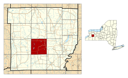 Location within Wyoming County and New York | |
 Wethersfield, New York Location within the state of New York | |
| Coordinates: 42°39′6″N 78°14′8″W / 42.65167°N 78.23556°WCoordinates: 42°39′6″N 78°14′8″W / 42.65167°N 78.23556°W | |
| Country | United States |
| State | New York |
| County | Wyoming |
| Area | |
| • Total | 36.1 sq mi (93.5 km2) |
| • Land | 35.8 sq mi (92.8 km2) |
| • Water | 0.3 sq mi (0.7 km2) |
| Elevation | 1,870 ft (570 m) |
| Population (2000) | |
| • Total | 891 |
| • Density | 24.9/sq mi (9.6/km2) |
| Time zone | Eastern (EST) (UTC-5) |
| • Summer (DST) | EDT (UTC-4) |
| FIPS code | 36-81325[1] |
| GNIS feature ID | 0979631[2] |
Wethersfield is a town in Wyoming County, New York. The population was 891 at the 2000 census.
The Town of Wethersfield is centrally located in the county.
History
The Town of Wethersfield was established in 1823 from part of the Town of Orangeville.
Geography
According to the United States Census Bureau, the town has a total area of 36.1 square miles (93 km2), of which 35.8 square miles (93 km2) is land and 0.3 square miles (0.78 km2) (0.78%) is water.
Wethersfield has 35 General Electric wind-power turbines atop a hill at approximately 2060 feet above sea level, which can be seen from NY Route 78 (Cattaraugus Road), Perry Road (CR 9), Pee Dee Road, and Poplar Tree Road.
Demographics
| Historical population | |||
|---|---|---|---|
| Census | Pop. | %± | |
| 1830 | 1,179 | — | |
| 1840 | 1,728 | 46.6% | |
| 1850 | 1,489 | −13.8% | |
| 1860 | 1,583 | 6.3% | |
| 1870 | 1,219 | −23.0% | |
| 1880 | 1,311 | 7.5% | |
| 1890 | 1,032 | −21.3% | |
| 1900 | 927 | −10.2% | |
| 1910 | 928 | 0.1% | |
| 1920 | 744 | −19.8% | |
| 1930 | 641 | −13.8% | |
| 1940 | 616 | −3.9% | |
| 1950 | 616 | 0.0% | |
| 1960 | 650 | 5.5% | |
| 1970 | 674 | 3.7% | |
| 1980 | 674 | 0.0% | |
| 1990 | 794 | 17.8% | |
| 2000 | 891 | 12.2% | |
| 2010 | 883 | −0.9% | |
| Est. 2014 | 870 | [3] | −1.5% |
As of the census[1] of 2000, there were 891 people, 323 households, and 248 families residing in the town. The population density was 24.9 people per square mile (9.6/km²). There were 442 housing units at an average density of 12.3 per square mile (4.8/km²). The racial makeup of the town was 96.75% White, 1.01% African American, 1.12% Asian, 0.34% Pacific Islander, 0.56% from other races, and 0.22% from two or more races. Hispanic or Latino of any race were 1.01% of the population.
There were 323 households out of which 35.3% had children under the age of 18 living with them, 63.8% were married couples living together, 6.5% had a female householder with no husband present, and 23.2% were non-families. 17.3% of all households were made up of individuals and 6.2% had someone living alone who was 65 years of age or older. The average household size was 2.76 and the average family size was 3.08.
In the town the population was spread out with 29.1% under the age of 18, 8.2% from 18 to 24, 29.2% from 25 to 44, 24.5% from 45 to 64, and 9.1% who were 65 years of age or older. The median age was 36 years. For every 100 females there were 104.8 males. For every 100 females age 18 and over, there were 110.7 males.
The median income for a household in the town was $37,337, and the median income for a family was $39,750. Males had a median income of $28,125 versus $25,625 for females. The per capita income for the town was $15,291. About 11.3% of families and 12.4% of the population were below the poverty line, including 11.5% of those under age 18 and 11.4% of those age 65 or over.
Notable people
- Don Bosseler, retired NFL fullback, member of College Football Hall of Fame
- John Morgan, former member of the Wisconsin State Assembly
Communities and locations in Wethersfield
- Camp O'Ryan – An abandoned New York National Guard rifle range located on the south side of Wethersfield Road, between Bumbacher and Poplar Tree Roads.
- Eastmans Corners – A location near the center of the town.
- Hermitage – A hamlet on Route 78 near the eastern town line.
- Poplar Tree Corners – A hamlet on Wethersfield Road on the northern border of the town.
- Smith's Corners – A hamlet on Route 78 in the southwest part of the town.
- Union Corners – A hamlet on Wethersfield Road on the western border of the town.
- Wethersfield Springs – A hamlet on Wethersfield Road on the northern border of the town, located by East Koy Creek.
Other information
Radio station WLKK is licensed to Wethersfield. The station is one of the vestiges of the Rural Radio Network and, since the 1980s, has primarily been used as a rimshot broadcaster attempting to reach the Buffalo radio market.
References
- 1 2 "American FactFinder". United States Census Bureau. Retrieved 2008-01-31.
- ↑ "US Board on Geographic Names". United States Geological Survey. 2007-10-25. Retrieved 2008-01-31.
- ↑ "Annual Estimates of the Resident Population for Incorporated Places: April 1, 2010 to July 1, 2014". Retrieved June 4, 2015.
- ↑ "Census of Population and Housing". Census.gov. Retrieved June 4, 2015.
Municipalities and communities of Wyoming County, New York, United States | ||
|---|---|---|
| Towns | 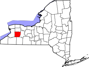 | |
| Villages | ||
| CDPs | ||
| Other hamlets | ||
| Footnotes | ‡This populated place also has portions in an adjacent county or counties | |