Weyers Cave, Virginia
| Weyers Cave, Virginia | |
|---|---|
| CDP | |
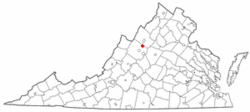 Location of Weyers Cave, Virginia | |
| Coordinates: 38°17′13″N 78°54′50″W / 38.28694°N 78.91389°WCoordinates: 38°17′13″N 78°54′50″W / 38.28694°N 78.91389°W | |
| Country | United States |
| State | Virginia |
| County | Augusta |
| Area | |
| • Total | 6.6 sq mi (17.1 km2) |
| • Land | 6.6 sq mi (17.1 km2) |
| • Water | 0.0 sq mi (0.0 km2) |
| Elevation | 1,161 ft (354 m) |
| Population (2010) | |
| • Total | 2,473 |
| • Density | 374.7/sq mi (144.6/km2) |
| Time zone | Eastern (EST) (UTC-5) |
| • Summer (DST) | EDT (UTC-4) |
| ZIP code | 24486 |
| Area code(s) | 540 |
| FIPS code | 51-85184[1] |
| GNIS feature ID | 1496397[2] |
Weyers Cave (/ˈwɪərz/ WEERZ) is a census-designated place (CDP) in Augusta County, Virginia, United States. The population was 2,473 at the 2010 census. It is part of the Staunton–Waynesboro Micropolitan Statistical Area.
Weyers Cave is the site of the first chapter (1927) of the Future Farmers of Virginia, later to become the National FFA Organization. It is also the site of Shenandoah Valley Regional Airport and the main campus of Blue Ridge Community College.
History
The West View Schoolhouse and Weyers Cave School are listed on the National Register of Historic Places.[3]
Geography
Weyers Cave is located at 38°17′13″N 78°54′50″W / 38.28694°N 78.91389°W (38.286833, -78.913977).[4]
According to the United States Census Bureau, the CDP has a total area of 6.6 square miles (17.1 km²), all of it land.
Demographics
As of the census of 2010,[1] there were 2,473 people, and 910 households residing in the CDP. The racial makeup of the CDP was 85.3% White, 1.8% African American, 0.06% Asian, 0.1% from other races, and 1.7% from two or more races. Hispanic or Latino of any race were 10.5% of the population.
References
- 1 2 "American FactFinder". United States Census Bureau. Retrieved 2011-05-14.
- ↑ "Weyers Cave". Geographic Names Information System. United States Geological Survey.
- ↑ National Park Service (2010-07-09). "National Register Information System". National Register of Historic Places. National Park Service.
- ↑ "US Gazetteer files: 2010, 2000, and 1990". United States Census Bureau. 2011-02-12. Retrieved 2011-04-23.
External links
Municipalities and communities of Augusta County, Virginia, United States | ||
|---|---|---|
| Towns | 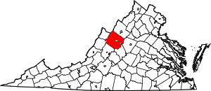 | |
| CDPs | ||
| Unincorporated communities | ||
| Footnotes | ‡This populated place also has portions in an adjacent county or counties | |