Willets, North Carolina
| Willets, North Carolina | |
|---|---|
| Unincorporated community | |
 Willets, North Carolina  Willets, North Carolina | |
| Coordinates: 35°24′42″N 83°06′56″W / 35.41167°N 83.11556°WCoordinates: 35°24′42″N 83°06′56″W / 35.41167°N 83.11556°W | |
| Country | United States |
| State | North Carolina |
| County | Jackson |
| Elevation | 2,690 ft (820 m) |
| Time zone | Eastern (EST) (UTC-5) |
| • Summer (DST) | EDT (UTC-4) |
| Area code(s) | 828 |
| GNIS feature ID | 996296[1] |
Willets is an unincorporated community in Jackson County, North Carolina, United States. Willets is located along US 74, West of Balsam and East of Sylva. It is home to the Balsam-Willets-Ochre Hill fire department, a church, and many homes. It was a thriving unincorporated town along the Murphy Branch of the Western North Carolina Railroad, but seriously declined during the Great Depression in the 1930s, consolidations of the schools in the Scott Creek Township in 1951, and the widening/straightening of US 23 in the early 1950s and early 1970s. Today it is a tiny bedroom community for the larger population centers of Waynesville and Sylva.
History
A post office called Willets was established in 1903, and remained in operation until 1934.[2] The community was named for A. P. Willets, the owner of a local sawmill.[3]
References
- ↑ "US Board on Geographic Names". United States Geological Survey. 2007-10-25. Retrieved 2008-01-31.
- ↑ "Jackson County". Jim Forte Postal History. Retrieved 23 May 2015.
- ↑ McRorie, J.D. (Aug 17, 1978). "Knowing Jackson...Names Chosen Informally". The Sylva Herald and Ruralite. p. 2. Retrieved 23 May 2015.
Municipalities and communities of Jackson County, North Carolina, United States | ||
|---|---|---|
| Towns | 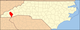 | |
| Village | ||
| CDPs | ||
| Unincorporated communities | ||
| Footnotes | ‡This populated place also has portions in an adjacent county or counties | |