Winooski, Vermont
| Winooski, Vermont | ||
|---|---|---|
| City | ||
|
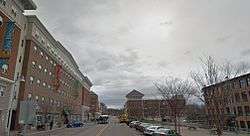
Downtown Winooski | ||
| ||
| Nickname(s): Onion City | ||
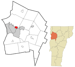 Location in Chittenden County and the state of Vermont. | ||
 Winooski, Vermont Location in the United States | ||
| Coordinates: 44°29′42″N 73°10′57″W / 44.49500°N 73.18250°WCoordinates: 44°29′42″N 73°10′57″W / 44.49500°N 73.18250°W | ||
| Country | United States | |
| State | Vermont | |
| County | Chittenden | |
| Government | ||
| • Mayor | Seth Leonard | |
| Area | ||
| • Total | 1.5 sq mi (3.9 km2) | |
| • Land | 1.4 sq mi (3.7 km2) | |
| • Water | 0.1 sq mi (0.2 km2) | |
| Elevation | 177 ft (54 m) | |
| Population (2010) | ||
| • Total | 7,267 | |
| • Density | 5,190.7/sq mi (1,964.1/km2) | |
| Time zone | Eastern (EST) (UTC-5) | |
| • Summer (DST) | EDT (UTC-4) | |
| ZIP code | 05404 | |
| Area code(s) | 802 | |
| FIPS code | 50-85150[1] | |
| GNIS feature ID | 1460302[2] | |

Winooski /wɪˈnuːski/ is a city in Chittenden County, Vermont, in the United States. Located at the mouth of the Winooski River, as of the 2010 census the municipal population was 7,267.[3] Home to immigrants from countries such as Bhutan, Bosnia and Herzegovina, Croatia, Rwanda, and Somalia, the city is the most diverse, as well as the most densely populated, municipality in northern New England, which comprises the states of Maine, New Hampshire, and Vermont. It is the smallest in area of Vermont's nine incorporated cities. As part of the Burlington metropolitan area, it is bordered by Burlington, Colchester, and South Burlington.
Geography
According to the United States Census Bureau, the city has a total area of 1.5 square miles (3.9 km2), of which 1.4 square miles (3.7 km2) is land and 0.1 square mile (0.2 km2) (5.30%) is water.
Etymology
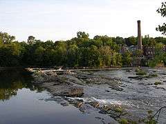
As early as 750 AD, the Abenaki tribe lived along the shores of a cascading waterfall in a fertile river valley they called "winoskitegw," meaning “land of the wild onion.”[4][5] Winooski's southern border is formed by the Winooski River, which is alternatively known as the Onion River.[6]
History
Pre-columbian
Five thousand years ago a single family of paleolithic Native Americans came to what is now the city. The prehistoric campground for this transient group is one of Vermont's significant archaeological sites. Other native people came to Winooski in the years that followed.[7]
Colonial
Situated on a main road, Winooski most likely started as a rest stop for travelers. With a set of waterfalls to assist the growth of industry, however, it soon also became a center for wool processing.[7]
In the early 1770s Ira Allen constructed a blockhouse on the Winooski (then "Onion") River which served both as a fort and as general store and office for the land-speculating "Onion River Company." "Fort Frederick" was never used for defense, but its presence increased the value of Onion River property and promoted settlement.[7]
Post-colonial
After the Revolutionary War, Ira Allen built a dam across the river with a sawmill at each end.[7]
In the late 1830s the Burlington Mill Company used the river's power for the manufacture of yarns and cloth.[8]
In 1846, James and Lucinda Stone from Winooski settled in Sheboygan County in the Wisconsin Territory and named their new settlement Winooski, Wisconsin.
Modern times
The American Woolen Company purchased the failing Burlington Mills in 1901 restoring a measure of economic growth to the area.[9] This success eventually led Winooski to incorporate as a city in 1922, breaking away from the town of Colchester.
The mills closed in 1954, resulting in two decades of economic problems for the city.[10] In the 1980s, two old mills were converted into commercial, office, and apartment space, helping to revitalize the area.[10]
In 1979, the city researched the construction of a dome over the entire city of Winooski, to reduce heating costs during the winter. The proposed dome would have been 200 feet (61 m) at the center, and internal combustion engines would have been banned.[11] Though the dome was never built, to this day the city's planner defends the concept, insisting "Economically, it's a slam dunk," and adding "You could have had year-round fly-fishing."[12]
In 2008, the city dismissed their city manager of 11 months, while he was still an "at-will" employee. His contract had been scheduled for three years.[13]
Government
The Mayor of the city is Seth Leonard.[14]
Demographics
| Historical population | |||
|---|---|---|---|
| Census | Pop. | %± | |
| 1880 | 2,833 | — | |
| 1890 | 3,659 | 29.2% | |
| 1900 | 3,659 | 0.0% | |
| 1910 | 4,520 | 23.5% | |
| 1920 | 4,932 | 9.1% | |
| 1930 | 5,308 | 7.6% | |
| 1940 | 6,036 | 13.7% | |
| 1950 | 6,734 | 11.6% | |
| 1960 | 7,420 | 10.2% | |
| 1970 | 7,309 | −1.5% | |
| 1980 | 6,318 | −13.6% | |
| 1990 | 6,649 | 5.2% | |
| 2000 | 6,561 | −1.3% | |
| 2010 | 7,267 | 10.8% | |
| Est. 2015 | 7,193 | [15] | −1.0% |
| U.S. Decennial Census[16] | |||
As of the census[1] of 2010, there were 7,267 people and 3,252 households residing in the city. The population density was 5,191 people per square mile (1,964.1/km2). There were 3,393 housing units at an average density of 2,107.5 per square mile (814.1/km2). The racial makeup of the city was 82.5% White (81.5% non-Hispanic White alone), 6.9% African American, 0.3% Native American, 6.2% Asian, 0.05% Pacific Islander, 0.53% from other races, and 3.3% from two or more races. Hispanic or Latino of any race were 2.2% of the population. 36% of the population are of French and French Canadian ancestry, 13% Irish, 8% English, and 5% Italian or German.[17]
There were 3,252 households, of which 24.2% had children under the age of 18 living with them, 34.4% were couples living together and joined in either marriage or civil union, 11.2% had a female householder with no husband present, and 50.2% were non-families. 36.8% of all households were made up of individuals and 12.2% had someone living alone who was 65 years of age or older. The average household size was 2.21 and the average family size was 2.98. 14.4% of the city's total population was born outside of the United States.
In the city the population was spread out with 21.5% under the age of 18, 12.3% from 18 to 24, 34.8% from 25 to 44, 17.8% from 45 to 64, and 13.5% who were 65 years of age or older. The median age was 33 years. For every 100 females there were 94.5 males. For every 100 females age 18 and over, there were 91.4 males.
Economy
Personal income
The median income for a household in the city was $30,592, and the median income for a family was $38,551. Males had a median income of $30,257 versus $21,168 for females. The per capita income for the city was $17,208. About 10.2% of families and 15.2% of the population were below the poverty line, including 19.8% of those under age 18 and 13.1% of those age 65 or over.
Industry
Winooski hosts the headquarters of VSAC, the Vermont Student Assistance Corporation. Their new headquarters is a large part of the city's downtown redevelopment project. Software company MyWebGrocer is also headquartered within the city. [18]
Transportation
Bus service is provided by Chittenden County Transportation Authority.
Notable person
- Jan Backus, former state senator, lives in Winooski
References
- 1 2 "American FactFinder". United States Census Bureau. Retrieved 2008-01-31.
- ↑ "US Board on Geographic Names". United States Geological Survey. 2007-10-25. Retrieved 2008-01-31.
- ↑ City Data
- ↑
- ↑
- ↑ Seven Days
- 1 2 3 4 Historical Look at Winooski
- ↑ About Winooski
- ↑ Burlington Vt. area
- 1 2 Historical look at Winooski
- ↑ A Dome for Winooski? - TIME Magazine retrieved June 15, 2008
- ↑ Doomed Dome: The Future That Never Was retrieved November 8, 2009
- ↑ Sutkoski, Matt (September 24, 2008). Winooski manager's future cloudy. Burlington Free Press.
- ↑ http://www.sevendaysvt.com/OffMessage/archives/2015/03/03/seth-leonard-wins-winooski-mayoral-race-by-big-margin
- ↑ "Annual Estimates of the Resident Population for Incorporated Places: April 1, 2010 to July 1, 2015". Retrieved July 2, 2016.
- ↑ "U.S. Decennial Census". United States Census Bureau. Retrieved May 16, 2015.
- ↑ Winooski - Winooski - Ancestry & family history. ePodunk. Retrieved on 2014-04-12.
- ↑ http://mywebgrocer.com/
External links
Municipalities and communities of Chittenden County, Vermont, United States | ||
|---|---|---|
| Cities | 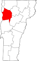 | |
| Towns | ||
| Villages | ||
| CDPs | ||
| Unincorporated communities | ||
Montpelier (capital) | |
| Regions | |
| Counties | |
| Cities | |
| Towns (pop. >5000) | |
| Festivals | |
| Topics |
|
| Society |
|