Woodson, Texas
| Woodson, Texas | |
|---|---|
| Town | |
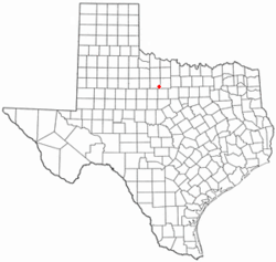 Location of Woodson, Texas | |
 | |
| Coordinates: 33°0′56″N 99°3′8″W / 33.01556°N 99.05222°WCoordinates: 33°0′56″N 99°3′8″W / 33.01556°N 99.05222°W | |
| Country | United States |
| State | Texas |
| County | Throckmorton |
| Area | |
| • Total | 0.6 sq mi (1.7 km2) |
| • Land | 0.6 sq mi (1.7 km2) |
| • Water | 0.0 sq mi (0.0 km2) |
| Elevation | 1,227 ft (374 m) |
| Population (2000) | |
| • Total | 296 |
| • Density | 462.8/sq mi (178.7/km2) |
| Time zone | Central (CST) (UTC-6) |
| • Summer (DST) | CDT (UTC-5) |
| ZIP code | 76491 |
| Area code(s) | 940 |
| FIPS code | 48-80188[1] |
| GNIS feature ID | 1350567[2] |
Woodson is a town in Throckmorton County, Texas, United States. The population was 296 at the 2000 census. A July 1, 2008 U.S. Census Bureau estimate placed the population at 266.[3]
Geography
Woodson is located at 33°0′56″N 99°3′8″W / 33.01556°N 99.05222°W (33.015517, -99.052276)[4] in North Central Texas. It is situated at the junction of U.S. Highway 183 and Farm Roads 209 and 1710 in southeastern Throckmorton County, approximately 15 miles (24 km) southeast of Throckmorton.[5]
According to the United States Census Bureau, the town has a total area of 0.6 square miles (1.7 km²), all of it land.
Climate
The climate in this area is characterized by hot, humid summers and generally mild to cool winters. According to the Köppen Climate Classification system, Woodson has a humid subtropical climate, abbreviated "Cfa" on climate maps.[6]
Wildlife
Woodson is situated in semi-arid rolling hills covered in mesquite with "jumping" and prickly pear cactus, "blue brush" and occasional live or post oaks. It has often hot dry summers and cold dry winters. The creek bottoms have huge pecan trees, hackberry, willow, "china berry", "chitelm", elm, cottonwood, and wild plums of several kinds as well as many other trees of various types occurring at times (bois d'arc, and mulberry are seen). The ground along creeks may be covered in green briars, poison ivy or oak and Virginia creeper grows high into the trees in places. The land, as a whole, is a patchwork of mesquite, and farm fields dotted with old oil wells. It is home to whitetailed deer, wild turkey, cottontailed and jack rabbits, feral hogs, bobcats, raccoons, opossum, rattlesnake, bobwhite quail, mourning doves, armadillo, coyotes, an occasional badger, beaver, fox, mountain lion, and even javalina is seen. Song birds and others thrive. There are many small animals like fox squirrels, hispid cotton rats, soft-shelled turtles and others too numerous to mention. Large yellow catfish live in the slow moving rivers or in the local lake and stock tanks (ponds) along with many other fish like channel catfish, large-mouthed bass (black bass), crappie, gar, carp, buffalo fish, drum, bream and goggle-eyed sun perch. Red-horse minnows, top-water minnows and a species locally known as bull-head minnows live in the ponds and thrive in the rippling shallows of the river and creeks.
History
The area was initially settled in 1875 by J.O. Wood and Henry McClintick. Wood's son, O.J. Wood played a leading role in the shaping of the community and its economics. Woodson was called Jom when it was established around a cotton gin built in part so that the ranchers could get cotton seed to feed to cattle. After Jom was established, O.J. Wood deeded lots measuring 100 feet (30 m)-by-190 feet (58 m) to anyone who would build a residence there, free of charge.[7] A post office was established in 1905. Wood and Sons grocery applied for a post office for Jom and it came back titled the Woodson post office. The town has been Woodson ever since. The community had an estimated population of 250 by 1914.[8] Farming and ranching were the main sources of income until 1923, when the first oil well was completed. In 1925 the Stubblefield #1 well drilled by the Texas Oil Company (Texaco) came in flowing vast amounts of oil. It has since produced more than 1,000,000 barrels (160,000 m3) from that one well and in 2010 was still producing. This set off a local drilling boom and Texaco even built a refinery north of Woodson where a boom town called Whiz Bang sprang to a short lived life just like the refinery it was beside. All the activity brought the railroad.
Woodson grew after the construction of the Cisco and Northeastern Railway in 1926. The depot was located just east of the city limits past the location of the community center. For short while the town thrived with a drive-in movie, doctor's office, 5 gas stations, the bank, cafe, pharmacy, lumber yard, at least 3 grocery stores, a barber shop, mechanics shop, a laundry north of the football field, an ice plant, two cotton gins etc. to serve the large farming, ranching and oil service community. West of town there was a polo field. Life was good. The population peaked at around 600 in 1940. Railroad service to the community was terminated in 1943, although the town survived as a market center for southeastern Throckmorton County. Woodson began to decline as larger towns such as Throckmorton and Albany grew. The population was 450 in 1950, 340 in 1970, and 291 in 1980. After falling to a low of 262 in 1990, the town reported 296 residents in the 2000 census.[8]
Demographics
| Historical population | |||
|---|---|---|---|
| Census | Pop. | %± | |
| 1960 | 337 | — | |
| 1970 | 340 | 0.9% | |
| 1980 | 291 | −14.4% | |
| 1990 | 262 | −10.0% | |
| 2000 | 296 | 13.0% | |
| 2010 | 264 | −10.8% | |
| Est. 2015 | 254 | [9] | −3.8% |
2010 census
As of the census of 2010, there were 264 people, a decrease of 10.81% since 2000 (32 people). The racial makeup of the town was 92.80% White (245 people), 2.65% African American (7 people), 3.41% from other races (9 people), and 1.14% from two or more races (3 people). Hispanic or Latino of any race were 15.91% of the population (42 people).
2000 census
As of the census[1] of 2000, there were 296 people, 113 households, and 80 families residing in the town. The population density was 462.8 people per square mile (178.6/km²). There were 138 housing units at an average density of 215.7/sq mi (83.3/km²). The racial makeup of the town was 93.24% White (276 people), 6.08% from other races (18 people), and 0.68% from two or more races (2 people). Hispanic or Latino of any race were 11.15% of the population (33 people).
There were 113 households out of which 33.6% had children under the age of 18 living with them, 54.9% were married couples living together, 13.3% had a female householder with no husband present, and 29.2% were non-families. 27.4% of all households were made up of individuals and 15.0% had someone living alone who was 65 years of age or older. The average household size was 2.62 and the average family size was 3.23.
In the town the population was spread out with 29.1% under the age of 18, 7.1% from 18 to 24, 24.0% from 25 to 44, 21.6% from 45 to 64, and 18.2% who were 65 years of age or older. The median age was 39 years. For every 100 females there were 89.7 males. For every 100 females age 18 and over, there were 87.5 males.
The median income for a household in the town was $26,389, and the median income for a family was $30,625. Males had a median income of $26,111 versus $14,750 for females. The per capita income for the town was $13,401. About 17.7% of families and 12.5% of the population were below the poverty line, including 13.1% of those under the age of eighteen and 13.5% of those sixty five or over.
Education
Public education in the town of Woodson is provided by the Woodson Independent School District. WISD is home of the Woodson Cowboys and Cowgirls. A small but fiercely competitive school where academic excellence and athletic success go hand in hand. "Be The Best We Can Be" is the school motto.
References
- 1 2 "American FactFinder". United States Census Bureau. Retrieved 2008-01-31.
- ↑ "US Board on Geographic Names". United States Geological Survey. 2007-10-25. Retrieved 2008-01-31.
- ↑ "Table 4: Annual Estimates of the Resident Population for Incorporated Places in Texas, Listed Alphabetically: April 1, 2000 to July 1, 2008" (CSV). United States Census Bureau, Population Division. 2009-07-01. Retrieved 2009-07-21.
- ↑ "US Gazetteer files: 2010, 2000, and 1990". United States Census Bureau. 2011-02-12. Retrieved 2011-04-23.
- ↑ "Woodson, Texas". Texas Escapes Online Magazine. Retrieved 2009-07-21.
- ↑ Climate Summary for Woodson, Texas
- ↑ "History of Woodson". Throckmorton County Chamber of Commerce. Retrieved 2009-07-21.
- 1 2 "Woodson, Texas". The Handbook of Texas online. Retrieved 2009-07-21.
- ↑ "Annual Estimates of the Resident Population for Incorporated Places: April 1, 2010 to July 1, 2015". Retrieved July 2, 2016.
- ↑ "Census of Population and Housing". Census.gov. Retrieved June 4, 2015.
Municipalities and communities of Throckmorton County, Texas, United States | ||
|---|---|---|
| Towns | 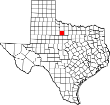 | |
| CDP | ||