Wrightsville Historic District
|
Wrightsville Historic District | |
|
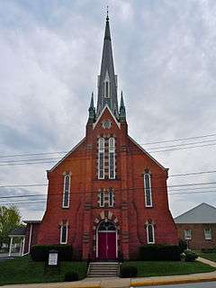
Lutheran church in Wrightsville Historic District, April 2011 | |
  | |
| Location | Roughly bounded by the Susquehanna River, Vine, 4th, and Willow Sts., Wrightsville, Pennsylvania |
|---|---|
| Coordinates | 40°01′26″N 76°31′41″W / 40.02389°N 76.52806°WCoordinates: 40°01′26″N 76°31′41″W / 40.02389°N 76.52806°W |
| Area | 129.5 acres (52.4 ha) |
| Built | 1790 |
| Built by | Multiple |
| Architectural style | Mixed (more Than 2 Styles From Different Periods), Other, Federal, Georgian Vernacular |
| NRHP Reference # | 83002291[1] |
| Added to NRHP | September 12, 1983 |
Wrightsville Historic District is a national historic district located at Wrightsville in York County, Pennsylvania. The district includes 350 contributing buildings and 5 contributing structures in the central business district and surround residential areas of Wrightsville. A majority of the dwellings are small, frame vernacular workers' houses dated to the 19th century. More substantial brick and stone dwellings date to as early as he 1790s. Notable industrial buildings and structures include the Wrightsville Hardware Complex, McConkey Building, Wrightsville silk mill, and lime kilns.[2]
It was listed on the National Register of Historic Places in 1983.[1]
References
- 1 2 National Park Service (2010-07-09). "National Register Information System". National Register of Historic Places. National Park Service.
- ↑ "National Historic Landmarks & National Register of Historic Places in Pennsylvania" (Searchable database). CRGIS: Cultural Resources Geographic Information System. Note: This includes Jay R. Barshinger (January 1983). "National Register of Historic Places Inventory Nomination Form: Wrightsville Historic District" (PDF). Retrieved 2011-12-28.
| Topics |   | |
|---|---|---|
| Lists by county |
| |
| Lists by city | ||
| Other lists | ||
| ||
This article is issued from Wikipedia - version of the 11/30/2016. The text is available under the Creative Commons Attribution/Share Alike but additional terms may apply for the media files.