Wyacondah Township, Davis County, Iowa
| Wyacondah Township | |
|---|---|
| Township | |
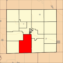 Location in Davis County | |
| Coordinates: 40°39′11″N 92°27′47″W / 40.65306°N 92.46306°WCoordinates: 40°39′11″N 92°27′47″W / 40.65306°N 92.46306°W | |
| Country |
|
| State |
|
| County | Davis |
| Area | |
| • Total | 48.24 sq mi (124.95 km2) |
| • Land | 48.11 sq mi (124.61 km2) |
| • Water | 0.13 sq mi (0.35 km2) 0.28% |
| Elevation | 866 ft (264 m) |
| Population (2000) | |
| • Total | 374 |
| • Density | 7.8/sq mi (3/km2) |
| GNIS feature ID | 0469020 |
Wyacondah Township is a township in Davis County, Iowa, USA. As of the 2000 census, its population was 374.
History
Wyacondah Township was organized in 1846.[1]
Geography
Wyacondah Township covers an area of 48.24 square miles (124.95 square kilometers); of this, 0.13 square miles (0.35 square kilometers) or 0.28 percent is water. The streams of Batten Branch and North Fabius Creek run through this township.
Unincorporated towns
- Lunsford
- Mark
- Savannah
(This list is based on USGS data and may include former settlements.)
Adjacent townships
- Bloomfield Township (northeast)
- Cleveland Township (northeast)
- Grove Township (east)
- Fabius Township (west)
- West Grove Township (northwest)
Cemeteries
The township contains thirteen cemeteries: Bragg, Bridwell, Davies, Dooley, Fenton, Howell, Inskeep, Kelley, Morgan, Savannah, Small, Sullivan and Wesley Chapel.
Major highways
References
- ↑ History of Davis County, Iowa. State Historical Company. 1882. p. 429.
External links
Municipalities and communities of Davis County, Iowa, United States | ||
|---|---|---|
| Cities | ||
| Townships | ||
| Unincorporated community | ||
This article is issued from Wikipedia - version of the 11/4/2016. The text is available under the Creative Commons Attribution/Share Alike but additional terms may apply for the media files.