Yeager, Oklahoma
| Yeager, Oklahoma | |
|---|---|
| Town | |
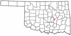 Location of Yeager, Oklahoma | |
| Coordinates: 35°9′26″N 96°20′25″W / 35.15722°N 96.34028°WCoordinates: 35°9′26″N 96°20′25″W / 35.15722°N 96.34028°W | |
| Country | United States |
| State | Oklahoma |
| County | Hughes |
| Area | |
| • Total | 0.2 sq mi (0.5 km2) |
| • Land | 0.2 sq mi (0.5 km2) |
| • Water | 0.0 sq mi (0.0 km2) |
| Elevation | 787 ft (240 m) |
| Population (2010)[1] | |
| • Total | 75 |
| • Density | 356/sq mi (138/km2) |
| Time zone | Central (CST) (UTC-6) |
| • Summer (DST) | CDT (UTC-5) |
| FIPS code | 40-82650[2] |
| GNIS feature ID | 1100043[3] |
Yeager is a town in Hughes County, Oklahoma, United States. The population was 75 at the 2010 census.[1] Developed in the early 1900s, the town grew with the help of an oil and gas field, but has always had a low population.[4]
History
Named for a Creek allottee, the town was developed along the St. Louis, Oklahoma and Southern Railway that was built between 1900 and 1901.[4] An oil and gas field opened in the town in 1917 and helped support the railroad industry in the 1920s.[4] The town's original name was changed by its first post office from Yargee to Yeager.[4]
Geography
Yeager is located six miles north of Holdenville, Oklahoma. Its geographic coordinates are 35°9′26″N 96°20′25″W / 35.15722°N 96.34028°W (35.157355, -96.340218).[5] According to the United States Census Bureau, the town has a total area of 0.2 square miles (0.52 km2), all land.
The town lies at an elevation of 870 feet above sea level and has an average of 39 inches of rain and 6.1 inches of snowfall annually.[6]
Demographics
| Historical population | |||
|---|---|---|---|
| Census | Pop. | %± | |
| 1910 | 231 | — | |
| 1920 | 286 | 23.8% | |
| 1930 | 300 | 4.9% | |
| 1940 | 284 | −5.3% | |
| 1950 | 180 | −36.6% | |
| 1960 | 129 | −28.3% | |
| 1970 | 107 | −17.1% | |
| 1980 | 138 | 29.0% | |
| 1990 | 40 | −71.0% | |
| 2000 | 67 | 67.5% | |
| 2010 | 75 | 11.9% | |
| Est. 2015 | 73 | [7] | −2.7% |
As of the census of 2010, there were 75 people residing in the town.[1] The population density was 356 people per square mile (136/km²). There were 33 housing units at an average density of 180 per square mile (69/km²).[1] The racial makeup of the town was 56.72% White, 32.84% Native American, and 10.45% from two or more races. Hispanic or Latino of any race were 1.49% of the population.
There were 27 households out of which 18.5% had children under the age of 18 living with them, 44.4% were married couples living together, 14.8% had a female householder with no husband present, and 40.7% were non-families. 33.3% of all households were made up of individuals and 18.5% had someone living alone who was 65 years of age or older. The average household size was 2.48 and the average family size was 3.31.
In the town the population was spread out with 16.4% under the age of 18, 7.5% from 18 to 24, 23.9% from 25 to 44, 34.3% from 45 to 64, and 17.9% who were 65 years of age or older. The median age was 46 years. For every 100 females there were 81.1 males. For every 100 females age 18 and over, there were 86.7 males.
The median income for a household in the town was $13,125, and the median income for a family was $16,250. Males had a median income of $12,500 versus $18,750 for females. The per capita income for the town was $6,438. There were 15.4% of families and 26.4% of the population living below the poverty line, including 44.4% of under eighteens and 14.3% of those over 64.
References
- 1 2 3 4 "2010 City Population and Housing Occupancy Status". U.S. Census Bureau. Retrieved October 18, 2013.
- ↑ "American FactFinder". United States Census Bureau. Retrieved 2008-01-31.
- ↑ "US Board on Geographic Names". United States Geological Survey. 2007-10-25. Retrieved 2008-01-31.
- 1 2 3 4 Wilson, Linda D., "Yeager," Encyclopedia of Oklahoma History and Culture (accessed June 23, 2010).
- ↑ "US Gazetteer files: 2010, 2000, and 1990". United States Census Bureau. 2011-02-12. Retrieved 2011-04-23.
- ↑ Sperling's Best Places, "Yeager, Oklahoma" (accessed June 23, 2010).
- ↑ "Annual Estimates of the Resident Population for Incorporated Places: April 1, 2010 to July 1, 2015". Retrieved July 2, 2016.
- ↑ "Census of Population and Housing". Census.gov. Retrieved June 4, 2015.
Municipalities and communities of Hughes County, Oklahoma, United States | ||
|---|---|---|
| Cities | 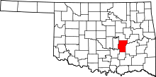 | |
| Towns | ||
| Unincorporated communities |
| |
| Footnotes | ‡This populated place also has portions in an adjacent county or counties | |