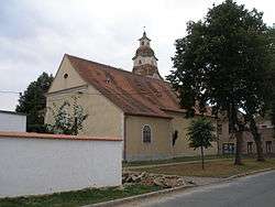
Štítary
| Štítary | ||
|---|---|---|
| Městys | ||
 | ||
| ||
 Štítary | ||
| Coordinates: 48°56′21″N 15°50′7″E / 48.93917°N 15.83528°ECoordinates: 48°56′21″N 15°50′7″E / 48.93917°N 15.83528°E | ||
| Country |
| |
| Region | South Moravian | |
| District | Znojmo | |
| Area | ||
| • Total | 24.97 km2 (9.64 sq mi) | |
| Elevation | 398 m (1,306 ft) | |
| Population (2006) | ||
| • Total | 670 | |
| • Density | 27/km2 (69/sq mi) | |
| Postal code | 671 02 | |
| Website | http://www.vranov-region.cz | |

Štítary is a small town (městys) in Znojmo District in the South Moravian Region of the Czech Republic.
The town covers an area of 24.97 square kilometres (9.64 sq mi), and has a population of 670 (as at 3 July 2006).
Štítary lies approximately 18 kilometres (11 mi) north-west of Znojmo, 64 km (40 mi) south-west of Brno, and 164 km (102 mi) south-east of Prague.
References
| Wikimedia Commons has media related to Štítary. |
This article is issued from Wikipedia - version of the 4/5/2016. The text is available under the Creative Commons Attribution/Share Alike but additional terms may apply for the media files.