Abilene, Kansas
| Abilene, Kansas | |
|---|---|
| City | |
|
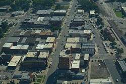
Aerial view of Abilene | |
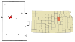 Location within Dickinson County and Kansas | |
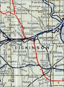
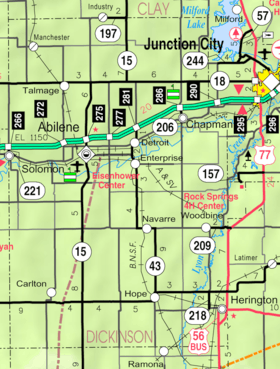 KDOT map of Dickinson County (legend) | |
| Coordinates: 38°55′11″N 97°13′2″W / 38.91972°N 97.21722°WCoordinates: 38°55′11″N 97°13′2″W / 38.91972°N 97.21722°W | |
| Country | United States |
| State | Kansas |
| County | Dickinson |
| Founded | 1857 |
| Incorporated | 1869 [1] |
| Government | |
| • Type | Mayor–Council |
| Area[2] | |
| • Total | 4.68 sq mi (12.12 km2) |
| • Land | 4.68 sq mi (12.12 km2) |
| • Water | 0 sq mi (0 km2) |
| Elevation | 1,155 ft (352 m) |
| Population (2010)[3] | |
| • Total | 6,844 |
| • Estimate (2012[4]) | 6,771 |
| • Density | 1,500/sq mi (560/km2) |
| Time zone | Central (CST) (UTC-6) |
| • Summer (DST) | CDT (UTC-5) |
| ZIP code | 67410 |
| Area code(s) | 785 |
| FIPS code | 20-00125 [5] |
| GNIS feature ID | 0476675 [6] |
| Website | AbileneCityHall.com |
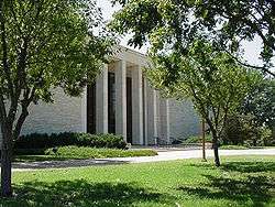
Abilene (pronounced /ˈæbᵻliːn/)[7] is a city in and the county seat of Dickinson County, Kansas, United States.[8] As of the 2010 census, the city population was 6,844.[9] The Dwight D. Eisenhower Presidential Library and Museum is located in Abilene.
History
19th century
For millennia, the land now known as Kansas was inhabited by Native Americans. In 1803, most of modern Kansas was secured by the United States as part of the Louisiana Purchase. In 1854, the Kansas Territory was organized, then in 1861 Kansas became the 34th U.S. state.
In 1857, Dickinson County was founded. Abilene began as a stage coach stop in the same year, established by Timothy Hersey and named Mud Creek. It wasn't until 1860 that it was named Abilene, from a passage in the Bible (Luke 3:1), meaning "city of the plains".[1]
In 1867, the Kansas Pacific Railway (Union Pacific) pushed westward through Abilene. In the same year, Joseph G. McCoy purchased 250 acres of land north and east of Abilene, on which he built a hotel, the Drover’s Cottage, stockyards equipped for 2,000 heads of cattle, and a stable for their horses. The Kansas Pacific put in a switch at Abilene that enabled the cattle cars to be loaded and sent on to their destinations. The first twenty carloads left September 5, 1867, en route to Chicago, Illinois, where McCoy was familiar with the market.[10] The town grew quickly and became the very first "cow town" of the west.[11]
McCoy encouraged Texas cattlemen to drive their herds to his stockyards. From 1867 to 1871, the Chisholm Trail ended in Abilene, bringing in many travelers and making Abilene one of the wildest towns in the west.[12][13] The stockyards shipped 35,000 head in 1867 and became the largest stockyards west of Kansas City, Kansas. In 1871, more than 5,000 cowboys herded from 600,000 to 700,000 cows to Abilene and other Kansas railheads.[1][14][15] Another source reports 440,200 head of cattle were shipped out of Abilene from 1867 to 1871.[16] As railroads were built further south, the end of the Chisholm Trail was slowly moved south towards Caldwell, while as Kansas homesteaders moved the trail west towards and past Ellsworth.
Town marshal Tom "Bear River" Smith was initially successful policing Abilene, often using only his bare hands. He survived two assassination attempts during his tenure. However, he was murdered and decapitated on November 2, 1870. Smith wounded one of his two attackers during the shootout preceding his death, and both suspects received life in prison for the offense.[11] He was replaced by Wild Bill Hickok in April 1871.[1] Hickok's time in the job was short. While the marshal was standing off a crowd during a street brawl, gambler Phil Coe took two shots at Hickok, who returned fire, killing Coe. But Hickok then accidentally shot his friend and deputy, Mike Williams,[17] who was coming to his aid. Hickok lost his job two months later in December.
In 1880 Conrad Lebold built the Lebold Mansion. Lebold was one of the early town developers and bankers from 1869 through 1889. The Hersey dugout can still be seen in the cellar. The house is now a private residence.[18] A marker outside credits the name of the town being given by opening a Bible and using the first place name pointed to.
In 1887, Atchison, Topeka and Santa Fe Railway built a branch line from Neva (3 miles west of Strong City) through Abilene to Superior, Nebraska. In 1996, the Atchison, Topeka and Santa Fe Railway merged with Burlington Northern Railroad and renamed to the current BNSF Railway. Most locals still refer to this railroad as the "Santa Fe".
In 1890, Dr. A.B. Seelye founded the A.B. Seelye Medical Company. Seelye developed over 100 products for the company including "Wasa-Tusa",[19] an Indian name meaning to heal.
20th century
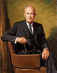
Abilene became home to Dwight D. Eisenhower when his family moved to Abilene from Denison, Texas in 1892. Eisenhower attended elementary school through high school in Abilene, graduating in 1909. The Dwight D. Eisenhower Presidential Library and Museum is the burial site of President Eisenhower, his wife, Mamie, and their first-born son Doud Dwight.[20]
Geography
Abilene is located at 38°55′11″N 97°13′2″W / 38.91972°N 97.21722°W (38.919721, −97.217329) at an elevation of 1,155 feet (352 m).[6][21] The city lies on the north side of the Smoky Hill River[1] in the Flint Hills region of the Great Plains.[22] Mud Creek, a tributary of the Smoky Hill, flows south through the city.[23] Located in north-central Kansas at the intersection of Interstate 70 and K-15, Abilene is approximately 27 mi (43 km) east of Salina, Kansas, 94 mi (151 km) north of Wichita, and 139 mi (224 km) west of Kansas City.[22][24]
According to the United States Census Bureau, the city has a total area of 4.68 square miles (12.12 km2), all of it land.[2]
Climate
Lying in the transition zone between North America's humid subtropical climate (Köppen Cfa) and humid continental climate (Köppen Dfa) zones, Abilene experiences hot, humid summers and cold, dry winters. Over the course of a year, temperatures range from an average low below 20 °F (−7 °C) in January to an average high of nearly 95 °F (35 °C) in July. The maximum temperature reaches 90 °F (32 °C) an average of 66 days per year and reaches 100 °F (38 °C) an average of 14 days per year. The minimum temperature falls to or below the freezing point an average of 116 days per year. Typically the first fall freeze occurs between the last week of September and the first week of November, and the last spring freeze occurs during April or the first week of May. The area receives nearly 33 inches (840 mm) of precipitation during an average year with the largest share being received in May and June—which when combined average 19 days of measurable precipitation. There are on average 79 days of measurable precipitation per year. Winter snowfall averages about 14 inches, but the median is less than 10 inches (250 mm). Measurable snowfall occurs an average of 7 days per year with at least an inch of snow being received on five of those days. Snow depth of at least an inch occurs an average of 8 days per year.[25] The hottest temperature recorded in Abilene was 113 °F (45 °C) in 1954; the coldest temperature recorded was −24 °F (−31 °C) in 1989.[26]
| Climate data for Abilene, Kansas | |||||||||||||
|---|---|---|---|---|---|---|---|---|---|---|---|---|---|
| Month | Jan | Feb | Mar | Apr | May | Jun | Jul | Aug | Sep | Oct | Nov | Dec | Year |
| Record high °F (°C) | 77 (25) |
83 (28) |
91 (33) |
98 (37) |
102 (39) |
111 (44) |
113 (45) |
111 (44) |
111 (44) |
98 (37) |
88 (31) |
73 (23) |
113 (45) |
| Average high °F (°C) | 41 (5) |
48 (9) |
59 (15) |
70 (21) |
78 (26) |
89 (32) |
94 (34) |
93 (34) |
84 (29) |
72 (22) |
55 (13) |
44 (7) |
68.9 (20.6) |
| Average low °F (°C) | 18 (−8) |
24 (−4) |
33 (1) |
43 (6) |
54 (12) |
63 (17) |
69 (21) |
67 (19) |
58 (14) |
45 (7) |
33 (1) |
23 (−5) |
44.2 (6.8) |
| Record low °F (°C) | −19 (−28) |
−22 (−30) |
−9 (−23) |
15 (−9) |
27 (−3) |
39 (4) |
44 (7) |
41 (5) |
23 (−5) |
16 (−9) |
−6 (−21) |
−24 (−31) |
−24 (−31) |
| Average precipitation inches (mm) | 0.82 (20.8) |
1.09 (27.7) |
2.55 (64.8) |
2.80 (71.1) |
4.73 (120.1) |
4.35 (110.5) |
4.31 (109.5) |
3.88 (98.6) |
2.54 (64.5) |
2.64 (67.1) |
1.99 (50.5) |
1.04 (26.4) |
32.74 (831.6) |
| Average snowfall inches (cm) | 4.8 (12.2) |
3.6 (9.1) |
1.9 (4.8) |
0.1 (0.3) |
0 (0) |
0 (0) |
0 (0) |
0 (0) |
0 (0) |
0.1 (0.3) |
0.8 (2) |
2.5 (6.4) |
13.8 (35.1) |
| Average precipitation days (≥ 0.01 in) | 4.1 | 4.2 | 6.9 | 7.8 | 10.3 | 8.3 | 7.5 | 7.9 | 6.4 | 6.0 | 5.4 | 4.4 | 79.1 |
| Average snowy days (≥ 0.1 in) | 2.3 | 1.7 | 0.8 | 0.1 | 0 | 0 | 0 | 0 | 0 | 0.1 | 0.4 | 1.9 | 7.3 |
| Source: The Weather Channel;[26] National Weather Service[25] | |||||||||||||
Economy
Abilene remains a cattle yard town, which is still loaded onto the rail system, along with grain and other crops.[1]
Demographics
| Historical population | |||
|---|---|---|---|
| Census | Pop. | %± | |
| 1880 | 2,360 | — | |
| 1890 | 3,547 | 50.3% | |
| 1900 | 3,507 | −1.1% | |
| 1910 | 4,118 | 17.4% | |
| 1920 | 4,895 | 18.9% | |
| 1930 | 5,658 | 15.6% | |
| 1940 | 5,671 | 0.2% | |
| 1950 | 5,775 | 1.8% | |
| 1960 | 6,746 | 16.8% | |
| 1970 | 6,661 | −1.3% | |
| 1980 | 6,572 | −1.3% | |
| 1990 | 6,242 | −5.0% | |
| 2000 | 6,543 | 4.8% | |
| 2010 | 6,844 | 4.6% | |
| Est. 2015 | 6,558 | [27] | −4.2% |
| U.S. Decennial Census | |||
2010 census
As of the 2010 census, there were 6,844 people, 2,878 households, and 1,781 families residing in the city. The population density was 1,463.6 people per square mile (3,791/km²). There were 3,143 housing units at an average density of 671.6 per square mile (259.8/km²). The racial makeup of the city was 94.9% White, 0.9% African American, 0.4% American Indian, 0.2% Asian, 1.1% from some other race, and 2.4% from two or more races. 4.7% of the population was Hispanic or Latino of any race.[5]
There were 2,878 households of which 31.1% had children under the age of 18 living with them, 47.3% were married couples living together, 4.0% had a male householder with no wife present, 10.6% had a female householder with no husband present, and 38.1% were non-families. 33.3% of all households were made up of individuals, and 17.2% had someone living alone who was 65 years of age or older. The average household size was 2.33, and the average family size was 2.97.[5]
In the city, the population was spread out with 25.7% under the age of 18, 6.9% from 18 to 24, 23.7% from 25 to 44, 24.5% from 45 to 64, and 19.2% who were 65 years of age or older. The median age was 39.6 years. For every 100 females, there were 92.3 males. For every 100 females age 18 and over, there were 87.2 males age 18 and over.[5]
The median income for a household in the city was $48,115, and the median income for a family was $61,146. Males had a median income of $42,332 versus $29,325 for females. The per capita income for the city was $21,820. About 7.3% of families and 10.8% of the population were below the poverty line, including 14.1% of those under age 18 and 15.1% of those age 65 or over.[5]
Education
Primary and secondary education
Abilene is part of Unified School District 435.[28][29]
Transportation
Interstate 70 and U.S. Route 40 run concurrently east-west immediately north of Abilene, intersecting highway K-15, which runs north-south through the city.[22]
Abilene Municipal Airport is located on the city's southwest side. Publicly owned, it has one asphalt runway and is used predominantly for general aviation.[30]
The Kansas Pacific (KP) line of the Union Pacific Railroad runs east-west through the city.[23][31] It intersects a BNSF Railway line which enters the city from the east and then turns north.[32]
Media
Abilene has one daily newspaper, The Abilene Reflector-Chronicle.[33]
Radio
The following radio stations are licensed to Abilene:
AM
| Frequency | Callsign[34] | Format[35] | City of License | Notes |
|---|---|---|---|---|
| 1560 | KABI | Adult Standards/MOR | Abilene, Kansas | - |
FM
| Frequency | Callsign[36] | Format[37] | City of License | Notes |
|---|---|---|---|---|
| 94.1 | K231AW | Religious | Abilene, Kansas | AFR; Translator of KAKA, Salina, Kansas[38] |
| 98.5 | KSAJ-FM | Oldies | Abilene, Kansas | Broadcasts from Salina, Kansas[39] |
Television
Abilene is in the Wichita-Hutchinson, Kansas television market.[40]
Points of interest

- Abilene and Smoky Valley Railroad - A tourist railroad based out of the old Rock Island train depot in Old Abilene Town; it hauls passengers between Abilene and Enterprise.[41]
- Eisenhower Presidential Center and the Dwight D. Eisenhower Presidential Library and Museum. - Contains murals depicting President Eisenhower's life, painted by artists, Louis George Bouché and Ross Moffett in 1954.
- Great Plains Theatre - Originally First Presbyterian Church, built in 1881, Landmarked, and is now a live professional theatre, and movie theatre.
- Greyhound Hall of Fame - Located near the Eisenhower Presidential Library, the hall exhibits the history of the greyhound breed and of greyhound racing.
- Heritage Center of Dickinson County - Two museums including the Historical Museum and the Museum of Independent Telephony. The Museum of Independent Telephony tells the story of C.L. Brown, whose independent Brown Telephone Company grew to become the telecommunications company known today as Sprint Nextel Corporation .
- Lebold Mansion - National Register Property listed in 1973. Built in 1880 in the Italianate Tuscan villa style. This decorative arts museum was once home to one of the finest collections of American Victorian antiques and artifacts. However the museum closed to all tours in June 2010 and was sold to new owners as a private residence on 9/15/10.
- Old Abilene Town - Constructed as a replica historic district, beginning in the late 1950s, it includes several original buildings that have been moved from their original locations.[42]
- A. B. Seelye House and Museum - A Georgian style mansion built in 1905 at a cost of $55,000. The 25 room mansion contains the original furniture and Edison light fixtures. The Patent Medicine Museum contains many artifacts of the A.B. Seelye Medical Company. Listed on the National Register of Historic Places, it is currently a museum showcasing Seelye, an advocate of patent medicines.[43]
- Kansas Historical Marker - Historic Abilene, on south Sixth Street.[44]
Notable people
Old West figures who lived in Abilene during its period as a cowtown included Wild Bill Hickok, cattle baron Joseph McCoy, gambler Phil Coe, marshal Tom “Bear River” Smith, gunfighters Pat Desmond, Thomas J. Smith, John Wesley Hardin and Ben Thompson, and Thompson's sister-in-law Libby, a prostitute and dance hall girl.[45][46]
President of the United States and five-star general Dwight D. Eisenhower grew up in Abilene as did his brothers Edgar, Earl, and Milton.[47][48] President Eisenhower is buried in Abilene, along with his wife Mamie and their eldest son Doud, on the grounds of his presidential library.[49]
Other notable individuals who were born in and/or have lived in Abilene include:
- C. Olin Ball, food scientist, inventor[50]
- Joseph R. Burton, U.S. Senator from Kansas[51]
- Steve Doocy, journalist, author[52]
- Edward C. Little, U.S. Representative from Kansas[53]
- Deane Waldo Malott, university administrator[54]
- Frank D. Parent, California court judge[55]
- Everett W. Stewart, World War II flying ace[56]
- Hy Vandenberg, Major League Baseball pitcher[57]
- Cody Whitehair, center for NFL
Sister Cities
See also
- National Register of Historic Places listings in Dickinson County, Kansas
- Abilene High School
- Abilene Trail
- Abilene, Texas
Further reading
- Guide Map of the Best and Shortest Cattle Trail to the Kansas Pacific Railway; Kansas Pacific Railway Company; 1875. (Read Online)(Map)
References
- 1 2 3 4 5 6 Hoiberg, Dale H., ed. (2010). "Abilene". Encyclopedia Britannica. I: A-ak Bayes (15th ed.). Chicago, IL: Encyclopedia Britannica Inc. p. 32. ISBN 978-1-59339-837-8.
- 1 2 "US Gazetteer files 2010". United States Census Bureau. Archived from the original on 2012-07-14. Retrieved 2012-07-06.
- ↑ "American FactFinder". United States Census Bureau. Retrieved 2012-07-06.
- ↑ "Population Estimates". United States Census Bureau. Archived from the original on 2013-06-17. Retrieved 2013-05-29.
- 1 2 3 4 5 "American FactFinder". United States Census Bureau. Archived from the original on 2013-09-11. Retrieved 2008-01-31.
- 1 2 "US Board on Geographic Names". United States Geological Survey. 2007-10-25. Retrieved 2008-01-31.
- ↑ William Allen White School of Journalism and Public Information (1955). A pronunciation guide to Kansas place names. Lawrence, KS: University of Kansas. p. 7.
- ↑ "Find a County". National Association of Counties. Archived from the original on 2015-05-10. Retrieved 2011-06-07.
- ↑ "2010 City Population and Housing Occupancy Status". U.S. Census Bureau. Archived from the original on July 21, 2011. Retrieved March 6, 2011.
- ↑ Smith, Jessica (2013). "Morality and Money: A Look at how the Respectable Community Battled the Sporting Community over Prostitution in Kansas Cowtowns, 1867-1885" (PDF). Kansas State University.
- 1 2 Joseph G. Rosa (1979). They Called Him Wild Bill. University of Oklahoma Press. pp. 172–206. ISBN 978-0-8061-1538-2. Retrieved 18 October 2010.
- ↑ "Chisholm Trail" at the Oklahoma Historical Society's Encyclopedia of Oklahoma History and Culture.
- ↑ Route of the Chisholm cattle trail in Kansas; Kansas Historical Society, 1960s.
- ↑ Gard, Wayne (1969) [1954]. The Chisholm Trail. Norman, OK: University of Oklahoma Press. pp. 155–156. LCCN 54-6204.
- ↑ Walker, Paul Robert (1997). Mulroy, Kevin, ed. Trail of the Wild West. Kingsport, TN: National Geographic Society. pp. 124–125. ISBN 978-0792270218.
- ↑ Kansas Pacific Railway Company. Guide Map of the Best and Shortest Cattle Trail to the Kansas Pacific Railway; Kansas Pacific Railway Company; 1875.
- ↑ Mile Williams
- ↑ "Lebold Mansion, Abilene". Kansas Sampler Foundation. Retrieved 18 October 2010.
- ↑ "The historic Seelye Mansion, Abilene, Kansas". Retrieved 18 October 2010.
- ↑ Eisenhower Centre at www.kansasflinthills.travel.
- ↑ "US Gazetteer files: 2010, 2000, and 1990". United States Census Bureau. 2011-02-12. Retrieved 2011-04-23.
- 1 2 3 "2003-2004 Official Transportation Map" (PDF). Kansas Department of Transportation. 2003. Retrieved 2011-04-17.
- 1 2 "General Highway Map - Dickinson County, Kansas" (PDF). Kansas Department of Transportation. 2010-07-01. Retrieved 2011-04-17.
- ↑ "City Distance Tool". Geobytes. Archived from the original on 12 April 2010. Retrieved 2010-04-11.
- 1 2 "NOWData - NOAA Online Weather Data". National Weather Service Forecast Office - Topeka, KS. Retrieved 2011-04-16.
- 1 2 "Average weather for Abilene, KS". The Weather Channel. Retrieved 2011-04-16.
- ↑ "Annual Estimates of the Resident Population for Incorporated Places: April 1, 2010 to July 1, 2015". Retrieved July 2, 2016.
- ↑ USD 435
- ↑ Kansas School District Boundary Map
- ↑ "K78 - Abilene Municipal Airport". AirNav.com. Retrieved 2011-04-16.
- ↑ "UPRR Common Line Names" (PDF). Union Pacific Railroad. Archived (PDF) from the original on 14 May 2011. Retrieved 2011-04-17.
- ↑ "Kansas Operating Division" (PDF). BNSF Railway. 2009-01-01. Archived (PDF) from the original on 25 March 2011. Retrieved 2011-04-16.
- ↑ "About this Newspaper: Abilene reflector-chronicle". Chronicling America. Library of Congress. Retrieved 2009-09-27.
- ↑ "AMQ AM Radio Database Query". Federal Communications Commission. Archived from the original on 25 August 2009. Retrieved 2009-09-27.
- ↑ "Station Information Profile". Arbitron. Retrieved 2009-09-27.
- ↑ "FMQ FM Radio Database Query". Federal Communications Commission. Archived from the original on 25 August 2009. Retrieved 2009-09-27.
- ↑ "Radio Stations in Abilene, Kansas". Radio-Locator. Retrieved 2011-05-11.
- ↑ "K231AW-FM Radio Station Information". Radio-Locator. Retrieved 2011-05-13.
- ↑ "Contact Us". KSAJ-FM. Retrieved 2011-12-17.
- ↑ "Kansas TV Market Map". EchoStar Knowledge Base. Retrieved 2011-05-13.
- ↑ Abilene & Smoky Valley Excursion Train, Kansas Department of Commerce. Accessed 2009-04-14.
- ↑ Historic Old Abilene Town, Abilene. Accessed 2009-04-14.
- ↑ Seelye Mansion, Abilene. Accessed 2009-04-14.
- ↑ Kansas Historical Marker - Historic Abilene
- ↑ Gray, Jim. "Abilene History". Kansas Cattle Towns. Retrieved 2011-04-23.
- ↑ Weiser, Kathy (2008). "Old West Legends - Texas Madam Squirrel Tooth Alice". Legends of America. Retrieved 2011-04-23.
- ↑ "Abilene Years". Eisenhower Presidential Center. Retrieved 2011-04-23.
- ↑ "President Dwight D. Eisenhower". Internet Accuracy Project. Retrieved 2011-04-23.
- ↑ "Final Post". Eisenhower Presidential Center. Retrieved 2011-04-23.
- ↑ Pehanich, Mike (2003-09-10). "Hail to the innovators". Food Engineering. Retrieved 2011-04-23.
- ↑ "Burton, Joseph Ralph". Biographical Directory of the United States Congress. Retrieved 2011-04-23.
- ↑ "Five Minutes with FOX & Friends". Fox News Channel. Retrieved 2011-04-23.
- ↑ "Little, Edward Campbell". Biographical Directory of the United States Congress. Retrieved 2011-04-23.
- ↑ "President Emeritus Malott dies at 98". Cornell Chronicle. 1996-09-19. Archived from the original on 14 May 2011. Retrieved 2011-04-23.
- ↑ F. D. Parent, Retired City Judge, Dies at 81: Inglewood Man, Who Served on Bench 28 Years, Coached Eisenhower in High School., Los Angeles Times, 1960-06-20, p. B1.
- ↑ Hatch, Gardner N.; Winter, Frank H. (1993), P-51 Mustang, Nashville: Turner Publishing Company, p. 135.
- ↑ "Hy Vandenberg Statistics and History". Baseball-Reference.com. Retrieved 2011-04-23.
- ↑ "Interactive City Directory". Sister Cities International.
External links
| Wikimedia Commons has media related to Abilene, Kansas. |
- City
- Schools
- USD 435, local school district
- Historical
- Historic Images of Abilene, Special Photo Collections at Wichita State University Library
- Kansas Photo Tour - Eisenhower Center
- Seelye Mansion on YouTube, from Hatteberg's People on KAKE TV news
- Maps
- Abilene City Map, KDOT
Municipalities and communities of Dickinson County, Kansas, United States | ||
|---|---|---|
| Cities | 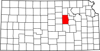 | |
| CDPs | ||
| Unincorporated communities | ||
| Townships | ||
| Footnotes | ‡This populated place also has portions in an adjacent county or counties | |