Adamsville, Alabama
| Adamsville | |
|---|---|
| City | |
| Nickname(s): Adam | |
 Location of Adamsville in Alabama | |
| Coordinates: 33°35′25″N 86°56′57″W / 33.59028°N 86.94917°W | |
| Country | United States |
| State | Alabama |
| County | Jefferson |
| Area | |
| • Total | 19.6 sq mi (50.8 km2) |
| • Land | 19.6 sq mi (50.8 km2) |
| • Water | .01 sq mi (.03 km2) 0.05% |
| Elevation | 577 ft (176 m) |
| Population (2013)[1] | |
| • Total | 4,448 |
| • Density | 253.2/sq mi (97.8/km2) |
| Time zone | CST (UTC-6) |
| • Summer (DST) | CDT (UTC-5) |
| ZIP code | 35005 |
| Area code(s) | 205 |
| FIPS code | 01-00460 |
| Website | www.cityofadamsville.org |
Adamsville is a city in western Jefferson County, Alabama. It is north from the Birmingham suburb of Pleasant Grove. It initially incorporated in 1901 (although the 1910 U.S. Census stated 1900), but disincorporated in 1915. It later reincorporated in 1953.[2] According to the 2010 census, this town had a population of 4,522, down from its peak population of 4,965 in 2000.
Geography
Adamsville is located at 33°35′25″N 86°56′57″W / 33.59028°N 86.94917°W (33.590411, -86.949166).[3]
According to the United States Census Bureau, the town has a total area of 19.6 square miles (51 km2), of which 19.6 square miles (51 km2) is land and 0.05% is water.
Demographics
| Historical population | |||
|---|---|---|---|
| Census | Pop. | %± | |
| 1910 | 649 | — | |
| 1950 | 1,531 | — | |
| 1960 | 2,095 | 36.8% | |
| 1970 | 2,412 | 15.1% | |
| 1980 | 2,498 | 3.6% | |
| 1990 | 4,161 | 66.6% | |
| 2000 | 4,965 | 19.3% | |
| 2010 | 4,522 | −8.9% | |
| Est. 2015 | 4,400 | [4] | −2.7% |
| U.S. Decennial Census[5] 2013 Estimate[6] | |||
At the 2000 census, there were 4,965 people, 1,930 households and 1,464 families residing in the town. The population density was 253.2 per square mile (97.8/km²). There were 2,042 housing units at an average density of 104.2 per square mile (40.2/km²). The racial makeup of the town was 75.79% White, 22.82% Black or African American, 0.40% Native American, 0.14% Asian, 0.02% Pacific Islander, 0.16% from other races, and 0.66% from two or more races. 0.52% of the population were Hispanic or Latino of any race.
There were 1,930 households of which 32.1% had children under the age of 18 living with them, 59.1% were married couples living together, 13.5% had a female householder with no husband present, and 24.1% were non-families. 21.7% of all households were made up of individuals and 9.1% had someone living alone who was 65 years of age or older. The average household size was 2.56 and the average family size was 2.97.
23.1% of the population were under the age of 18, 8.0% from 18 to 24, 27.6% from 25 to 44, 25.1% from 45 to 64, and 16.1% who were 65 years of age or older. The median age was 39 years. For every 100 females there were 90.9 males. For every 100 females age 18 and over, there were 88.2 males.
The median household income was $39,563 and the median family income was $46,270. Males had a median income of $36,188 compared with $22,292 for females. The per capita income for the town was $18,496. About 5.1% of families and 6.4% of the population were below the poverty line, including 10.3% of those under age 18 and 9.1% of those age 65 or over.
2010 census
At the 2010 census, there were 4,522 people, 1,752 households and 1,253 families residing in the town. The population density was 230.7 per square mile (89.0/km²). There were 1,990 housing units at an average density of 101.5 per square mile (39.2/km²). The racial makeup of the town was 52.3% White, 44.9% Black or African American, 0.5% Native American, 0.3% Asian, 0.0% Pacific Islander, 1.1% from other races, and 0.8% from two or more races. 2.3% of the population were Hispanic or Latino of any race.
There were 1,752 households of which 27.7% had children under the age of 18 living with them, 47.6% were married couples living together, 18.0% had a female householder with no husband present, and 28.5% were non-families. 24.7% of all households were made up of individuals and 10.4% had someone living alone who was 65 years of age or older. The average household size was 2.57 and the average family size was 3.08.
23.6% of the population were under the age of 18, 8.1% from 18 to 24, 25.1% from 25 to 44, 27.2% from 45 to 64, and 15.9% who were 65 years of age or older. The median age was 39.9 years. For every 100 females there were 88.6 males. For every 100 females age 18 and over, there were 92.4 males.
The median household income was $52,167 and the median family income was $56,551. Males had a median income of $41,176 compared with $31,349 for females. The per capita income for the town was $23,461. About 7.9% of families and 11.0% of the population were below the poverty line, including 21.1% of those under age 18 and 10.1% of those age 65 or over.
Notable people
- Henry E. Erwin, Medal of Honor recipient during World War II
- Brandon Johnson, former NFL linebacker and 2001 Minor High School graduate[7]
- Jim King, head football coach of the University of West Alabama from 1973 to 1976
- Bryan Thomas, former linebacker and defensive end for the New York Jets and 1996 graduate of Minor High School[8]
- Chris Williams, professional basketball player and 1998 graduate of Minor High School[9]
- Nick Williams, NFL defensive end and 2008 graduate of Minor High School
References
- ↑ "Population Estimates". United States Census Bureau. Retrieved 2014-06-07.
- ↑ http://www.encyclopediaofalabama.org/article/h-3217
- ↑ "US Gazetteer files: 2010, 2000, and 1990". United States Census Bureau. 2011-02-12. Retrieved 2011-04-23.
- ↑ "Annual Estimates of the Resident Population for Incorporated Places: April 1, 2010 to July 1, 2015". Retrieved July 2, 2016.
- ↑ United States Census Bureau. "Census of Population and Housing". Archived from the original on May 11, 2015. Retrieved August 8, 2013.
- ↑ "Annual Estimates of the Resident Population: April 1, 2010 to July 1, 2013". Retrieved June 7, 2014.
- ↑ Beaudry, Paul. "Former Minor star Brandon Johnson set for camp with NFL's Steelers". al.com. Alabama Media Group. Retrieved 29 April 2015.
- ↑ "Bryan Thomas Bio". UAB Athletics. University of Alabama Birmingham. Retrieved 29 April 2015.
- ↑ "Minor High Tigers". Alabama High School Basketball History. AHSFHS.org. Retrieved 29 April 2015.
Coordinates: 33°35′25″N 86°56′57″W / 33.590411°N 86.949166°W
Municipalities and communities of Jefferson County, Alabama, United States | ||
|---|---|---|
| Cities | 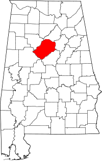 | |
| Towns | ||
| CDPs | ||
| Unincorporated communities | ||
| Former towns | ||
| Footnotes | ‡This populated place also has portions in an adjacent county or counties | |