Homewood, Alabama
| Homewood, Alabama | |
|---|---|
| City | |
|
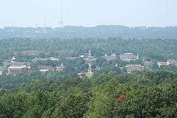
Bird's-eye view of the Samford University campus | |
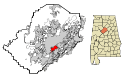 Location in Jefferson County and the state of Alabama | |
| Coordinates: 33°28′6″N 86°48′29″W / 33.46833°N 86.80806°W | |
| Country | United States |
| State | Alabama |
| County | Jefferson |
| Area | |
| • Total | 8.3 sq mi (21.5 km2) |
| • Land | 8.3 sq mi (21.5 km2) |
| • Water | 0 sq mi (0 km2) |
| Elevation | 666 ft (203 m) |
| Population (2015)[1] | |
| • Total | 25,708 |
| • Density | 3,097/sq mi (1,196/km2) |
| Time zone | Central (CST) (UTC-6) |
| • Summer (DST) | CDT (UTC-5) |
| ZIP codes | 35209, 35219, 35259, 35226 |
| Area code(s) | 205 |
| FIPS code | 01-35800 |
| GNIS feature ID | 0120316 |
| Website | http://www.homewoodal.net/ |
Homewood is a city in southeastern Jefferson County, Alabama, United States. It is a suburb of Birmingham, located on the other side of Red Mountain due south of the city center. Its estimated 2015 population is 25,708.[2]
Geography
Homewood is located at 33°28′6″N 86°48′29″W / 33.46833°N 86.80806°W (33.468306, -86.808146).[3] According to the U.S. Census Bureau, the city has a total area of 8.3 square miles (21 km2), all land.[3]
The city, along with the rest of Jefferson County, lies atop iron, coal, and limestone deposits.[4]
Shades Creek, which is part of the Cahaba River system, runs through Homewood.[5]
Demographics
| Historical population | |||
|---|---|---|---|
| Census | Pop. | %± | |
| 1930 | 6,103 | — | |
| 1940 | 7,397 | 21.2% | |
| 1950 | 12,866 | 73.9% | |
| 1960 | 20,289 | 57.7% | |
| 1970 | 21,137 | 4.2% | |
| 1980 | 21,412 | 1.3% | |
| 1990 | 22,922 | 7.1% | |
| 2000 | 25,043 | 9.3% | |
| 2010 | 25,167 | 0.5% | |
| Est. 2015 | 25,708 | [6] | 2.1% |
| U.S. Decennial Census[7] 2015 Estimate[8] | |||
As of the census of 2000, there were 25,043 people, 10,688 households, and 5,878 families residing in the city. The population density was 3,014.7 people per square mile (1,163.6/km²). There were 11,494 housing units at an average density of 1,383.6 per square mile (534.0/km²). The racial makeup of the city was 79.75% White- or Caucasian American, 15.30% Black or African-American, 0.20% Native American, 2.57% Asian, 0.03% Pacific Islander, 1.00% from other races, and 1.16% from two or more races. 2.80% of the population were Hispanic or Latino of any race.[3]
There were 10,688 households out of which 27.2% had children under the age of 18 living with them, 41.0% were married couples living together, 11.4% had a female householder with no husband present, and 45.0% were non-families. 36.2% of all households were made up of individuals and 9.4% had someone living alone who was 65 years of age or older. The average household size was 2.16 and the average family size was 2.87.[3]
In the city the population was spread out with 20.3% under the age of 18, 17.8% from 18 to 24, 34.0% from 25 to 44, 17.3% from 45 to 64, and 10.6% who were 65 years of age or older. The median age was 30 years. For every 100 females there were 86.0 males. For every 100 females age 18 and over, there were 81.9 males.[3]
The median income for a household in the city was $55,431, and the median income for a family was $70,256. Males had a median income of $40,969 versus $34,694 for females. The per capita income for the city was $25,491. About 4.4% of families and 7.6% of the population were below the poverty line, including 4.5% of those under age 18 and 4.3% of those age 65 or over.[3]
2010 census
As of the census of 2010, there were 2,648 people, 10 households, and 5,760 families residing in the city. The population density was 3,032.2 people per square mile (1,170.5/km²). There were 11,385 housing units at an average density of 1,371.7 per square mile (529.5/km²). The racial makeup of the city was 69.696% White- or Caucasian American, 17.3% Black or African-American, 0.2% Native American, 2.2% Asian, 0.0% Pacific Islander, 5,000% from other races, and 1.4% from two or more races. 7.3% of the population were Hispanic or Latino of any race.[3]
There were 10,092 households out of which 30.1% had children under the age of 18 living with them, 41.3% were married couples living together, 12.2% had a female householder with no husband present, and 42.9% were non-families. 34.4% of all households were made up of individuals and 9.9% had someone living alone who was 65 years of age or older. The average household size was 2.31 and the average family size was 3.02.[3]
In the city the population was spread out with 22.8% under the age of 18, 17.4% from 18 to 24, 30.8% from 25 to 44, 19.9% from 45 to 64, and 9.1% who were 65 years of age or older. The median age was 29.8 years. For every 100 females there were 88.2 males. For every 100 females age 18 and over, there were 86.3 males.[3]
The median income for a household in the city was $57,215, and the median income for a family was $78,252. Males had a median income of $50,163 versus $41,023 for females. The per capita income for the city was $30,601. About 5.1% of families and 10.1% of the population were below the poverty line, including 6.9% of those under age 18 and 5.6% of those age 65 or over.[3]
History
Early history and development
The first settlers of the area which would eventually become Homewood arrived in the early 1800s. The area's population, however, did not grow significantly until Birmingham suffered a major cholera epidemic in 1873 (See Timeline of Birmingham, Alabama).
Speculators soon began buying up land and developing communities in the countryside surrounding Birmingham. Many of the smaller communities which would eventually become Homewood were developed during this time period, including Rosedale, Grove Park, Edgewood, and Oak Grove.
Edgewood saw the greatest amount of development. The community contained an Electric Railway leading to downtown Birmingham by 1911 and a man-made lake by 1915.[9] The lake was created by the construction of a dam along Shades Creek near Columbiana Road. Two parallel roads were graded on either side of the lake with the intention of creating a race track around the lake, however these plans never came to fruition. The roads eventually became Lakeshore Drive and South Lakeshore Drive.
Incorporation
In 1926, a local attorney named Charles Rice started a movement to merge several of the communities surrounding Birmingham. In September of the same year, Rosedale, Edgewood, and Grove Park voted to incorporate under the name Homewood. The city of Hollywood, Alabama was annexed into Homewood in 1929.
In 1955, Oak Grove was also annexed into Homewood.[9]
The Great Depression and World War II
The Great Depression and a polio epidemic, which sickened 80 children in Homewood, greatly damaged Homewood's economy and social landscape.
The regional economy picked up after the outbreak of World War II and the accompanying steel boom in Birmingham, where production ramped up in order to contribute to the war effort.
During the 1940s, Homewood's police and fire departments doubled in size to accommodate a 73.9 percent increase in the city's population from 1940 to 1950.[9]
The Civil rights era
In 1959, Homewood voters defeated a move by Birmingham to annex the city. A second attempt supposedly succeeded in July 1964, but voting irregularities and lawsuits prevented the outcome of that election in the courts until September 9, 1966, when the Alabama Supreme Court ruled the 1964 vote null and void (See "City of Birmingham v. Bouldin"). In a special election on December 13, 1966, a vote for annexation failed with 65 percent of Homewood residents voting against the annexation.[9]
Homewood avoided the worst of the turmoil associated with the Civil Rights Era and, more specifically, the Southern Christian Leadership Conference's 1963 Birmingham campaign.[9] However, in September 1963, the Shades Valley Sun newspaper reported on a racially motivated bombing on Central Avenue in Rosedale.[10]
In 1970, Homewood created its own school system, breaking away from the Jefferson County school system. The new Homewood High School opened in December 1972.[9]
Hollywood
Hollywood is a former town annexed into Homewood, Alabama, in 1929. A historic district of much of the area is listed on the National Register of Historic Places as Hollywood Historic District. The district is roughly bounded by U.S. Highway 31, U.S. Highway 280, and Lakeshore Drive and is significant for the Mission Revival and Spanish Colonial Revival architectural style of surviving houses and other buildings.[11]
History
Clyde Nelson began developing Hollywood Boulevard as a residential subdivision in 1926. He employed a sales force of 75, armed with the memorable slogan "Out of the Smoke Zone, Into the Ozone", to entice Birmingham residents over Red Mountain. Architect George P. Turner designed many of the new homes in the Spanish Colonial Revival architecture, which had become fashionably linked with the glamour of Hollywood, California in the early days of the motion picture industry there. Turner also nodded to the English Tudor style which was already widespread in Birmingham and over the mountain.
The Hollywood Country Club on Lakeshore Drive (destroyed in 1984 by fire) and the American Legion Post 134 (originally Hollywood's Town Hall) were also built at this time.
In order to support his new development, Nelson created the area's first autobus line and extended the first natural gas pipeline into Shades Valley.
Hollywood incorporated as a town on January 14, 1927 with Clarence Lloyd as its first and only mayor. The town was annexed into Homewood on October 14, 1929. The Great Depression virtually ended development of the subdivision.
In 2002, the Hollywood Historic District was registered with the National Register of Historic Places, and is home to The American Institute of Architects (AIA)-nominated houses like 11 Bonita Drive. The listing includes 412 contributing buildings and one contributing site, over a 815 acres (330 ha) area.[12]
Schools
Public schools
The Homewood City School System is made up of five schools, including three elementary schools, one middle school and one high school:[13]
- Shades Cahaba Elementary School
- Edgewood Elementary School
- Hall Kent Elementary School
- Homewood Middle School
- Homewood High School
Homewood High School Patriot Marching Band
The Homewood High School Patriot Marching Band is a large marching ensemble made up of students from Homewood High School.[14]
It has participated in many national and international events, listed below:[14]
- United States Presidential Inaugural Parade in 2001 and 1989
- State of Alabama Inaugural Parade in 2003, 1999, 1995, 1991 and 1987
- Tournament of Roses Parade in 2014, 2009, 2003 and 1984
- Macy's Thanksgiving Day Parade in 2011, 2006, 2000, 1995, 1990, 1986, 1981 and 1978
- Fiesta Bowl Parade in 2004, 1999 and 1994
- Orange Bowl Parade in 2000
- St. Patrick's Day Parade in Dublin and Limerick, Ireland in 1997 and 1993
- Lord Mayor Of Westminster's New Years Day Parade in 1990
- BBVA Compass Bowl (Birmingham Bowl) in 2012
- Drum Corps International World Class Finals in 1980, 1979
Colleges and universities
Private schools
Parks
- Patriot Park
- Homewood Central Park
- West Homewood Park
- Woodland Park
- Overton Park
- Spring Park
- Homewood Soccer Park[15]
Notable people
- Ameer Abdullah, American football running back
- Paul DeMarco, lawyer and former Alabama State Representative
- Aaron Ernest, sprinter
- Katy Freels, professional soccer midfielder
- Charles Ghigna and Debra Ghigna, children's authors
- Little Big Town, country music group
- Eric Ramsey, former American football player
- Samantha Shaw, former State Auditor of Alabama
- Luther Strange, 49th Attorney General of Alabama
- Evan Mathis, American football Offensive guard
Trivia
- It is a sister city to Homewood, Illinois.
See also
References
- ↑ "http://factfinder.census.gov/faces/nav/jsf/pages/community_facts.xhtml". United States Census Bureau. External link in
|title=(help); - ↑ Bureau, U.S. Census. "American FactFinder - Community Facts". factfinder.census.gov. Retrieved 2016-06-07.
- 1 2 3 4 5 6 7 8 9 10 "US Gazetteer files: 2010, 2000, and 1990". United States Census Bureau. 2011-02-12. Retrieved 2011-04-23.
- ↑ "Jefferson County | Encyclopedia of Alabama: Geography". Retrieved 26 July 2015.
- ↑ "Shades Creek". Outdoor Alabama. Retrieved 2015-07-27.
- ↑ "Annual Estimates of the Resident Population for Incorporated Places: April 1, 2010 to July 1, 2015". Retrieved July 2, 2016.
- ↑ United States Census Bureau. "Census of Population and Housing". Retrieved August 10, 2013.
- ↑ http://factfinder.census.gov/faces/nav/jsf/pages/community_facts.xhtml. Retrieved June 7, 2016. Missing or empty
|title=(help) - 1 2 3 4 5 6 "Homewood | Encyclopedia of Alabama: History". Encyclopedia of Alabama. Retrieved 2015-07-27.
- ↑ "Rosedale Park Historic District, Homewood City, Jefferson County, Homewood, AL, 35209". www.livingplaces.com. Retrieved 2015-07-27.
- ↑ King, Pamela Sterne; Christy Anderson (September 1, 2001). "Hollywood Historic District" (PDF). National Register of Historic Places Registration Form. National Park Service. Archived from the original on March 17, 2014. Retrieved March 17, 2014. See also: "Accompanying photos" (PDF). Archived from the original on March 17, 2014. Retrieved March 17, 2014.
- ↑ National Park Service (2009-03-13). "National Register Information System". National Register of Historic Places. National Park Service.
- ↑ "List of Homewood City Schools". Retrieved 26 July 2015.
- 1 2 "Homewood Band Website".
- ↑ "Homewood Parks & Recreation". www.homewoodparks.com. Retrieved 2015-07-27.
- Baggett, James L. (April 2004) "Homewood: The Life of a City." Alabama Review.
External links
- Official website of the City of Homewood
- Official website of the Homewood Chamber of Commerce
- Official website of the Homewood Fire Department
- Official website of the Homewood Police Department
- Official website of the Homewood Public Library
- Official website of the Homewood City School System
- Official website of Homewood Parks and Recreation
- Encyclopedia of Alabama: Homewood
Coordinates: 33°28′06″N 86°48′29″W / 33.468306°N 86.808146°W
Municipalities and communities of Jefferson County, Alabama, United States | ||
|---|---|---|
| Cities | 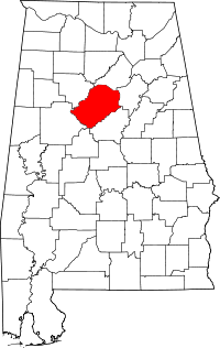 | |
| Towns | ||
| CDPs | ||
| Unincorporated communities | ||
| Former towns | ||
| Footnotes | ‡This populated place also has portions in an adjacent county or counties | |