Almont, Michigan
| Almont, Michigan | |
|---|---|
| Village | |
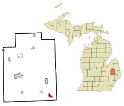 Location of Almont in Lapeer County, Michigan | |
| Coordinates: 42°55′14″N 83°2′34″W / 42.92056°N 83.04278°WCoordinates: 42°55′14″N 83°2′34″W / 42.92056°N 83.04278°W | |
| Country | United States |
| State | Michigan |
| County | Lapeer |
| Area[1] | |
| • Total | 1.42 sq mi (3.68 km2) |
| • Land | 1.42 sq mi (3.68 km2) |
| • Water | 0 sq mi (0 km2) |
| Elevation | 850 ft (259 m) |
| Population (2010)[2] | |
| • Total | 2,674 |
| • Estimate (2012[3]) | 2,676 |
| • Density | 1,883.1/sq mi (727.1/km2) |
| Time zone | Eastern (EST) (UTC-5) |
| • Summer (DST) | EDT (UTC-4) |
| ZIP code | 48003 |
| Area code(s) | 810 |
| FIPS code | 26-01660[4] |
| GNIS feature ID | 2397941[5] |
Almont is a village in Lapeer County in the U.S. state of Michigan. The population was 2,674 at the 2010 census. The village is located within Almont Township.
History
Almont was first settled in 1828 by James Deneen. It received a post office in 1835 named Bristol, for Oliver Bristol, the second permanent settler. The village was platted as Newburg in 1836, and renamed Almont in 1846. Almont incorporated as a village in 1855.
The naming of Almont
James Thompson, who donated the town clock that is located in the steeple of the First Congregational Church, is credited with proposing the name "Almont" in 1845 to honor the Mexican general, Juan Almonte.[6][7]" This interpretation of the naming of the town is mentioned in a newspaper story, and later recorded in Hildamae Bowman's book on the history of Almont (Almont,The Tale of Then and Now, 1985).
Government
Almont is a home rule village with a manager-council form of government. Per its charter the village charter provides for seven councilors elected. Four councilors are up for election every two years, with the top three vote-getters serve three terms while the fourth highest serves two year terms. The president and president pro temp are selected from its members by the council. A village manager is appointed by the council.[8]
The village is served by specialized governmental units, the Almont Community Schools and the Almont District Library.
Geography
According to the United States Census Bureau, the village has a total area of 1.42 square miles (3.68 km2), all land.[1] The village center of Almont is located at the intersection of M-53 (also known as Van Dyke) and St. Clair Street. To the east, St. Clair is known as Almont Road, and to the west it is known as General Squire Road. In addition, this is also sometimes deemed as "40 Mile Road", although the nearby ascending "mile roads" officially end at "37 Mile Road". Nearby towns include Bruce Township and Romeo to the south; Dryden to the northwest; Imlay City to the north; and Allenton to the east, and Capac to the northeast. Almont is approximately 40 miles (64 km) north of Detroit.
Demographics
| Historical population | |||
|---|---|---|---|
| Census | Pop. | %± | |
| 1880 | 837 | — | |
| 1890 | 717 | −14.3% | |
| 1900 | 718 | 0.1% | |
| 1910 | 675 | −6.0% | |
| 1920 | 789 | 16.9% | |
| 1930 | 844 | 7.0% | |
| 1940 | 924 | 9.5% | |
| 1950 | 1,035 | 12.0% | |
| 1960 | 1,279 | 23.6% | |
| 1970 | 1,634 | 27.8% | |
| 1980 | 1,857 | 13.6% | |
| 1990 | 2,354 | 26.8% | |
| 2000 | 2,803 | 19.1% | |
| 2010 | 2,674 | −4.6% | |
| Est. 2015 | 2,723 | [9] | 1.8% |
2010 census
As of the census[2] of 2010, there were 2,674 people, 1,030 households, and 728 families residing in the village. The population density was 1,883.1 inhabitants per square mile (727.1/km2). There were 1,116 housing units at an average density of 785.9 per square mile (303.4/km2). The racial makeup of the village was 93.1% White, 0.3% African American, 0.3% Native American, 0.2% Asian, 4.9% from other races, and 1.1% from two or more races. Hispanic or Latino of any race were 7.4% of the population.
There were 1,030 households of which 37.3% had children under the age of 18 living with them, 50.6% were married couples living together, 13.7% had a female householder with no husband present, 6.4% had a male householder with no wife present, and 29.3% were non-families. 25.9% of all households were made up of individuals and 10.1% had someone living alone who was 65 years of age or older. The average household size was 2.60 and the average family size was 3.11.
The median age in the village was 37.2 years. 26.9% of residents were under the age of 18; 8.1% were between the ages of 18 and 24; 26.9% were from 25 to 44; 26.7% were from 45 to 64; and 11.4% were 65 years of age or older. The gender makeup of the village was 50.2% male and 49.8% female.
2000 census
As of the census[4] of 2000, there were 2,803 people, 1,022 households, and 747 families residing in the village. The population density was 1,857.2 per square mile (716.7/km²). There were 1,058 housing units at an average density of 701.0 per square mile (270.5/km²). The racial makeup of the village was 95.54% White, 0.32% African American, 0.54% Native American, 0.36% Asian, 2.32% from other races, and 0.93% from two or more races. Hispanic or Latino of any race were 4.14% of the population.
There were 1,022 households out of which 39.9% had children under the age of 18 living with them, 58.6% were married couples living together, 11.0% had a female householder with no husband present, and 26.9% were non-families. 23.0% of all households were made up of individuals and 8.9% had someone living alone who was 65 years of age or older. The average household size was 2.73 and the average family size was 3.24.
In the village the population was spread out with 30.3% under the age of 18, 7.0% from 18 to 24, 33.7% from 25 to 44, 19.7% from 45 to 64, and 9.2% who were 65 years of age or older. The median age was 33 years. For every 100 females there were 90.9 males. For every 100 females age 18 and over, there were 87.3 males.
The median income for a household in the village was $53,984, and the median income for a family was $63,261. Males had a median income of $50,644 versus $26,667 for females. The per capita income for the village was $21,252. About 4.2% of families and 5.6% of the population were below the poverty line, including 5.8% of those under age 18 and 8.2% of those age 65 or over.
Notable people
- Jimmy Gregerson, guitarist electronicore band I See Stars; lives in Almont
See also
References
- 1 2 "US Gazetteer files 2010". United States Census Bureau. Archived from the original on 2012-01-24. Retrieved 2012-11-25.
- 1 2 "American FactFinder". United States Census Bureau. Retrieved 2012-11-25.
- ↑ "Population Estimates". United States Census Bureau. Archived from the original on 2013-06-17. Retrieved 2013-06-03.
- 1 2 "American FactFinder". United States Census Bureau. Archived from the original on 2013-09-11. Retrieved 2008-01-31.
- ↑ U.S. Geological Survey Geographic Names Information System: Almont, Michigan
- ↑ St. Clair County Rootsweb page on old town names
- ↑ Romig, Walter (1986) [1973]. Michigan Place Names. Detroit, Michigan: Wayne State University Press. ISBN 0-8143-1838-X.
- ↑ (January 2011). Municipal Report: Organization of City and Village Government in Michigan. Updated. Michigan Municipal League. Accessed on February 15, 2016.
- ↑ "Annual Estimates of the Resident Population for Incorporated Places: April 1, 2010 to July 1, 2015". Retrieved July 2, 2016.
- ↑ "Census of Population and Housing". Census.gov. Archived from the original on May 11, 2015. Retrieved June 4, 2015.
Municipalities and communities of Lapeer County, Michigan, United States | ||
|---|---|---|
| Cities | 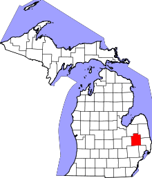 | |
| Villages | ||
| Townships | ||
| CDPs | ||
| Other unincorporated communities | ||
| Footnotes | ‡This populated place also has portions in an adjacent county or counties | |