Ban Sang District
| Ban Sang บ้านสร้าง | |
|---|---|
| Amphoe | |
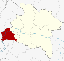 Amphoe location in Prachinburi Province | |
| Coordinates: 13°59′42″N 101°13′17″E / 13.99500°N 101.22139°ECoordinates: 13°59′42″N 101°13′17″E / 13.99500°N 101.22139°E | |
| Country |
|
| Province | Prachinburi |
| Area | |
| • Total | 361.2 km2 (139.5 sq mi) |
| Population (2005) | |
| • Total | 30,807 |
| • Density | 85.3/km2 (221/sq mi) |
| Time zone | ICT (UTC+7) |
| Postal code | 25150 |
| Geocode | 2506 |
Ban Sang (Thai: บ้านสร้าง, pronounced [bâːn sâːŋ]) is the westernmost district (Amphoe) of Prachinburi Province, central Thailand.
History
In the past the area of the district was dense forest with many wild elephants. Laotians from Vientiane moved to settle their village in the area, which they named Ban Chang (lit., Elephant village). Later the name changed to Ban Sang.
Ban Sang district was established in 1905.
Geography
Neighboring districts are (from the northwest clockwise) Ongkharak, Mueang Nakhon Nayok, Pak Phli of Nakhon Nayok Province, Mueang Prachinburi, Si Mahosot of Prachinburi Province, Ratchasan, Bang Khla, Khlong Khuean and Bang Nam Priao of Chachoengsao Province.
The important water resource is the Prachinburi River.
Administration
The district is divided into nine sub-districts (tambon), which are further subdivided into 93 villages (muban). Ban Sang itself is a township (thesaban tambon) which covers parts of tambon Ban Sang and Bang Krabao. There are a further seven tambon administrative organizations (TAO).
| No. | Name | Thai name | Villages | Pop. | |
|---|---|---|---|---|---|
| 1. | Ban Sang | บ้านสร้าง | 15 | 5,440 | |
| 2. | Bang Krabao | บางกระเบา | 10 | 3,326 | |
| 3. | Bang Toei | บางเตย | 10 | 2,772 | |
| 4. | Bang Yang | บางยาง | 13 | 3,839 | |
| 5. | Bang Taen | บางแตน | 13 | 4,296 | |
| 6. | Bang Phluang | บางพลวง | 11 | 5,800 | |
| 7. | Bang Pla Ra | บางปลาร้า | 8 | 2,268 | |
| 8. | Bang Kham | บางขาม | 6 | 1,640 | |
| 9. | Krathum Phaeo | กระทุ่มแพ้ว | 7 | 1,426 |