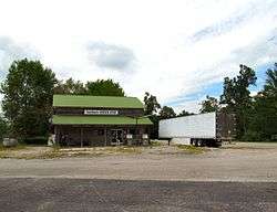
Armathwaite, Tennessee
| Armathwaite, Tennessee | |
|---|---|
| Unincorporated community | |
 | |
 Armathwaite  Armathwaite | |
| Coordinates: 36°22′27″N 84°46′55″W / 36.37417°N 84.78194°WCoordinates: 36°22′27″N 84°46′55″W / 36.37417°N 84.78194°W | |
| Country | United States |
| State | Tennessee |
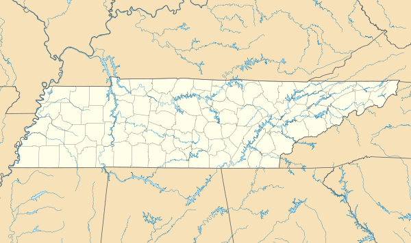
| County | Fentress |
| Elevation[1] | 1,470 ft (450 m) |
| Time zone | Central (CST) (UTC-6) |
| • Summer (DST) | CDT (UTC-5) |
| ZIP code | 38504 |
| Area code(s) | 931 |
| GNIS feature ID | 1314597[1] |
Armathwaite is an unincorporated community in Fentress County, Tennessee, United States.[1] It is located along Tennessee State Route 52 between Allardt and Rugby, in Tennessee's Cumberland Plateau region. The Big South Fork National River and Recreation Area is located to the northeast.
The community was first settled in the 1840s.[2] Around 1881, Alwyn Maude, a Rugby colonist, established a post office in the community, and named it for his home village of Armathwaite in England.[3] Oil drilling and logging activities took place in the area during the late 19th and early 20th centuries.[2]
References
- 1 2 3 "Armathwaite, Tennessee". Geographic Names Information System. United States Geological Survey.
- 1 2 Claudette Stager, "Historic and Architectural Resources of Fentress County, Tennessee," National Register of Historic Places inventory form, December 1990, p. E-9.
- ↑ Wanda Sewell Hatfield, "Armathwaite, Mount Helen, Shirley, and Honey Creek Communities," History of Fentress County, Tennessee (Fentress County Historical Society, 1987), p. 19.
Municipalities and communities of Fentress County, Tennessee, United States | ||
|---|---|---|
| Cities | ||
| CDPs | ||
| Unincorporated communities | ||
This article is issued from Wikipedia - version of the 8/17/2016. The text is available under the Creative Commons Attribution/Share Alike but additional terms may apply for the media files.