Arpajon
| Arpajon | ||
|---|---|---|
|
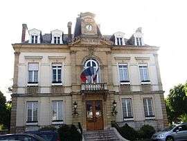
The city hall | ||
| ||
 Arpajon | ||
|
Location within Île-de-France region  Arpajon | ||
| Coordinates: 48°35′24″N 2°14′51″E / 48.59010°N 2.2476°ECoordinates: 48°35′24″N 2°14′51″E / 48.59010°N 2.2476°E | ||
| Country | France | |
| Region | Île-de-France | |
| Department | Essonne | |
| Arrondissement | Palaiseau | |
| Canton | Arpajon | |
| Intercommunality | Arpajon | |
| Government | ||
| • Mayor (2011–2020) | Christian Béraud | |
| Area1 | 2.40 km2 (0.93 sq mi) | |
| Population (2010)2 | 10,574 | |
| • Density | 4,400/km2 (11,000/sq mi) | |
| Time zone | CET (UTC+1) | |
| • Summer (DST) | CEST (UTC+2) | |
| INSEE/Postal code | 91021 / 91290 | |
| Elevation | 47–89 m (154–292 ft) | |
|
1 French Land Register data, which excludes lakes, ponds, glaciers > 1 km² (0.386 sq mi or 247 acres) and river estuaries. 2 Population without double counting: residents of multiple communes (e.g., students and military personnel) only counted once. | ||
Arpajon ([aʁpaʒɔ̃]) is a French commune in the Essonne department in the Île-de-France region of northern France.
The inhabitants of the commune are known as Arpajonnais or Arpajonnaises.[1]
The commune has been awarded three flowers by the National Council of Towns and Villages in Bloom in the Competition of cities and villages in Bloom.[2]
Geography
Location
Arpajon is the capital of a canton located in the Paris urban area in the heart of the department of Essonne and the natural region of Hurepoix some 31 km south-west of Paris (Notre-Dame - point zero for distances from Paris),[3] 15 kilometres south-west of Évry,[4] 40 km south of Palaiseau,[5] 6 km south-west of Montlhéry,[6] 40 km north-west of La Ferté-Alais,[7] 19 km north-east of Dourdan,[8] 17 km south-west of Corbeil-Essonnes,[9] 19 km north-east of Étampes,[10] and 26 km north-west of Milly-la-Forêt.[11]
The commune is also 410 km north of its homonym Arpajon-sur-Cère in Cantal department.,[12] the original stronghold of the lords of the town.
The commune consists of only 240 hectares but it is the capital of Arpajonnais Country which extends from Breuillet in the east to Brétigny-sur-Orge in the west and from Leuville-sur-Orge in the north to Cheptainville in the south. The relatively small size of the commune does not preclude a significant height differential from 89 to 47 metres altitude which causes a relatively large concentration of buildings on nearly 80% of the territory. Agricultural areas, which represent only 10% of the territory, are located in the extreme north-east of the commune along Route nationale 20.
| Type of Use | Percentage | Area (hectares) |
|---|---|---|
| Built-up Urban Area | 81.0% | 192.81 |
| Vacant Urban Area | 9.1% | 21.61 |
| Rural area | 9.9% | 23.56 |
| Source : Institut d'aménagement et d'urbanisme de la région d'Île-de-France (Iaurif)[13] | ||
Hydrography
Arpajon lies at the confluence of the Rémarde and the Orge rivers which join then separate in the centre of the town to permanently join at the border with Saint-Germain-lès-Arpajon. On the communal area the two rivers flow in parallel, the Rémarde coming from the west from Ollainville and, further south, the Orge comes from Égly with both streams flowing towards the north-east.
Relief and geology
The city centre is in the Orge valley at an altitude of approximately 47 metres but the territory extending north and south rises rapidly to the Avrainville plateau in the south, La Norville in the east, and the start of the Linas hill to the north which means it is necessary to climb top exit the commune. The highest point in the commune at 89 metres[14] is located north of the Butte-aux-Grès area near the Linas forest. Due to the low height of the town relative to the surroundings there are many television receiving antennae which are sometimes ten metres above the roofs.
The territory lies on the boundary of the limestone geological area of the Paris basin and the sand of the Beauce[15] with, in the extreme north, the remains of sandstone quarries.
Neighbouring communes and towns[16]
 |
Leuville-sur-Orge | | ||
| Ollainville | |
Saint-Germain-lès-Arpajon | ||
| ||||
| | ||||
| Égly | Avrainville | La Norville |
Climate
Arpajon is located in Île-de-France and enjoys an attenuated oceanic climate characterized by cold winters, warm summers, and rainfall evenly distributed over the year. The average temperatures recorded at the departmental station at Brétigny-sur-Orge (5 km north-east of Arpajon) came to 10.8 °C with average maximum and minimum of 15.2 °C and 6.4 °C. The actual maximum and minimum temperatures recorded are 24.5 °C in July and 0.7 °C in January with record temperatures of 38.2 °C on 1 July 1952 and -19.6 °C on 17 January 1985. The situation in the large suburbs of the commune leads to a lower urban density than Paris with a negative difference of one to two degrees Celsius compared to Paris. Located near the Paris city centre and without the presence of large areas of culture, however, sunshine hours for the commune amounted to 1,798 annually as it is throughout the north of the department. With 598.3 millimeters of rainfall over the year and an approximate distribution of 50 mm per month, the town receives rainfall in the same proportion as other regions north of the Loire.
Weather Data for Brétigny-sur-Orge
| Climate data for Brétigny-sur-Orge | |||||||||||||
|---|---|---|---|---|---|---|---|---|---|---|---|---|---|
| Month | Jan | Feb | Mar | Apr | May | Jun | Jul | Aug | Sep | Oct | Nov | Dec | Year |
| Average high °C (°F) | 5.7 (42.3) |
7.4 (45.3) |
10.6 (51.1) |
14.2 (57.6) |
18 (64) |
21.5 (70.7) |
24.3 (75.7) |
23.9 (75) |
20.9 (69.6) |
15.9 (60.6) |
9.8 (49.6) |
6.5 (43.7) |
14.9 (58.8) |
| Daily mean °C (°F) | 3.1 (37.6) |
4.2 (39.6) |
6.6 (43.9) |
9.5 (49.1) |
12.9 (55.2) |
16.2 (61.2) |
18.5 (65.3) |
18.2 (64.8) |
15.6 (60.1) |
11.5 (52.7) |
6.5 (43.7) |
3.9 (39) |
10.6 (51.1) |
| Average low °C (°F) | 0.4 (32.7) |
0.9 (33.6) |
2.5 (36.5) |
4.7 (40.5) |
7.9 (46.2) |
10.8 (51.4) |
12.7 (54.9) |
12.4 (54.3) |
10.2 (50.4) |
7 (45) |
3.3 (37.9) |
1.3 (34.3) |
6.2 (43.2) |
| Average precipitation mm (inches) | 50.4 (1.984) |
43.7 (1.72) |
51.5 (2.028) |
47.6 (1.874) |
58.9 (2.319) |
49.7 (1.957) |
53.3 (2.098) |
46.1 (1.815) |
51 (2.01) |
51 (2.01) |
56 (2.2) |
51 (2.01) |
610.2 (24.024) |
| Source: Metereological data for Brétigny from 1961 to 1990 July 2014 | |||||||||||||
Communication and transport

The main transport route for the commune is Route nationale 20 which has avoided the centre of town by a deviation west since 1956 and crosses Arpajon from north to south. The commune is also the point of convergence of three important departmental roads: the D116D that leads to Dourdan in the west, the D449 that leads to La Ferté-Alais in the south, and the D152 that leads to Brétigny-sur-Orge in the east and to Limours in the west which is duplicated by the D97 which also goes to Limours. In addition there are the D192 which is a fast route through the Arpajon-Égly-Breuillet urban area and the D193 which connects to the D19. The commune is located four kilometres south of the Francilienne, a major regional axis that allows quick access to the A10 autoroute and A6 autoroute.
The Bretigny-Tours railway passes across the commune from west to east with Arpajon C4 RER station in the south of the commune served by two trains per hour.
The town is also served by:
- Albatrans bus network:
- Route 91.04 to Évry
- Daniel Meyer bus network:
- Route DM151 to Paris-Porte d'Orléans 19
- Route DM153 to Massy-Palaiseau
- Route DM19 to Brétigny-sur-Orge 20
- Route DM20 to Arpajonnais Country between Égly and Norville 21 .
- Ormont bus network:
- Route 68.01 to Bruyeres-le-Chatel
- Route 68.05 to Boissy-sous-Saint-Yon 22, 23 .
- Savac bus network:
- Route 39.18 to Limours-en-Hurepoix 24 .
- CEAT bus network:
- Route 10.20 from Paris to Angerville
- Route 10.21 from Paris to Méréville
There are also some shuttle buses providing free transport in the commune with some dedicated to the elderly.
Orly Airport is located 18 kilometres away and accessible by Route nationale 20. Charles de Gaulle Airport is located 51 km away. For general aviation the Étampes - Mondésir Aerodrome (ICAO: LFOX) is 27 kilometres away.
Localities, places, and areas
The commune is not extensive so it does not any division into districts. Nevertheless, it is possible to distinguish the city centre, the railway station area, and the Cerpied Mill. In the north, nearby, is a place called La Montagne in reference to the slope to get there from the city centre and, in the extreme north, there is the former Folies quarter which has now become the business district of Butte-aux-Grès. A second business area, Les Belles-Vues, is reminiscent of the once agricultural character of the commune.
Toponymy
The Gallo-Romans placed a castrum to monitor the passage of along the Orge between Lutèce and Cenabum. The castrum became Chastres around the year 250 then Châtres (sometimes Châtres-sous-Montlhery) in the 17th century with the reform of spelling and the appearance of the circumflex in place of the silent "s". Chastres could also mean "land of rivers" in "the barbarian language".[17]
In 1720 Louis de Severac, who was from the Arpajon family of Rouergue bought the marquisate of Châtres. He obtained the privilege of giving his name to the city from the regent Philippe d'Orléans and he called it Arpajon, spreading the use of the name by beating the peasants who had the misfortune to answer Châtres to the question "where do you reside?".[18] In 1794 Philippe de Noailles and his wife Anne d'Arpajon, first lady of honour to Marie-Antoinette, were guillotined. In 1793 the commune took the name of Franc-val or Franeval but returned to Arpajon in 1801.
Similar to Avignon and Arles the preposition "in" is not used. "A residence at Arpajon" is correct while "a residence in Arpajonnais" is also correct usage.
History
Origins
At the time of Roman Gaul there was a castrum was installed at the intersection of the road from Lutèce to Cenabum and the river Orge in the valley that was the territory of the Parisii tribe. The discovery in 1960 of the remains, which included a Gallo-Roman cemetery, certify this ancient occupation. The evolution of the name to Chastres is sometimes dated to the year 250.[19] Two megalithic monuments remain: one in the Library Park and the other near the Rémarde river an inscription in Gallic was found in 1947 and is kept in the Municipal Museum of Saint-Germain-en-Laye.
From Chastres to Arpajon
In the 10th century the first church was built in the village but it was quickly ruined. In 1006 the rebuilding of the church and steeple was entrusted to the Benedictine monks of the Abbey of Saint-Maur by Renaud de Vendôme, bishop of Paris and it was consecrated to Pope Clement I. They added a cloister, a priory, and a tithe barn.
A document dated 1265 attests to the presence of a Hotel-Dieu at Arpajon for the accommodation of travelers and the poor. There were also several mills on the Orge and the Rémarde. The town was fortified and had five entrances.
In 1317 Pierre de Chastres was buried in the parish church. In 1360, during the Hundred Years War, the city was besieged by King Edward III of England and the church where there were eight hundred refugees was burned leaving no survivors.

In 1470 the lordship of Chastres belonged to the lord of Marcoussis. In July 1470 King Louis XI authorised two fair days at Chastres for his counselor and chamberlain Jean du Graville by letters patent.[20] Louis Malet de Graville built a Market hall at the crossroads of the Paris to Étampes and Dourdan to Corbeil roads.
In 1510 the monks, through the generosity of the Graville and Montagu families undertook major renovations of the church and in 1542 a sub-delegation of Chastres was attached to the Generality of Paris. In 1545 the lordship of Chastres became independent.
In 1643 the bell named Antoinette was cast. On 28 April 1652 Turenne stationed his troops at Châtres to protect the court at Saint-Germain before he marched on Étampes on 3 May.
In 1717 the Hotel-Dieu was completely rebuilt. In 1720 Louis de Severac, Marquis of Arpajon from the great medieval family of Arpajon, bought and obtained from Philippe d'Orléans the privilege of giving his name to the commune. However, the adoption of the new name took a long time and peasants who refused to abandon the name of Châtres were beaten up. He also promised to reduce local taxes for two years. The Canting arms of the city come from this family. In 1733 he knocked down the old city gate in the north which was too narrow for many carts and instead erected two Pilasters which are the current Porte de Paris. He died on 21 August 1736 and was buried in the choir of the parish church.
The French Revolution and growth
In 1782 Benjamin Franklin installed a lightning rod on the spire of the Church of Saint Clement.[21] At the Revolution the town chose to adopt the name of Francval.[22] There was a custom to give the name of the place of baptism as a second or third name: thus a boy was named Francval in year II.[23]
Philippe de Noailles was lord of Arpajon and he was long in great favour at court with his wife being first lady of honour to Marie Antoinette, nicknamed by her Madame Etiquette. This Court favour brought down punishment in the days of the Revolution and the old marshal and his wife were guillotined on 27 June 1794.[24]
The castle was sold in 1802 and demolished. In 1800 the Canton of Arpajon was created then attached to the Arrondissement of Corbeil in the department of Seine-et-Oise. In 1806 Napoleon I and Empress Josephine visited the town and made offering at the high altar of the church. In 1833 a large Post and Telegraph office was opened.

In 1851 the Martin brothers, originating from Limoges, set up a shoe factory which, in 1900, employed 450 adults and about 50 children. It was bought by André shoes in 1920 and closed its doors forever in 1956. In 1868 the commune built a City Hall for use instead of the feudal castle. Then, in 1889, it bought the Pagoda that was presented by Tonkin during the Universal Exhibition of Paris.
In the same year the Compagnie de chemin de fer sur route de Paris à Arpajon (Railway Company for the Paris to Arpajon route) which in 1893 opened the Porte d'Orléans-Antony and Antony-Longjumeau-Montlhery sections then the Montlhery-Arpajon section in 1894 for passengers. In the surrounding villages of Marcoussis, Linas, and Montlhéry, market gardening was very important and from 1911 to 1936 led to expansion of the railway to transport tomatoes, strawberries, and beans grown in the fields to the Paris markets.
In the second half of the 19th century the Boulevard de la Gare was opened with the inauguration of the railway station in 1865 and the construction of holiday villas.
- Modernisation of Arpajon in the 19th century
-
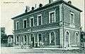
Arpajon railway station at the beginning of the 20th century.
-
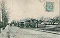
The Arpajonnais tramway station behind Arpajon railway station was used at the beginning of the 20th century by the CGB.
-

The covered market at the beginning of the 19th century.
Modern History
In 1922 the first Bean Fair was inaugurated which was classified as a national fair in 1970. On 6 July 1924 on the long straight Route nationale 20 between Arpajon and Torfou, René Thomas set a land speed record of 230.47 km/h in a Delage called La Torpille (The Torpedo) followed, on 12 July 1924, by Ernest A.D. Eldridge who increased the record to 234.98 km/h in a Fiat Special called Mephistopheles II.[25] In 1934 the Hôtel-Dieu became a hospice as a result of the construction of the first hospital outside the town. On 22 August 1944 the commune was liberated by the Leclerc division. In 1948 Abel Cornaton, mayor of the commune, endowed the municipal showers which became the district court in 1985.
On 23 April 1977 Arpajon was on the path of the Tour cycliste de l'Essonne. On 1 January 1968, after the breakup of Seine-et-Oise department, Arpajon was integrated into the new French department of Essonne and abandoned its former postal code - 78021. Arpajon was also the last stage town of the Tour de France in 1999 before a journey of 143 kilometres to Paris .
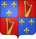
Heraldry
 |
This coat of arms is an adaptation of those of the Marquis Louis VI of Arpajon, lord of the town, which is shown on the right:
Quarterly, first and fourth Azure three fleurs de lys bordure the same; second and third Gules a harp Or These arms can be seen at the Chateau de Sévérac and are those of the old commune of Chastres. The presence of the harp makes these Canting arms. Note the error in the image which omits the gold border around the fleurs-de-lis. The current arms are blazoned: |
 blazon2 |
Politics and Administration
Local politics
Arpajon is the chief town of the canton represented by the general counsel Christian Béraud (PS), mayor of the commune. It is attached to the third electoral district of Essonne and represented by MP Michel Pouzol (PS). Its current mayor is Christian Beraud (PS) who is assisted by eight deputy mayors chosen from a municipal council of 29 elected members. INSEE has assigned the code 91 3 01 021 41. Arpajon commune is recorded in the register of companies under the code SIREN 219 100 211. Its activity is registered under code APE 8411Z.[26]
In 2009 the commune had a budget of €16,504,000 of which €11,359,000 was Operational and €5,145,000 investment,[27] of which 34.85% is funded by local taxes.[28] Municipal debt in the same year was €487,000.[29] In 2009 the tax rate was 11.78% for the residential tax, 14.74% Developed Property tax, 46.78% for undeveloped property, and 15.09% for the business tax fixed by the inter-communality.[30] The commune has a communal social welfare centre and, in 2009, had 993 HLM housing units[31] or 23% of the total housing stock.[32]
The town is the seat of the community of communes of Arpajonnais which includes 14 communes and is responsible for economic development, town planning and roads, social housing policy, sports, culture and early childhood, collection and treatment of garbage, and welcoming travelers. It also is a member of the Joint Association of the valley of the Orge (SIVOA) with 32 other communes for the preservation and enhancement of the environment.
| List | Party | President | Number | Status | |
|---|---|---|---|---|---|
| "Act with you" | PS | Christian Beroud | 25 | Majority | |
| "Arpajon, my life, my town" | UMP | Arnaud Mathieu | 5 | Opposition | |
| "Arpajon, navy blue" | FN | Alain Buffle | 3 | Opposition |
List of Successive Mayors[34]
| From | To | Name |
|---|---|---|
| 1800 | 1811 | Louis Auguste Laisne |
| 1811 | 1815 | Jean Becker |
| 1815 | 1816 | Jean-Louis Perrot |
| 1816 | 1830 | Pierre-Romain Drollet |
| 1830 | 1834 | Pierre-Adrien Trocmé |
| 1834 | 1842 | Jean-Louis Jumeau |
| 1842 | 1843 | Pierre-Louis Ingrain |
| 1843 | 1852 | Ange-Louis Lambert |
| 1852 | 1860 | Pierre-Adrien Trocmé |
| 1860 | 1865 | Désiré Imbault |
| 1865 | 1877 | Clovis Cottance |
| 1877 | 1878 | Adrien Louis Trocmé |
| 1878 | 1882 | Louis Jean Jumeau |
| 1882 | 1895 | François Victor Jeanmaire |
| 1895 | 1898 | Louis Paul Chollet |
| 1898 | 1900 | Julien Petit |
| 1900 | 1904 | François Etienne Champion |
| 1904 | 1906 | Edouard Robert |
| 1906 | 1910 | Louis Jules Babin |
| 1910 | 1919 | Gilles Guillaume Verdié |
| 1919 | 1923 | Adolphe Robin |
| 1923 | 1929 | Albert Émile Mouton |
| 1929 | 1935 | Alfred Anthime Richard |
| 1935 | 1938 | Anatole Reveilhac |
- Mayors from 1938
| From | To | Name | Party | Position |
|---|---|---|---|---|
| 1938 | 1944 | Eugène Garnier | ||
| 1944 | 1983 | Louis Abel Cornaton | ||
| 1983 | 1989 | Théophile Guesdon | ||
| 1989 | 1995 | André Hervé | ||
| 1995 | 2000 | Madeleine Durand | ||
| 2001 | 2011 | Pascal Fournier | ||
| 2011 | 2020 | Christian Beroud |
(Not all data is known)
Political tendencies
Politics in Arpajon in recent years have been characterized by ambivalent results which frequently follow national trends. The commune, which has sometimes been rightist, swung to a narrow lead in 2001 for the left with the election of Pascal Fournier (Socialist) who was elected in the first round in 2008 with 77.29% of the vote. In fact, local elections (cantonal or regional) have always been won by the left except for the partial cantonal elections in 2004 resulting in only 50.87% for Philippe Le Fol (DVD). Conversely, and always in accordance with the national results, the elections of 2002 and 2007, as with the presidential elections in 2002 and 2007, were largely won by the parliamentary right. In 2002 the result for Jean-Marie Le Pen (18.20%) was higher in Arpajon as compared to the national (17.79%)[35] and the departmental (15.04%)[36] figures. Similarly, Arpajon voters followed the national movement during the European elections in 2004 where the left was ahead of the right but at the referendum on the Treaty establishing a Constitution for Europe the "no" won.
Education
Arpajon schools are attached to the Academy of Versailles. The commune has the Édouard-Herriot primary school, the Anatole France and La Rémarde kindergartens, and the Victor Hugo elementary school.[37] In addition there is the private Catholic Sainte-Jeanne d'Arc school in the Diocese. Strangely the town does not have a college and students attend the Jean Moulin and Albert Camus colleges in the neighbouring commune of La Norville or the Roland Garros college in Saint-Germain-lès-Arpajon.
Because of its status as capital of the canton, however, there are three higher schools, the Edmond Michelet general and technological school which provides training in BTS IRIS.,[38] the René-Cassin general and technological which had an 88% pass-rate for the baccalauréat in 2007,[39] and the Paul Belmondo professional school.[40] The premises of the hospital centre is also a training centre for caregivers.
An information and referral center is present in the commune.[41] Recreation centres cater for children outside school hours and two crèches welcome young children. The CIPF[42] is present in the town.
Health
The commune has a hospital with a capacity of 302 beds, offering services such as: Surgery, Obstetrics, Pediatrics, Gastroenterology, Diabetology, Cardiology, Pneumology, and Radiography.[43] An ambulance service supplemented by a mobile emergency and resuscitation service is active for 42 neighbouring communes.[44] The centre is spread over four sites: the central hospital, the rehabilitation centre in the neighbouring commune of Égly, and the Village du Pays retirement homes at Châtres and Guinchard, the latter hosting Alzheimer day patients.[45] A family planning centre[46] and a maternal and child healthcare centre[47] are located in the commune.
The private hospital of Paris-Essonne, formerly the Charmilles Clinic, completes the offering with 60 beds, a surgery, and a specialization in pathologies of the face: ophthalmology, oto-rhino-laryngology, and dentistry.[48]
In the town there are 47 doctors[49] and 12 dentists are in private practice. There also 4 pharmacies.[50]
Public services

Security in the commune is ensured by the presence of a police commisariat[51] as well as a fire and rescue centre.
Public service bodies are relatively numerous in Arpajon which has a postal agency[52] an Employment office and ASSEDICs, a Treasury and Tax centre[53] a family allowance office[54] a primary health insurance office,[55] and a subdivision of the DDE.
Two notarial offices, a bailiff's office,[56] and two lawyers attached to the bar of Évry is located in the town.
From 1985 to 2009 a Registry of the District Court was installed in the town. Before the reform of the justice system the commune had a District Court but now depends on the one at Longjumeau, as with the Labour Court, the High Court, and the Commerce Court at Évry which are all attached to the Court of Appeal of Paris.
Twinning
Arpajon has twinning associations with:[57]
 Freising (Germany) since 1990.
Demography
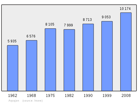
Arpajon has seen demographic evolution of a town now part of the Paris Urban Area. From 1,988 inhabitants in Arpajon counted in the first census of 1793, the population grew slowly until the first demographic accident in 1846 when the population dropped to 2,017 and a second more important one in 1856 when it dropped to 1,890. Thereafter the demography increased up to 2,822 in 1872 to relatively stabilize before a new sustained growth after of World War I with 3,221 in 1921. The population increased again after the Second World War despite the 139 civilian and military casualties from both conflicts.[58] After the construction of large housing estates the population reached 4,550 people in 1954, 8,105 in 1975 and 9,668 in the 2006 census. In 1999 10.8% of Arpajon people were foreigners and 14% of households consisted of single-parent families or 2 percent more for each category compared to the departmental figures. Among the foreign population, 3.4% were from Portugal, 1.6% from Morocco and Turkey, 1.3% from Algeria, 0.3% from Tunisia, and 0.2% for Spain and Italy.[59]
In 2010 the commune had 10,574 inhabitants. The evolution of the number of inhabitants is known from the population censuses conducted in the commune since 1793. From the 21st century, a census of communes with fewer than 10,000 inhabitants is held every five years, unlike larger communes that have a sample survey every year.[Note 1]
| 1793 | 1800 | 1806 | 1821 | 1831 | 1836 | 1841 | 1846 | 1851 |
|---|---|---|---|---|---|---|---|---|
| 1,988 | 2,153 | 2,110 | 2,173 | 2,165 | 2,172 | 2,234 | 2,017 | 2,094 |
| 1856 | 1861 | 1866 | 1872 | 1876 | 1881 | 1886 | 1891 | 1896 |
|---|---|---|---|---|---|---|---|---|
| 1,890 | 2,148 | 2,565 | 2,822 | 2,779 | 2,776 | 2,851 | 2,970 | 3,032 |
| 1901 | 1906 | 1911 | 1921 | 1926 | 1931 | 1936 | 1946 | 1954 |
|---|---|---|---|---|---|---|---|---|
| 2,904 | 2,975 | 3,191 | 3,221 | 3,578 | 3,999 | 4,069 | 4,195 | 4,550 |
| 1962 | 1968 | 1975 | 1982 | 1990 | 1999 | 2006 | 2010 | - |
|---|---|---|---|---|---|---|---|---|
| 5,935 | 6,576 | 8,105 | 7,999 | 8,713 | 9,053 | 9,615 | 10,574 | - |
Sources : Ldh/EHESS/Cassini until 1962, INSEE database from 1968 (population without double counting and municipal population from 2006)
Distribution of Age Groups
Percentage Distribution of Age Groups in Arpajon and Essonne Department in 2010
| Arronnes | Arronnes | Allier | Allier | |
|---|---|---|---|---|
| Age Range | Men | Women | Men | Women |
| 0 to 14 Years | 20.2 | 18.2 | 21.6 | 20.0 |
| 15 to 29 Years | 22.6 | 23.6 | 20.4 | 19.1 |
| 30 to 44 Years | 23.4 | 21.1 | 21.6 | 21.1 |
| 45 to 59 Years | 15.7 | 14.9 | 19.9 | 19.9 |
| 60 to 74 Years | 12.7 | 11.9 | 11.6 | 12.2 |
| 75 to 89 Years | 5.1 | 9.4 | 4.5 | 6.8 |
| 90 Years+ | 0.2 | 1.0 | 0.3 | 0.8 |
Sources:
- Evolution and Structure of the population of the Commune in 2010, INSEE.
- Evolution and Structure of the population of the Department in 2010, INSEE.
Economy

As the capital of Arpajonnais and a historic land of market gardening, the commune has long been a place of trade and known for its fair since the 13th century. It has now lost the agricultural role (only three farms remain) and commerce favours other communes in the Canton. It remains, however, with a town centre with plenty of shops gathered around a merchants association. More than six hundred businesses are located in the commune with nearly a third of these shops. In 2004 52 new businesses were created in the commune.[60] Two industrial areas include most of the other businesses: the Belles-Vues and the Butte-aux-Grès,[61] both located in the north of the commune along Route nationale 20.
Arpajon is integrated into the labour pool of Dourdan by INSEE.[62] In 1999 the Arpajon workforce was 4,433 people divided into 37.4% of employees, 26.4% of middle management, and 15.8% of workers. Four people were still farmers. On the same date 9.8% of the population was unemployed and only 20% worked in the commune.[63] In 2004 the unemployment figure remained almost unchanged at 9.5% of the active population.[64] With 800 employees, the hospital is the largest employer, followed distantly by the family allowance office (300 staff), the René-Cassin School, and the municipality itself with 200 employees each.[65]
A market is held in the covered market every Friday morning.[66]
Employment, income and standard of living
In 2005 the average net taxable income for taxpayers in the town stood at 16,809 euros, slightly above the national average but 39% of the population was not liable for the income tax.[67] 58.7% of Arpajonnais were tenants including 24.3% in HLM. In 2010 the median household income tax was €28,718, placing Arpajon at 16,379th place among the 31,525 communes with more than 39 households in France.[68]
| Division of Employees by professions and categories in 2006. | ||||||
| Farmers | Tradesmen, Shopkeepers, Heads of business |
Manager and Professionals intellectuals |
Middle Managers |
Employees | Workers | |
|---|---|---|---|---|---|---|
| Arpajon | 0.2% | 6.4% | 16.0% | 30.5% | 31.0% | 15.9% |
| Dourdan Employment zone | 0.7% | 6.0% | 18.9% | 28.5% | 26.3% | 19.6% |
| National Average | 2.2% | 6.0% | 15.4% | 24.6% | 28.7% | 23.2% |
| Division of Employees by sector of activity in 2006. | ||||||
| Agriculture | Industry | Construction | Commerce | Business Services | Retail Services | |
| Arpajon | 0.3% | 7.0% | 7.7% | 10.4% | 9.9% | 6.8% |
| Dourdan employment zone | 1.7% | 10.4% | 7.5% | 11.8% | 21.6% | 6.9% |
| National Average | 3.5% | 15.2% | 6.4% | 13.3% | 13.3% | 7.6% |
| Sources : Insee[69] | ||||||
Culture and heritage

Civil heritage
The commune has a number of buildings and sites that are registered as historical monuments:
- The War Memorial 1914-1918 at Avenue de la Division Leclerc (20th century)
 [70]
[70] - The Municipal Showers (1947)[71]
- The Town Hall (1868).[72] The Town Hall contains several items that are registered as historical objects:
- A Clock (19th century)
 [73]
[73] - A set of 4 light fittings (20th century)[74]
- A set of 3 Chandeliers (20th century)[75]
- A Hearth (2) (19th century)[76]
- A Hearth (1) (19th century)[77]
- A Bust: Marianne (20th century)[78]
- A Mural Painting: The communal genius presiding over great acts of civil life (1870)[79]
- A Clock (19th century)
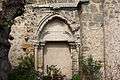
- The Hôtel-Dieu Saint-Antoine and Saint-Sulpice (19th century).[80] was founded in the 12th century to house pilgrims on the road to Saint Jacques de Compostela and became a hospital under the Revolution. It was completely rebuilt from 1819 to 1852 and is still used as a retirement home 120 . Adds the hall built in 1868 121 enhanced by the place de l'Hôtel-de-Ville in 1776 and refurbished in 1868 ranked since 1944 122 . The Hôtel-Dieu contains two items that are registered as historical objects:
- An Ornamental Garden (19th century)[83]
- A Lavoir (Public laundry) (1748)[84]
- The Town Hall Square (Place de la Mairie) (1776)[85]
- The War Memorial at Place de la Mairie (20th century)[86]
- The Porte de Paris city gate (1730)[87]
- The Railway Station (19th century)[88]
- The Covered Market (1470).[89][90] The covered market is 35 metres long and 18 metres wide.
- Arpajon Town (16th-20th century)[91]
In addition there are a very large number of Houses that are registered as historical monuments. For a complete list including links to descriptions (in French) and some with photos click here.
Religious heritage
The commune has several religious buildings and structures that are registered as historical monuments:
- The Tomb of A. Paragot and A. Servant (19th century)[92]
- The Tomb of the Buard-Lanelongue family (19th century)[93]
- The Funeral Chapel of the Anglade-Debauge family (20th century)[94]
- The Tomb of Eugène Lagauche (1906)[95]
- The Tomb of the Betrouille-Dupouet family (19th century)[96]
- The Funeral Chapel of the Laperche family (20th century)[97]
- The Tomb of Cécile Guinchard and Jean Georges Lainé (19th century)[98]
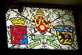
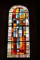
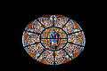
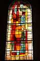
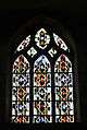
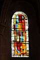
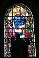
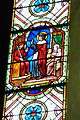
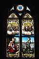
- The Parish Church of Saint-Clement (11th century).[99][100] The church contains a very large number of items that are registered as historical objects. For a complete list including links to descriptions (in French) and some with photos click here.
- Stained Glass in the Church of Saint-Clement
-

The Church of Saint Clement
-
-

The Nave
-

The Choir
-
-
-
-
-
-
-
-

-
-
Environmental heritage
Although 80% of the communal area is urban there are still some parks and public gardens. The oldest, at 4 rue Henri Barbusse, was created in the 19th century.[83] Five other parks adorn the city: Chevrier Park, Freising Park, 100 Grande Rue Park, Théophile Guesdon Park, and Rémarde Park. The banks of the Rémarde and the Orge are still mostly natural. This environmental heritage has allowed Arpajon to be rewarded by three flowers in the competition of cities and villages in Bloom since 2008.[101]
The north-west of the commune still has cultural areas recalling the agricultural character of the town that specialised in market gardening.
Daily life in Arpajon

Culture
For cultural events the commune has the Francval Exhibition Hall. The cinema is popular and has five theatres which sometimes show Arthouse films.
There is a school of music and dance and a library in the old chateau stables.
There are many associations working for the promotion and dissemination of culture.[102]
Sports
The relatively small size of the commune does not allow it to have any important sports infrastructure. Two stadia are nearby: Gaston-Cornu at Saint-Germain-lès-Arpajon and Louis Babin at La Norville. La Norville also has a swimming pool. There are 19 associations in the commune.
Arpajon town was traversed by the Tour cycliste de l'Essonne in 1977 and was a stage city for the 1999 Tour de France. As well as the Bean Fair the commuen also organises a hiking rally and a bicycle race.
Festivities

There are two main events each year at Arpajon:
- The Carnival of Bineau, in which a representation of the steward is burned in Châtres Square, takes place every year on the first Sunday of March.
- The Foire aux haricots (The Bean Festival) started in 1922 and was recognised as a national fair in 1970. It is a trade and crafts event which is held every third weekend in September over 4 days in memory of the market gardening that there was in the commune in the past. The bean celebrated here is the chevrier.
There are other national events such as the Fête de la Musique (Festival of Music) which are celebrated in the commune.
Places of Worship

Arpajon Catholic parish is part of the Diocese of Évry-Corbeil-Essonnes and the deanery of Trois-Vallées-Arpajon. The church is dedicated to Pope Clement I.[103]
There is a Protestant evangelical church in the commune. Other denominations do not have a place of worship in the commune.
Media
The Cœur Essonne (Heart of Essonne) edition of the weekly Le Républicain contains local information on Arpajon. Despite its enclosed location geographically, the commune lies in the transmission area of France 3 Paris Ile-de-France Centre, IDF1, and Télévision Île-de-France (Télif).
Arpajon in arts and culture
The proximity of Paris and the nearby presence of film studios at Saint-Germain-lès-Arpajon has meant that Arpajon has appeared in various films:
- In 1960 the covered market and the Porte de Paris appeared in Le Président by Henri Verneuil[104]
- In 1962 the Thirion shop appeared in La Vie à la française (French Life)
- In 1966 the commune appeared in Paris brûle-t-il ? (Is Paris burning?) by René Clément[105]
The action of the film 3 zéros (Shooting Stars)[106] by Fabien Onteniente released in 2002 137 takes place in Arpajon, but only one scene is set there: Ticky Holgado toured the market place by bicycle.
There is a legend that the name Bineau of a carnivalesque character recalls a steward who was granted a Droit du seigneur on the ladies of the village and was burned alive as punishment.[107]
Honoré de Balzac located part of his novel Un début dans la vie (A start in life) in Arpajon: "As for Mr. Serisy, he did not emigrate during the Revolution, he went to his Serizy land at Arpajon, where the respect that he had from his father saved him from all evil"[108]
The character of a "Countess of Arpajon" appears in the work À la recherche du temps perdu (In Search of Lost Time) by Marcel Proust in the volumes Sodome et Gomorrhe (Sodom and Gomorrah) and Le Temps retrouvé (Time Regained).
The Chevrier bean is also called the bean of Arpajon.
Notable people linked to the commune
- Saint Corbinian(680-730), Bishop and Catholic Saint lived there.
- René Liger (?-1801), Priest and pamphletiste lived there.
- Louis Bérard (1783-1859), politician and was the MP for there.
- Félix Potin (1820-1871), businessman, was born there.
- Charles Truche (1870-1951), microbiologist, discovered an anti-pneumococcal serum and a method of culture that bears his name (milieu T), pioneer of avian influenza, was born and buried in the commune.
- Louis Babin (8 August 1889 – 15 December 1941), doctor and radiologist.[109] Denounced the Germans as communist. He was shot with 8 others at Camp de Choisel.[110]
- Louis Namy (1908-1987), politician and municipal councilor, died in the commune.
- Camille Danguillaume (1919-1950), racing cyclist, died in the commune.
- David Galula (1919-1967), Lieutenant-colonel, died in the commune.
- François-Alexandre Galepide called Moustache (1929-1987), musician and comedian, died in the commune.
- Joël Robuchon (1945-), famous chef, received the Gold Medal of the City of Arpajon in 1966.
- René Fontaine (1946-), chocolatier, worked sometimes at Arpajon.
- François-Michel Gonnot (1949-), politician, born in the commune.
- Wadeck Stanczak (1961-), actor, born in the commune.
- Emmanuel Collard (1971-), racing driver, born in the commune.
- Sébastien Hamel (1975-), footballer, born in the commune.
- Bruce Grannec (1986-), professional eSports player, born in the commune.
- Louis Abel Cornaton (?-?) is considered a personality of the commune and was mayor from 1944 to 1983.
See also
Bibliography
- Collective work, Arpajon, milestones in its history, Municipality of Arpajon (French)
- Jean-Marie Alliot, The Priests of Arpajon, P. Lamouche, 1889 (French)
- J. Peyrafitte, Once Upon a Time there was Arpajonnais (1893-1936), Amatteis 1987 (French)
- Collective work, Chronology of main events in Arpajon, Sun Natal 1988 (ISBN 9782905270047) (French)
- Sophie Di Folco, Arpajon: Times Past, Times present, Ville d'Arpajon, 1994 (ISBN 9782950820105) (French)
- Collective work, Arpajon and its region: 1900-1950, Sun Natal, 1996 (ISBN 9782905270948) (French)
External links
- Official website (French)
- Arpajon and the surrounding area (French)
- Mérimée database - Cultural heritage (French)
- Arpajon on Lion1906
- Arpajon on Google Maps
- Arpajon on Géoportail, National Geographic Institute (IGN) website (French)
- Arpajon on the 1750 Cassini Map
- Arpajon on the INSEE website (French)
- INSEE (French)
Notes and references
Notes
- ↑ At the beginning of the 21st century, the methods of identification have been modified by Law No. 2002-276 of 27 February 2002, the so-called "law of local democracy" and in particular Title V "census operations" allows, after a transitional period running from 2004 to 2008, the annual publication of the legal population of the different French administrative districts. For communes with a population greater than 10,000 inhabitants, a sample survey is conducted annually, the entire territory of these communes is taken into account at the end of the period of five years. The first "legal population" after 1999 under this new law came into force on 1 January 2009 and was based on the census of 2006.
References
- ↑ Inhabitants of Essonne (French)
- ↑ Arpajon in the Competition for Towns and Villages in Bloom Archived December 10, 2014, at the Wayback Machine. (French)
- ↑ Orthodromic distance between Arpajon and Paris from Lion1906.com
- ↑ Orthodromic distance between Arpajon and Évry from Lion1906.com (French).
- ↑ Orthodromic distance between Arpajon and Palaiseau from Lion1906.com (French).
- ↑ Orthodromic distance between Arpajon and Montlhéry from Lion1906.com (French).
- ↑ Orthodromic distance between Arpajon and La Ferté-Alais from Lion1906.com (French).
- ↑ Orthodromic distance between Arpajon and Dourdan from Lion1906.com (French).
- ↑ Orthodromic distance between Arpajon and Corbeil-Essonnes from Lion1906.com (French).
- ↑ Orthodromic distance between Arpajon and Étampes from Lion1906.com (French).
- ↑ Orthodromic distance between Arpajon and Milly-la-Forêt from Lion1906.com (French).
- ↑ Orthodromic distance between Arpajon and Arpajon-sur-Cère from Lion1906.com (French).
- ↑ Division of land occupation in 2008 on the Iaurif website, Consulted on 1 November 2010 (French)
- ↑ Géoportail, IGN (French)
- ↑ Geological analysis of the Arpajon region, Géologie appliquéetraité du gisement et de l’exploitation des minéraux utiles d’Amédée Burat, Consulted on 9 May 2008. (French)
- ↑ Google Maps
- ↑ Anecdotes of Essonne on the le91.free.fr website, Consulted on 31 May 2008 (French)
- ↑ History of Arpajon on the Arpajon.fdn.fr website, consulted on 10 May 2008 (French)
- ↑ History of Arpajon and its region, arpajon.fdn.fr website, consulted on 25 May 2008 (French)
- ↑ Letters patent of Louis XI, Les Ponts-de-Cé, July 1470 (French)
- ↑ Arpajon Tourist website
- ↑ Communal Notice on the Cassini website (French)
- ↑ Pierre-Henri Billy, "Of revolutionary forenames in France", Historical Annals of the French Revolution, 322 | October–December 2000, put online 6 April 2004, consulted on 9 April 2014 (French)
- ↑ Noailles in Encyclopædia Britannica 1904
- ↑ The speed records at Arpajon, on the Autodrome de Montlhéry blog (French)
- ↑ Enterprise page for the commune of Arpajon, on the verif.com website (French)
- ↑ Municipal accounts on the Alize database of the Ministry of Finances, consulted on 7 December 2010 (French)
- ↑ Detailed analysis of municipal accounts on the Alize database of the Ministry of Finances, consulted on 7 December 2010 (French)
- ↑ Municipal debt on the Alize database of the Ministry of Finances, consulted on 7 December 2010 (French)
- ↑ Taxes imposed, on the taxe.com website, consulted on 7 December 2010 (French)
- ↑ Division of the legacy of social housing by commune and by lessor on the Aorif website, consulted on 15 May 2010 (French)
- ↑ Statistical Dossier on Arpajon, on the INSEE website (p. 12), consulted on 11 May 2008 (French)
- ↑ List of elected council members 2014 on the linternaute.com website. (French)
- ↑ List of Mayors of France (French)
- ↑ Results of the Presidential election 2002 in France, on the Ministry of Interior website, consulted on 17 May 2008 (French)
- ↑ Results of the Presidential election 2002 in Essonne, on the Ministry of Interior website, consulted on 17 May 2008 (French)
- ↑ List of schools in the department, in the Academic Inspectorate of Essonne website, consulted on 1 September 2010 (French)
- ↑ Lycée Edmond-Michelet website, consulted on 17 May 2008 (French)
- ↑ Pass rate for the bac, on the letudiant.fr website, consulted on 17 May 2008 (French)
- ↑ List of second degree establishments in the department, on the Academy of Versailles website, consulted on 5 September 2010 (French)
- ↑ Coordinates of the CIO of Arpajon on the Public Services of Essonne website, consulted on 5 September 2010 (French)
- ↑ FCPE of Arpajon website Archived July 14, 2014, at the Wayback Machine., consulted on 17 May 2008 (French)
- ↑ Division of services on the CH Arpajon website Archived July 14, 2014, at the Wayback Machine., consulted on 17 May 2008 (French)
- ↑ Presentation of SMUR of Arpajon, on the samu91.free.fr website, consulted on 5 September 2010 (French)
- ↑ Page on Alzheimer day care Archived July 14, 2014, at the Wayback Machine. on the CH Arpajon website, consulted on 17 May 2008 (French)
- ↑ Page on the family planning centre of Arpajon, on the General Council of Essonne website, consulted on 16 January 2013 (French)
- ↑ Page on the PMI centre of Arpajon on the General Council of Essonne website, consulted on 5 September 2010 (French)
- ↑ Charmilles Clinic of Arpajon website, consulted on 17 May 2008 (French)
- ↑ Annual of doctors on the National Order website, consulted on 17 May 2008 (French)
- ↑ List of pharmacies on the National Order website, consulted on 17 May 2008 (French)
- ↑ Location of the Police commissariat on the Public services website, consulted on 5 September 2010 (French)
- ↑ Location of the Post Office in Arpajon on the official La Poste website, consulted on 13 November 2010 (French)
- ↑ List of Treasuries in Essonne Archived March 7, 2009, at the Wayback Machine. of the Drire of Île-de-France website, consulted on 3 February 2010 (French)
- ↑ Location of the CAF branch in Arpajon on the Public Services in Essonne website, consulted on 5 September 2010 (French)
- ↑ Location of the CPAM branch of Arpajon on the Public Services in Essonne website, consulted on 5 September 2010 (French)
- ↑ List of bailiffs of Arpajon on the National Chamber of Bailiffs of Justice website, consulted on 18 May 2008 (French)
- ↑ National Commission for Decentralised cooperation (French)
- ↑ List of dead for France at Arpajon on the memorial-genweb.org website, consulted on 21 March 2009 (French)
- ↑ Division of the population by nationality on the INSEE website, consulted on 2 April 2009 (French)
- ↑ Enterprises and services in Arpajon on the linternaute.com website, consulted on 18 May 2008 (French)
- ↑ List of zones of activity in Arpajonnais on the zones-activites.net website, Consulted on 18 May 2008 (French)
- ↑ Presentation of the areas of employment of Dourdan Archived July 6, 2009, at the Wayback Machine. on the INSEE website, consulted on 18 May 2008 (French)
- ↑ Economic data on Employment on the INSEE website, consulted on 18 May 2008 (French)
- ↑ Statistics of Employment on the linternaute.com website, consulted on 18 May 2008 (French)
- ↑ List of the large establishments in the Community of communes of Arpajonnais on the INSEE website, consulted on 18 May 2008 (French)
- ↑ Annual of markets on the Markets of France website, consulted on 25 April 2011 (French)
- ↑ Financial Statistics on the INSEE website, consulted on 18 May 2008 (French)
- ↑ Page RFDM2010COM: Local fiscal revenue of households - 2010, INSEE website, consulted on 29 January 2013 (French)
- ↑ National Statistical report on the INSEE website, consulted on 5 July 2009 (French)
- ↑ Ministry of Culture, Mérimée IA91000365 War Memorial at Avenue de la Division Leclerc (French)
- ↑ Ministry of Culture, Mérimée IA91000328 Municipal Showers (French)
- ↑ Ministry of Culture, Mérimée IA91000326 Town Hall (French)
- ↑ Ministry of Culture, Palissy IM91001309 Clock (French)
- ↑ Ministry of Culture, Palissy IM91001308 4 Light Fittings (French)
- ↑ Ministry of Culture, Palissy IM91001307 3 Chandeliers (French)
- ↑ Ministry of Culture, Palissy IM91001300 Hearth (2) (French)
- ↑ Ministry of Culture, Palissy IM91001299 Hearth (1) (French)
- ↑ Ministry of Culture, Palissy IM91001298 Bust: Marianne (French)
- ↑ Ministry of Culture, Palissy IM91001297 Mural Painting: The communal genius presiding over great acts of civil life (French)
- ↑ Ministry of Culture, Mérimée IA91000356 Hôtel-Dieu Saint-Antoine and Saint-Sulpice (French)
- ↑ Ministry of Culture, Palissy IM91001311 Bell called Marie (French)
- ↑ Ministry of Culture, Palissy IM91001310 Painting: Rest during the flight from Egypt (French)
- 1 2 Ministry of Culture, Mérimée IA91000340 Ornamental Garden (French)
- ↑ Ministry of Culture, Mérimée IA91000327 Lavoir (French)
- ↑ Ministry of Culture, Mérimée IA91000321 Town Hall Square (French)
- ↑ Ministry of Culture, Mérimée IA91000324 War Memorial at Place de la Mairie (French)
- ↑ Ministry of Culture, Mérimée IA91000323 Porte de Paris (French)
- ↑ Ministry of Culture, Mérimée IA91000355 Railway Station (French)
- ↑ Ministry of Culture, Mérimée IA91000357 Covered Market (French)
- ↑ Ministry of Culture, Mérimée PA00087803 Covered Market (French)

- ↑ Ministry of Culture, Mérimée IA91000375 Arpajon Town (French)
- ↑ Ministry of Culture, Mérimée IA91000364 Tomb of A. Paragot and A. Servant (French)
- ↑ Ministry of Culture, Mérimée IA91000363 Tomb of the Buard-Lanelongue family (French)
- ↑ Ministry of Culture, Mérimée IA91000362 Funeral Chapel of the Anglade-Debauge family (French)
- ↑ Ministry of Culture, Mérimée IA91000361 Tomb of Eugène Lagauche (French)
- ↑ Ministry of Culture, Mérimée IA91000360 Tomb of the Betrouille-Dupouet family (French)
- ↑ Ministry of Culture, Mérimée IA91000359 Funeral Chapel of the Laperche family (French)
- ↑ Ministry of Culture, Mérimée IA91000358 Tomb of Cécile Guinchard and Jean Georges Lainé (French)
- ↑ Ministry of Culture, Mérimée IA91000320 Parish Church of Saint-Clement (French)
- ↑ Ministry of Culture, Mérimée PA00087802 Parish Church of Saint-Clement (French)
- ↑ Prizes for towns and villages in bloom Archived July 16, 2014, at the Wayback Machine., on the Towns and Villages in Bloom website (French)
- ↑ Associations of Arpajon Archived May 12, 2012, at the Wayback Machine. on the official commune website, consulted on 18 May 2008 (French)
- ↑ Parish of Arpajon on the diocese website, consulted on 1 June 2008 (French)
- ↑ Le Président, Internet Movies database, consulted on 15 July 2014.
- ↑ Is Paris Burning?, Internet Movies database, consulted on 15 July 2014.
- ↑ Shooting Stars, Internet Movies database, consulted on 15 July 2014.
- ↑ Legend of Bineau on the Arpajon and its region promotional website, consulted on 18 May 2008 (French).
- ↑ Un début dans la vie, Furne, vol. 4, p. 427 (French)
- ↑ Louis Babin (French)
- ↑ Louis Babin (deceased) (French)
| Wikimedia Commons has media related to Arpajon. |