Cerny, Essonne
| Cerny | ||
|---|---|---|
|
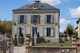
The town hall of Cerny | ||
| ||
 Cerny | ||
|
Location within Île-de-France region  Cerny | ||
| Coordinates: 48°28′35″N 2°19′45″E / 48.4763°N 2.3291°ECoordinates: 48°28′35″N 2°19′45″E / 48.4763°N 2.3291°E | ||
| Country | France | |
| Region | Île-de-France | |
| Department | Essonne | |
| Arrondissement | Étampes | |
| Canton | La Ferté-Alais | |
| Intercommunality | Val d'Essonne | |
| Government | ||
| • Mayor (2008–2014) | Marie-Claire Chambaret-Grzeskowiak | |
| Area1 | 17.13 km2 (6.61 sq mi) | |
| Population (2006)2 | 3,312 | |
| • Density | 190/km2 (500/sq mi) | |
| Time zone | CET (UTC+1) | |
| • Summer (DST) | CEST (UTC+2) | |
| INSEE/Postal code | 91129 / 91590 | |
| Elevation | 52–152 m (171–499 ft) | |
|
1 French Land Register data, which excludes lakes, ponds, glaciers > 1 km² (0.386 sq mi or 247 acres) and river estuaries. 2 Population without double counting: residents of multiple communes (e.g., students and military personnel) only counted once. | ||

Cerny is a commune in the Essonne department in Île-de-France in northern France. It is 53 km South of Paris.
It has an airfield named Aérodrome de Cerny-La-Ferté-Allais, including an airplane museum.[1]
Inhabitants of Cerny are known as Cernois.
Architectural heritage
Saint-Pierre Church, from the 13th century, was awarded as a historical monument 10 February 1948 Château de Villiers: the castle of Villiers is given by François I to Jean de Selve, after de Selve negotiated the Madrid treaty in 1526
Notable people from this commune
- Jean de Selve (1475-1529), politician entitled as a lord
- Cécile Carnot (1841-1898), widow of Sadi Carnot, 4th president of the Third Republic. She died in Château de Presles.
- Jean-Baptiste Salis (1896-1967), pilot and collector of classic aircraft, founder of the Aerodrome of Cerny
- Philippe Clay (1927-2007), singer and actor who lived there
- Jean Salis (1937-), director of the aerodrome
See also
References
- INSEE
- Mayors of Essonne Association (French)
- ↑ Amicale Jean-Baptiste Salis website Archived November 12, 2008, at the Wayback Machine.
External links
| Wikimedia Commons has media related to Cerny. |
- Official website (French)
- Mérimée database - Cultural heritage (French)
- Land use (IAURIF) (English)
This article is issued from Wikipedia - version of the 11/18/2016. The text is available under the Creative Commons Attribution/Share Alike but additional terms may apply for the media files.