Montgeron
| Montgeron | ||
|---|---|---|
|
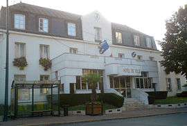
The town hall of Montgeron | ||
| ||
 Location (in red) within Paris inner and outer suburbs | ||
| Coordinates: 48°42′14″N 2°27′38″E / 48.7039°N 2.4605°ECoordinates: 48°42′14″N 2°27′38″E / 48.7039°N 2.4605°E | ||
| Country | France | |
| Region | Île-de-France | |
| Department | Essonne | |
| Arrondissement | Évry | |
| Canton | Montgeron | |
| Intercommunality | Sénart Val de Seine | |
| Government | ||
| • Mayor (2008–2014) | Gérald Hérault | |
| Area1 | 11.22 km2 (4.33 sq mi) | |
| Population (2006)2 | 23,163 | |
| • Density | 2,100/km2 (5,300/sq mi) | |
| Time zone | CET (UTC+1) | |
| • Summer (DST) | CEST (UTC+2) | |
| INSEE/Postal code | 91421 / 91230 | |
| Elevation |
31–812,538 m (102–2,665,807 ft) (avg. 32 m or 105 ft) | |
|
1 French Land Register data, which excludes lakes, ponds, glaciers > 1 km² (0.386 sq mi or 247 acres) and river estuaries. 2 Population without double counting: residents of multiple communes (e.g., students and military personnel) only counted once. | ||

Montgeron is a commune in the southeastern suburbs of Paris, France. It is located 18.5 km (11.5 mi) from the center of Paris.
Inhabitants of Montgeron are known as Montgeronnais.
The café Au Reveil Matin at 22 Avenue Jean Jaurès was the departure point of the first Tour de France in 1903.
Transport
Montgeron is served by Montgeron – Crosne station on Paris RER line D.
Miscellaneous
The local school (J-C Gatinot) was decorated by painter Maurice Boitel. The engraver Paul-Marcel Dammann (1885–1939) was born and died in Montgeron.
References
- INSEE
- Mayors of Essonne Association (French)
External links
 Media related to Montgeron at Wikimedia Commons
- Official website (French)
- Mérimée database - Cultural heritage (French)
- Land use (IAURIF) (English)
This article is issued from Wikipedia - version of the 10/11/2016. The text is available under the Creative Commons Attribution/Share Alike but additional terms may apply for the media files.