Ashuelot, New Hampshire
| Ashuelot, New Hampshire | |
|---|---|
| Unincorporated community | |
 Ashuelot  Ashuelot | |
| Coordinates: 42°46′38″N 72°25′24″W / 42.77722°N 72.42333°WCoordinates: 42°46′38″N 72°25′24″W / 42.77722°N 72.42333°W | |
| Country | United States |
| State | New Hampshire |
| County | Cheshire |
| Town | Winchester |
| Elevation | 430 ft (130 m) |
| Time zone | Eastern (EST) (UTC-5) |
| • Summer (DST) | EDT (UTC-4) |
| ZIP code | 03441 |
| Area code(s) | 603 |
| GNIS feature ID | 865270[1] |
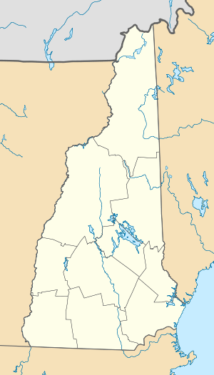
Ashuelot is an unincorporated community in the town of Winchester near the southwestern corner of New Hampshire. The village is named after the Ashuelot River.
New Hampshire Route 119 passes through the village connecting Hinsdale to the west and the village of Winchester to the east. A covered bridge crosses the Ashuelot River at the village. Ashuelot has a separate ZIP code (03441) from the rest of the town of Winchester.
References
Municipalities and communities of Cheshire County, New Hampshire, United States | ||
|---|---|---|
| City | 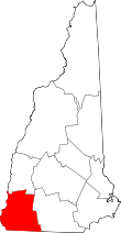 | |
| Towns | ||
| CDPs | ||
| Other villages | ||
This article is issued from Wikipedia - version of the 7/11/2016. The text is available under the Creative Commons Attribution/Share Alike but additional terms may apply for the media files.