Athelstan, Iowa
| Athelstan, Iowa | |
|---|---|
| CDP | |
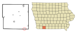 Location of Athelstan, Iowa | |
| Coordinates: 40°34′22″N 94°32′33″W / 40.57278°N 94.54250°WCoordinates: 40°34′22″N 94°32′33″W / 40.57278°N 94.54250°W | |
| Country |
|
| State |
|
| County | Taylor |
| Area | |
| • Total | 0.13 sq mi (0.3 km2) |
| • Land | 0.13 sq mi (0.3 km2) |
| • Water | 0.00 sq mi (0.0 km2) |
| Elevation | 1,076 ft (328 m) |
| Population (2010) | |
| • Total | 19 |
| • Density | 146/sq mi (56/km2) |
| Time zone | Central (CST) (UTC-6) |
| • Summer (DST) | CDT (UTC-5) |
| FIPS code | 19-03430 |
| GNIS feature ID | 0454272 |
Athelstan is a former city in Taylor County, Iowa, United States, along the Platte River, and is also majority owned by the Young family. The population was 18 at the 2000 census. In 2004, after years of rural flight, the tiny city was disincorporated, ending its status as an officially recognized community.[1] As of the 2010 census, it is recognized as a census-designated place with a population of 19.[2]
History
Athelstan had its start by the building of the Chicago Great Western Railroad through that territory.[3]
Geography
Athelstan's longitude and latitude coordinates
in decimal form are 40.572664, -94.542476.[4]
According to the 2010 census, the CDP has a total area of 0.13 square miles (0.34 km2), all land.[2]
Demographics
As of the census[5] of 2000, there were 18 people, 13 households, and 2 families residing in the city. The population density was 138.8 people per square mile (53.5/km²). There were 16 housing units at an average density of 123.4 per square mile (47.5/km²). The racial makeup of the city was 100.00% White.
There were 13 households out of which none had children under the age of 18 living with them, 15.4% were married couples living together, and 84.6% were non-families. 61.5% of all households were made up of individuals and 23.1% had someone living alone who was 65 years of age or older. The average household size was 1.38 and the average family size was 2.00.
In the city the population was spread out with 5.6% from 18 to 24, 22.2% from 25 to 44, 16.7% from 45 to 64, and 55.6% who were 65 years of age or older. The median age was 68 years. For every 100 females there were 200.0 males. For every 100 females age 18 and over, there were 200.0 males.
The median income for a household in the city was $23,750, and the median income for a family was $25,625. Males had a median income of $24,688 versus $0 for females. The per capita income for the city was $13,737. There were no families and 31.6% of the population living below the poverty line, including no under eighteens and 50.0% of those over 64.
See also
Other discontinued cities in Iowa:
- Donnan
- Green Island
- Hurstville
- Kent
- Littleport
- Moneta
- Oneida
- Plain View
References
- ↑ "New, Consolidated and Discontinued Cities". State Data Center of Iowa. Iowa Data Center. 2007-06-27. Retrieved 2007-09-15.
- 1 2 "2010 Census U.S. Gazetteer Files for Places - Iowa". United States Census. Retrieved 2012-10-19.
- ↑ Crosson, Frank E. (1910). History of Taylor County, Iowa: From the Earliest Historic Times to 1910. Walsworth Publishing Company. p. 209.
- ↑ "US Gazetteer files: 2010, 2000, and 1990". United States Census Bureau. 2011-02-12. Retrieved 2011-04-23.
- ↑ "American FactFinder". United States Census Bureau. Archived from the original on 2013-09-11. Retrieved 2008-01-31.
Municipalities and communities of Taylor County, Iowa, United States | ||
|---|---|---|
| Cities | ||
| Townships | ||
| CDP | ||
| Footnotes | ‡This populated place also has portions in an adjacent county or counties | |