Ayyubiyah
| Ayyubiyah أيو Ayyo | |
|---|---|
| Village | |
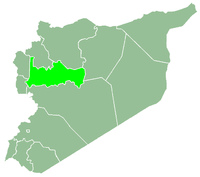
 Ayyubiyah Location in Syria | |
| Coordinates: 35°01′58″N 36°44′05″E / 35.032737°N 36.734591°ECoordinates: 35°01′58″N 36°44′05″E / 35.032737°N 36.734591°E | |
| Country |
|
| Governorate | Hama |
| District | Hama |
| Subdistrict | Hama |
| Population (2004) | |
| • Total | 1,980 |
| Time zone | EET (UTC+2) |
| • Summer (DST) | EEST (UTC+3) |
Ayyubiyah (Arabic: أيو, also known as Ayyo) is a village in northern Syria, administratively part of the Hama Governorate, located south of Hama. Nearby localities include Kafr Buhum to the northwest, al-Khalidiyah to the north, Maarin al-Jabal to the northeast, al-Buraq to the east, Nisrin to the southeast and al-Biyah and Birin to the southwest. According to the Syria Central Bureau of Statistics, Ayyubiyah had a population of 1,980 in the 2004 census.[1]
References
- ↑ General Census of Population and Housing 2004. Syria Central Bureau of Statistics (CBS). Hama Governorate. (Arabic)
This article is issued from Wikipedia - version of the 9/17/2015. The text is available under the Creative Commons Attribution/Share Alike but additional terms may apply for the media files.