Balaganj Upazila
| Balaganj বালাগঞ্জ | |
|---|---|
| Upazila | |
 | |
| Country |
|
| Division | Sylhet Division |
| District | Sylhet District |
| Government | |
| • MP (Sylhet-2) | Md. Yahya Chowdhury (Jatiya Party) |
| Area | |
| • Total | 389.51 km2 (150.39 sq mi) |
| Population | |
| • Total | 230,865 |
| • Density | 590/km2 (1,500/sq mi) |
| Time zone | BST (UTC+6) |
| Postal code | 3120-3129 |
Balaganj (Bengali: বালাগঞ্জ) is an upazila of Sylhet District in the division of Sylhet, Bangladesh.[1]
Etymology
The name Balaganj is derived from the Sylheti word bala meaning 'good' and the Persian/Bengali word ganj that means 'marketplace' or 'neighbourhood'.
History
Balaganj was the home of M. A. G. Osmani commander-in-chief of the Mukti Bahini during the 1971 Bangladesh Liberation War and was scene of two battles with Pakistani forces, at Sherpur and Sadipur, during that conflict. The war dead are buried in mass graves at Aadittapur, Burunga and Vatpara Solimpur.
It is the third largest Upazila of Sylhet zila by population, Balaganj thana was established in 1882 and was turned into an upazila on 10 January 1983. It consists of 14 union parishads, 241 mouzas and 467 villages.
Geography
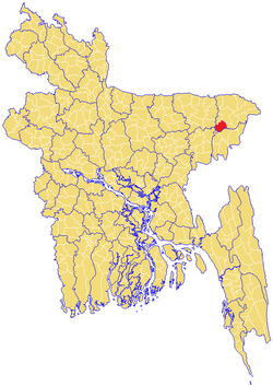
Balaganj is located at 24°40′00″N 91°50′00″E / 24.6667°N 91.8333°E . It has 36919 house hold units and, in total, The Upazila occupies an area of 389.51 km2. The Upazila is bordered on the north by Sylhet Sadar and Bishwanath Upazilas, on the east by Fenchuganj Upazila, on the South by Maulvibazar Sadar Upazila and Rajnagar Upazila of Maulvibazar zila, and on the west by Jagannathpur Upazila of Sunamganj zila and Nabiganj Upazila of Habiganj zila.
Demographics
As of the 1991 Bangladesh census, Balaganj has a population of 230,865. Males constitute 50.67% of the population, and females 49.33%. Muslim 90.04%, Hindu 9.89%, Buddhist, Christian and others 0.07%. This Upazila's eighteen and over population is 115,624. Balaganj has an average literacy rate of 57.4% (7+ years), with the national average being 32.4%.[2] Educational institutions: college 11, secondary school 57, primary school 278, madrasa 44. Goher Pur Jamea Islamia Hussainia Title Madrassa, Islamia Mohammadiya Alim Madrasha, Balaganj Degree College, Taj Pur Degree College, Islamia Mohammadiya Alim Madrasha and Balaganj D.N. High School,D.N. High School was estd. in the year 1946. Dewan Abdur Rahim High School and Aziz Pur High School are notable.
Main hats, bazars and fairs Balaganj, Goala Bazar, Tajpur Bazar, Doyamir Bazar, Pirer Bazar, Bualjur Bazar, Ilash pur Bazar, Aziz pur Bazar, Goher pur Bazar/Murar Bazar, Madrassa Bazar,Bangla Bazar, Khaler Mukh Hats and Shior Khal Mela are notable.
Main occupations Agriculture 26.04%, service 24.51%, commerce 18.22%, agricultural labourer 11.31%, wage labourer 7.25%, fishing 4.29%, transport 1.97%, others 6.41%
Immigration
A large proportion of Immigrants from Balaganj, more than any other thana's in Sylhet have migrated to the United Kingdom; United States of America; Singapore; France; Spain; Canada; Australia; the people of Balaganj are very family orientated, and as a result their overseas communities are very closely knit, they live alongside fellow Balaganjis' and have even formed entire communities within cities in the United Kingdom that contain people only from Balaganj. Many have moved to the county of Sussex, are in Birmingham UK, most notably in the Aston, Small Heath and Sparkbrook districts. Whilst in the London Borough of Tower Hamlets, which is notable for its Bangladeshi immigrants, has a large proportion of Balganji migrants in the Bow and Bethnal Green districts. There are also large concentrations in Cardiff, Wales, and Michigan, Detroit, Los Angeles, Paterson, NJ, Newark, NJ and New York City in the United States.
Administration
Balaganj has 14 Unions/Wards, 240 Mauzas/Mahallas, and 467 villages.
The unions are:
- Balaganj
- Boaljur Bazar
- Burunga
- Dayamir
- Dewan Bazar
- Goula Bazar
- Omarpur
- Osmanpur
- Paschim Gauripur
- Paschim Pailanpur
- Purba Gauripur
- Purba Pailanpur
- Sadipur
- Tajpur
See also
References
- ↑ Mahiuddin Shiru (2012), "Balaganj Upazila", in Sirajul Islam and Ahmed A. Jamal, Banglapedia: National Encyclopedia of Bangladesh (Second ed.), Asiatic Society of Bangladesh
- ↑ "Population Census Wing, BBS.". Archived from the original on 2005-03-27. Retrieved November 10, 2006.
Capital: Sylhet | ||
| Habiganj District |  | |
| Moulvibazar District | ||
| Sunamganj District | ||
| Sylhet District | ||