Bassa, Kogi State
| Bassa | |
|---|---|
| LGA | |
 Bassa Location in Nigeria | |
| Coordinates: 7°54′N 7°03′E / 7.900°N 7.050°ECoordinates: 7°54′N 7°03′E / 7.900°N 7.050°E | |
| Country |
|
| State | Kogi State |
| Headquarters | Oguma |
| Area | |
| • Total | 1,925 km2 (743 sq mi) |
| Population (2006 census) | |
| • Total | 139,993 |
| Time zone | WAT (UTC+1) |
| 3-digit postal code prefix | 272 |
| ISO 3166 code | NG.KO.BA |
Bassa is a Local Government Area in Kogi State, Nigeria. Its northern border is the Benue River and its western border is the Niger River. Its headquarters are in the town of Oguma.
It has an area of 1,925 km² and a population of 139,993 at the 2006 census.
The postal code of the area is 272.[1]
The traditional title holder of the Bassa Nge is the Etsu Bassa Nge.
References
- ↑ "Post Offices- with map of LGA". NIPOST. Archived from the original on 7 October 2009. Retrieved 2009-10-20.
State capital: Lokoja | ||
| LGAs | 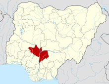 | |
This article is issued from Wikipedia - version of the 10/28/2016. The text is available under the Creative Commons Attribution/Share Alike but additional terms may apply for the media files.