Bay Point, California
| Bay Point | |
|---|---|
| CDP | |
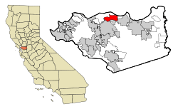 Location in Contra Costa County and the state of California | |
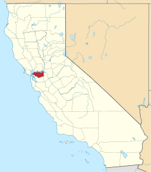
 Bay Point Location in the United States | |
| Coordinates: 38°01′45″N 121°57′42″W / 38.02917°N 121.96167°WCoordinates: 38°01′45″N 121°57′42″W / 38.02917°N 121.96167°W | |
| Country |
|
| State |
|
| County | Contra Costa |
| Government | |
| • State Senator | Steve Glazer (D)[1] |
| • State Assembly | Tim Grayson (D)[2] |
| • U. S. Congress | Mark DeSaulnier (D)[3] |
| Area[4] | |
| • Total | 7.371 sq mi (18.091 km2) |
| • Land | 6.554 sq mi (16.975 km2) |
| • Water | 0.817 sq mi (2.116 km2) 11.7% |
| Elevation | 89 ft (27 m) |
| Population (2010) | |
| • Total | 21,349 |
| • Density | 3,257.4/sq mi (1,257.7/km2) |
| Time zone | PST (UTC-8) |
| • Summer (DST) | PDT (UTC-7) |
| ZIP code | 94565 |
| Area code(s) | 925 |
| FIPS code | 06-04415 |
| GNIS feature IDs | 1853376, 2407808 |
Bay Point, formerly West Pittsburg, is a suburb of the Bay Area and census-designated place located in eastern Contra Costa County, California, just west of the city of Pittsburg and northeast over Willow Pass from Concord. The population was 21,349 at the 2010 census. The Pittsburg-Bay Point terminal of the Bay Area Rapid Transit (BART) rail system is located adjacent to Bay Point in Pittsburg. The community is traversed by a freeway, State Route 4, the California Delta Highway. Being unincorporated, Bay Point does not have its own police department. The community is policed by the California Highway Patrol and the Contra Costa County Sheriff's Office. The ZIP code is 94565, and the area code is 925.
Geography
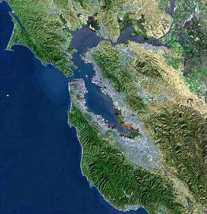
According to the United States Census Bureau, the CDP has a total area of 7.4 square miles (19 km2), 88.3% land and 11.7% water. Bay Point borders Suisun Bay.
Demographics
2010
The 2010 United States Census[5] reported that 21,349 people, 6,224 households, and 4,853 families resided in the CDP. The population density was 3,257.4 people per square mile (1,257.7/km²). There were 6,762 housing units at an average density of 917.4 per square mile (354.2/km²). The racial makeup of the CDP was 71.4% White (20.5% non-Hispanic), 11.6% African American (10.9% non-Hispanic), 1.1% Native American, 9.9% Asian, 0.7% Pacific Islander, 28.8% from other races, and 6.5% from two or more races. 24.9% of the population was Hispanic or Latino of any race.
The Census reported that 99.5% of the population lived in households, 0.1% lived in non-institutionalized group quarters, and 0.4% were institutionalized.
There were 6,224 households out of which 50.6% had children under the age of 18 living in them, 49.0% were opposite-sex married couples living together, 20.1% had a female householder with no husband present, and 8.8% had a male householder with no wife present. 8.0% of households were unmarried opposite-sex partnerships and 0.6% were same-sex married couples or partnerships. 16.4% of households were made up of individuals and 4.5% had someone living alone who was 65 years of age or older. The average household size was 3.41 and the average family size was 3.77.
The population was spread out with 30.5% under the age of 18, 11.0% aged 18 to 24, 30.2% aged 25 to 44, 21.9% aged 45 to 64, and 6.5% who were 65 years of age or older. The median age was 40.1 years. For every 100 females there were 99.7 males. For every 100 females age 18 and over, there were 97.3 males.
History
Bay Point was previously known by several names, including Bella Vista and, until 1993, West Pittsburg. An election was held in 1993 to vote on renaming the community Bay Point, reviving a historical name used in this area. "West Pittsburg," the former name, was sometimes confused with the western unincorporated section of Pittsburg, California. Bay Point is unincorporated.
Bay Point Municipal Advisory Council (MAC)
Members of the MAC were originally appointed by the Supervisor for the area, District 5. In the mid 1990s these turned into elected positions, and now have reverted into appointments.
Ambrose Park annexation
The neighboring City of Pittsburg annexed Ambrose Park in July 2008. Administrative control remained with the Ambrose Parks and Recreation District, which had owned and operated the site and its facilities since 1946.[6] The move was designed to bring Pittsburg's greater development funding and general resources to a joint project to replace the long-time swimming pool facilities at the park. The new Ambrose Aquatic Center is tentatively scheduled to open on July 4, 2016.[7] By population, about 20% of the Ambrose Parks and Recreation District is within Pittsburg City limits. Ambrose Park features picnic, tennis, basketball and hiking, and picnic facilities in 12.3 acres of unincorporated land at 125 Memorial Way, immediately adjacent to the City of Pittsburg. It was a gift to the community from the local Enes family in 1947.[6]
Education
The Bay Point Library of the Contra Costa County Library is located in Bay Point. Bay Point has many public schools such as Riverview Middle School, Rio Vista Elementary School, Shore Acres Elementary School and Bel Air Elementary School.[8][9]
References
- ↑ "Senators". State of California. Retrieved March 28, 2013.
- ↑ "Members Assembly". State of California. Retrieved March 28, 2013.
- ↑ "California's 11th Congressional District - Representatives & District Map". Civic Impulse, LLC.
- ↑ "2010 Census U.S. Gazetteer Files – Places – California". United States Census Bureau.
- ↑ "2010 Census Interactive Population Search: CA - Bay Point CDP". U.S. Census Bureau. Retrieved July 12, 2014.
- 1 2 Bugarino, Paul (July 9, 2008). "Ambrose Park annexed into Pittsburg". Inside Bay Area. Digital First Media. Retrieved 9 January 2016.
- ↑ Richards, Sam. "Bay Point, Pittsburg: Ambrose Park pool plans up for approval". San Jose Mercury News. Digital First Media. Retrieved 9 January 2016.
- ↑ "Bay Point Library." Contra Costa County Library. Retrieved on April 1, 2010.
- ↑ "Bay Point CDP, California Archived June 6, 2011, at the Wayback Machine.." U.S. Census Bureau. Retrieved on April 1, 2010.
External links
- Ambrose Park & Recreation District website
- Riverview Middle School website
- U.S. Geological Survey Geographic Names Information System: Bay Point, California
| Bodies of water |
|  |
|---|---|---|
| Counties | ||
| Major cities | ||
| Cities and towns 100k–250k | ||
| Cities and towns 50k–99k | ||
| Cities and towns 25k-50k | ||
| Cities and towns 10k–25k |
| |
| Sub-regions | ||
 |
Suisun Bay | | ||
| Clyde | |
Pittsburg | ||
| ||||
| | ||||
| Concord | Clayton |