Discovery Bay, California
| Discovery Bay | |
|---|---|
| Census-designated place | |
|
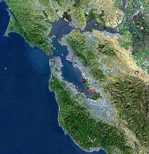
Aerial view of Discovery Bay | |
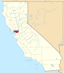
 Location in Contra Costa County and the state of California | |
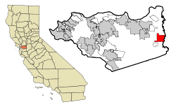
 Discovery Bay Location in the United States | |
| Coordinates: 37°54′31″N 121°36′01″W / 37.90861°N 121.60028°WCoordinates: 37°54′31″N 121°36′01″W / 37.90861°N 121.60028°W | |
| Country |
|
| State |
|
| County | Contra Costa |
| Government | |
| • State Senate | Steve Glazer (D)[1] |
| • State Assembly | Jim Frazier (D)[2] |
| • U. S. Congress | Jerry McNerney (D)[3] |
| Area[4] | |
| • Total | 7.040 sq mi (18.232 km2) |
| • Land | 6.219 sq mi (16.107 km2) |
| • Water | 0.821 sq mi (2.125 km2) 11.7% |
| Elevation[5] | 7 ft (2 m) |
| Population (2010) | |
| • Total | 13,352 |
| • Density | 1,900/sq mi (730/km2) |
| Time zone | PST (UTC-8) |
| • Summer (DST) | PDT (UTC-7) |
| ZIP code | 94505 |
| Area code(s) | 925 |
| FIPS code | 06-19339 |
| GNIS feature IDs | 1701762, 2408672 |
.jpg)
Discovery Bay is a census-designated place (CDP) in extreme eastern Contra Costa County, California in the United States, about 60 miles (97 km) from San Francisco. It is located in the East Bay region of the San Francisco Bay Area. As of 2010, its population was 13,352, a 48.7 percent gain from 8,981 at the 2000 census.[6]
Discovery Bay is a waterfront community built on a network of man-made dikes, surrounded by freshwater, except for the southeast quadrant, which comprises the golf course of Discovery Bay Country Club. Many homes have private docks with access to the Sacramento–San Joaquin River Delta. Road access is via California State Route 4.
History
Discovery Bay has a short history. It was begun as a planned community in 1964, and originally designated as "Riverside" and "River Lake." It was built on land known as the Byron Tract, which was previously used for growing barley and potatoes. In 1968, Jurgen Lunding led an effort to give the community its current name.[7]
In July 2007, Discovery Bay received its own ZIP code: 94505. Formerly, it had shared 94514 with Byron. The ensuing celebration included a world record-setting paddle boat raft-up.
Geography
According to the United States Census Bureau, the CDP has a total area of 7.0 square miles (18 km2), of which, 6.2 square miles (16 km2) of it is land and 0.8 square miles (2.1 km2) of it (11.7%) is water.
Government
The Town of Discovery Bay Community Services District (CSD) serves as Discovery Bay's local government. Its primary duties are handling water, sewer, landscaping and recreation. The CSD Board has five members who are elected by community residents. While the CSD Board has no land use or zoning authority, the CSD can advise the County on decisions related to police and fire services, residential and commercial development, and more.[8]
Demographics
2000
As of the census[9] of 2000, there were 8,981 people, 3,349 households, and 2,635 families residing in the town. The population density was 429.2/km² (1,111.9/mi²). There were 3,781 housing units at an average density of 180.7/km² (468.1/mi²). The racial makeup of the town was 87.57% White, 1.84% Black or African American, 0.84% Native American, 1.78% Asian, 0.18% Pacific Islander, 3.95% from other races, and 3.84% from two or more races. 10.43% of the population were Hispanic or Latino of any race.
There were 3,349 households out of which 33.7% had children under the age of 18 living with them, 71.3% were married couples living together, 4.3% had a female householder with no husband present, and 21.3% were non-families. 14.0% of all households were made up of individuals and 2.9% had someone living alone who was 65 years of age or older. The average household size was 2.64 and the average family size was 2.91.
In the CDP the population was spread out with 24.5% under the age of 18, 4.4% from 18 to 24, 33.0% from 25 to 44, 29.5% from 45 to 64, and 8.6% who were 65 years of age or older. The median age was 39 years. For every 100 females there were 107.0 males. For every 100 females age 18 and over, there were 106.6 males.
The median income for a household in the CDP was $89,915, and the median income for a family was $90,272. Males had a median income of $66,121 versus $41,850 for females. The per capita income for the CDP was $41,313. About 1.9% of families and 3.3% of the population were below the poverty threshold, including 1.7% of those under age 18 and 4.3% of those age 65 or over.
2010
The 2010 United States Census[10] reported that Discovery Bay had a population of 13,352. The population density was 1,896.7 people per square mile (732.3/km²). The racial makeup of Discovery Bay was 10,909 (81.7%) White, 550 (4.1%) African American, 86 (0.6%) Native American, 522 (3.9%) Asian, 51 (0.4%) Pacific Islander, 468 (3.5%) from other races, and 766 (5.7%) from two or more races. Hispanic or Latino of any race were 2,074 persons (15.5%).
The Census reported that 13,315 people (99.7% of the population) lived in households, 37 (0.3%) lived in non-institutionalized group quarters, and 0 (0%) were institutionalized.
There were 4,702 households, out of which 1,879 (40.0%) had children under the age of 18 living in them, 3,133 (66.6%) were opposite-sex married couples living together, 369 (7.8%) had a female householder with no husband present, 231 (4.9%) had a male householder with no wife present. There were 297 (6.3%) unmarried opposite-sex partnerships, and 42 (0.9%) same-sex married couples or partnerships. 686 households (14.6%) were made up of individuals and 193 (4.1%) had someone living alone who was 65 years of age or older. The average household size was 2.83. There were 3,733 families (79.4% of all households); the average family size was 3.12.
The population was spread out with 3,588 people (26.9%) under the age of 18, 837 people (6.3%) aged 18 to 24, 3,571 people (26.7%) aged 25 to 44, 3,871 people (29.0%) aged 45 to 64, and 1,485 people (11.1%) who were 65 years of age or older. The median age was 39.6 years. For every 100 females there were 101.0 males. For every 100 females age 18 and over, there were 100.1 males.
There were 5,403 housing units at an average density of 767.5 per square mile (296.3/km²), of which 3,873 (82.4%) were owner-occupied, and 829 (17.6%) were occupied by renters. The homeowner vacancy rate was 3.4%; the rental vacancy rate was 6.3%. 10,578 people (79.2% of the population) lived in owner-occupied housing units and 2,737 people (20.5%) lived in rental housing units.
Education
Schools in Discovery Bay are part of the Byron Union School District. There are two K-5 schools in the district, and both were named California Distinguished Schools in 2012 — Discovery Bay Elementary and Timber Point Elementary. Excelsior Middle School is located in Byron and is the district's sole 6-8 school. Major renovations and new buildings were completed at Excelsior Middle School in 2012. It was a California Distinguished School in early 2004. High School students (9-12) attend Liberty High School in the Liberty Union High School District, located in nearby Brentwood. Plans for a fifth high school on the south side of State Route 4 are on hold.
References
- ↑ "Senators". State of California. Retrieved March 29, 2013.
- ↑ "Members Assembly". State of California. Retrieved March 29, 2013.
- ↑ "California's 9th Congressional District - Representatives & District Map". Civic Impulse, LLC. Retrieved March 9, 2013.
- ↑ "2010 Census U.S. Gazetteer Files – Places – California". United States Census Bureau.
- ↑ "Discovery Bay". Geographic Names Information System. United States Geological Survey.
- ↑ CensusViewer:Discovery Bay, California Population Retrieved December 20, 2013
- ↑ Lemyre, Rick. "The History of Place Names in Contra Costa." Brentwood Press. December 16, 2011.
- ↑ Town of Discovery Bay. Retrieved December 20, 2013.
- ↑ "American FactFinder". United States Census Bureau. Retrieved 2008-01-31.
- ↑ "2010 Census Interactive Population Search: CA - Discovery Bay CDP". U.S. Census Bureau. Retrieved July 12, 2014.
| Wikimedia Commons has media related to Discovery Bay, California. |
External links
- Town of Discovery Bay
- Reclamation District 800
- Discovery Bay Chamber of Commerce
- Discovery Bay Lions Club
- Discovery Bay Yacht Harbor
- Discovery Bay Golf & Country Club
| Bodies of water |
|  |
|---|---|---|
| Counties | ||
| Major cities | ||
| Cities and towns 100k–250k | ||
| Cities and towns 50k–99k | ||
| Cities and towns 25k-50k | ||
| Cities and towns 10k–25k |
| |
| Sub-regions | ||