Bekwarra
| Bekwarra Ebekwarra | |
|---|---|
| LGA | |
 Bekwarra Location in Nigeria | |
| Coordinates: 6°41′38″N 8°58′03″E / 6.69389°N 8.96750°ECoordinates: 6°41′38″N 8°58′03″E / 6.69389°N 8.96750°E | |
| Country |
|
| State | Cross River State |
| Area | |
| • Total | 306 km2 (118 sq mi) |
| Population (2006 census) | |
| • Total | 105,822 |
| Time zone | WAT (UTC+1) |
| 3-digit postal code prefix | 550 |
| ISO 3166 code | NG.CR.BE |
Bekwarra is a Local Government Area in northern Cross River State, Nigeria. Its headquarters are in the town of Abuochiche (or Abuo Chiche) on the A4 highway. Other towns in the LGA are Nyanya-Ulim, Nyanya-Idigwe, Gakem, Itekpa, Ugboro, Ibiragidi, Utukwe, Afrike and Ukpah, ijibor and others.
It has an area of 306 square kilometres (118 sq mi), and had a population of 105,822 as of the 2006 census.
The postal code of the area is 550.[1]
References
- ↑ "Post Offices- with map of LGA". NIPOST. Archived from the original on 7 October 2009. Retrieved 2009-10-20.
State capital: Calabar | ||
| LGAs | 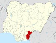 | |
This article is issued from Wikipedia - version of the 10/26/2016. The text is available under the Creative Commons Attribution/Share Alike but additional terms may apply for the media files.