Yala, Nigeria
| Yala Iyala | |
|---|---|
| LGA | |
 Yala Location in Nigeria | |
| Coordinates: 6°42′N 8°36′E / 6.700°N 8.600°ECoordinates: 6°42′N 8°36′E / 6.700°N 8.600°E | |
| Country |
|
| State | Cross River State |
| Area | |
| • Total | 1,739 km2 (671 sq mi) |
| Population (2006 census) | |
| • Total | 210,843 |
| Time zone | WAT (UTC+1) |
| 3-digit postal code prefix | 550 |
| ISO 3166 code | NG.CR.YL |
Yala is a Local Government Area in Cross River State, Nigeria. Its headquarters are in the town of Okpoma in the east of the area at6°35′35″N 8°38′01″E / 6.59306°N 8.63361°E.
It has an area of 1,739 km² and a population of 210,843 at the 2006 census.[1] This makes Yala the second most populated LGA in Cross River State, coming after Akpabuyo.
The postal code of the area is 550.[2]
The dominant tribe in the Area are the Yala. Some Yala towns and villages are Okuku, Yahe, Ugaga, Ijegu, Oloko, Imaje, Oke, Echumoga, Woda, Ebo, Igede Edii Nation, Itekpa, Maa, Wonye, Uchu, Osina, Mbuor, Aliforkpa, Echumofana, Wanihem, Wanikade, Wanikom, etc. Yala is also a language spoken by some inhabitants of Yalaland.
Other major tribes in Yala Local Government Area are Gabu, Ukele and Yache. They speak Igede, Ukele and Yache language respectively.
The LGA has abundant salt deposit which can sustain any small to medium scale salt industry. There are many salt ponds in Okpoma which are of great history to the people and are mined locally. The LGA also offers a wide range of investment opportunities in agro-based industries as well as solid mineral industries.
See also
References
- ↑ Simon O. Ering (2010). "The Population Situation in Cross River State of Nigeria and Its Implication for Socio-Economic Development: Observations from the 1991 and 2006 Censuses" (PDF).
- ↑ "Post Offices- with map of LGA". NIPOST. Retrieved 2009-10-20.
State capital: Calabar | ||
| LGAs | 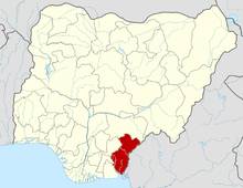 | |