Bennet, Nebraska
| Bennet, Nebraska | |
|---|---|
| Village | |
|
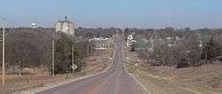
Bennet, seen from the south along Nebraska Highway 43 | |
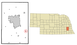 Location of Bennet, Nebraska | |
| Coordinates: 40°40′49″N 96°30′23″W / 40.68028°N 96.50639°WCoordinates: 40°40′49″N 96°30′23″W / 40.68028°N 96.50639°W | |
| Country | United States |
| State | Nebraska |
| County | Lancaster |
| Area[1] | |
| • Total | 0.51 sq mi (1.32 km2) |
| • Land | 0.51 sq mi (1.32 km2) |
| • Water | 0 sq mi (0 km2) |
| Elevation | 1,280 ft (390 m) |
| Population (2010)[2] | |
| • Total | 719 |
| • Estimate (2012[3]) | 792 |
| • Density | 1,409.8/sq mi (544.3/km2) |
| Time zone | Central (CST) (UTC-6) |
| • Summer (DST) | CDT (UTC-5) |
| ZIP code | 68317 |
| Area code(s) | 402 |
| FIPS code | 31-04300 |
| GNIS feature ID | 0827321[4] |
| Website | http://lancaster.ne.gov/bennet/ |
Bennet is a village in Lancaster County, Nebraska, United States. It is part of the Lincoln, Nebraska Metropolitan Statistical Area. The population was 719 at the 2010 census.
History
Bennet was platted in 1871 when the railroad was extended to that point.[5] It is named for John Bennett, officer of the Midland Pacific Railway.[6]
Geography
Bennet is located at 40°40′49″N 96°30′23″W / 40.68028°N 96.50639°W (40.680349, -96.506355).[7]
According to the United States Census Bureau, the village has a total area of 0.51 square miles (1.32 km2), all of it land.[1]
Demographics
| Historical population | |||
|---|---|---|---|
| Census | Pop. | %± | |
| 1880 | 214 | — | |
| 1890 | 474 | 121.5% | |
| 1900 | 495 | 4.4% | |
| 1910 | 457 | −7.7% | |
| 1920 | 473 | 3.5% | |
| 1930 | 428 | −9.5% | |
| 1940 | 412 | −3.7% | |
| 1950 | 396 | −3.9% | |
| 1960 | 381 | −3.8% | |
| 1970 | 489 | 28.3% | |
| 1980 | 523 | 7.0% | |
| 1990 | 544 | 4.0% | |
| 2000 | 570 | 4.8% | |
| 2010 | 719 | 26.1% | |
| Est. 2015 | 845 | [8] | 17.5% |
| U.S. Decennial Census[9] 2012 Estimate[10] | |||
2010 census
As of the census[2] of 2010, there were 719 people, 286 households, and 199 families residing in the village. The population density was 1,409.8 inhabitants per square mile (544.3/km2). There were 306 housing units at an average density of 600.0 per square mile (231.7/km2). The racial makeup of the village was 98.9% White, 0.1% Asian, and 1.0% from two or more races. Hispanic or Latino of any race were 0.3% of the population.
There were 286 households of which 36.4% had children under the age of 18 living with them, 57.0% were married couples living together, 8.4% had a female householder with no husband present, 4.2% had a male householder with no wife present, and 30.4% were non-families. 22.4% of all households were made up of individuals and 8% had someone living alone who was 65 years of age or older. The average household size was 2.51 and the average family size was 2.99.
The median age in the village was 32.9 years. 26.6% of residents were under the age of 18; 7.5% were between the ages of 18 and 24; 33.7% were from 25 to 44; 20.7% were from 45 to 64; and 11.5% were 65 years of age or older. The gender makeup of the village was 52.9% male and 47.1% female.
2000 census
As of the census of 2000, there were 570 people, 222 households, and 174 families residing in the village. The population density was 1,339.7 people per square mile (511.8/km²). There were 231 housing units at an average density of 542.9 per square mile (207.4/km²). The racial makeup of the village was 98.25% White, 0.18% African American, 0.18% Asian, 0.35% from other races, and 1.05% from two or more races. Hispanic or Latino of any race were 0.70% of the population.
There were 222 households out of which 37.8% had children under the age of 18 living with them, 66.2% were married couples living together, 8.6% had a female householder with no husband present, and 21.2% were non-families. 19.4% of all households were made up of individuals and 8.6% had someone living alone who was 65 years of age or older. The average household size was 2.57 and the average family size was 2.91.
In the village the population was spread out with 28.8% under the age of 18, 4.2% from 18 to 24, 31.9% from 25 to 44, 22.1% from 45 to 64, and 13.0% who were 65 years of age or older. The median age was 37 years. For every 100 females there were 109.6 males. For every 100 females age 18 and over, there were 101.0 males.
As of 2000 the median income for a household in the village was $42,237, and the median income for a family was $46,250. Males had a median income of $32,045 versus $21,176 for females. The per capita income for the village was $17,280. About 2.8% of families and 3.5% of the population were below the poverty line, including 3.1% of those under age 18 and 12.2% of those age 65 or over.
References
- 1 2 "US Gazetteer files 2010". United States Census Bureau. Archived from the original on 2012-07-14. Retrieved 2012-06-24.
- 1 2 "American FactFinder". United States Census Bureau. Retrieved 2012-06-24.
- ↑ "Population Estimates". United States Census Bureau. Archived from the original on 2013-06-17. Retrieved 2013-05-29.
- ↑ "US Board on Geographic Names". United States Geological Survey. 2007-10-25. Retrieved 2008-01-31.
- ↑ "Bennet, Lancaster County". Center for Advanced Land Management Information Technologies. University of Nebraska. Retrieved 18 August 2014.
- ↑ Burr, George L. (1921). History of Hamilton and Clay Counties, Nebraska, Volume 1. S.J. Clarke Publishing Company. p. 126.
- ↑ "US Gazetteer files: 2010, 2000, and 1990". United States Census Bureau. 2011-02-12. Retrieved 2011-04-23.
- ↑ "Annual Estimates of the Resident Population for Incorporated Places: April 1, 2010 to July 1, 2015". Retrieved July 2, 2016.
- ↑ United States Census Bureau. "Census of Population and Housing". Archived from the original on May 11, 2015. Retrieved October 19, 2013.
- ↑ "Annual Estimates of the Resident Population: April 1, 2010 to July 1, 2012". Retrieved October 19, 2013.
External links
- Lancaster A photoblog from Bennet, Lancaster County, Nebraska
Municipalities and communities of Lancaster County, Nebraska, United States | ||
|---|---|---|
| Cities | ||
| Villages | ||
| CDPs |
| |
| Other unincorporated communities | ||
| Footnotes | ‡This populated place also has portions in an adjacent county or counties | |