Hallam, Nebraska
| Hallam, Nebraska | |
|---|---|
| Village | |
|
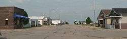
Main Street, Hallam | |
 Location of Hallam, Nebraska | |
| Coordinates: 40°32′12″N 96°47′12″W / 40.53667°N 96.78667°WCoordinates: 40°32′12″N 96°47′12″W / 40.53667°N 96.78667°W | |
| Country | United States |
| State | Nebraska |
| County | Lancaster |
| Area[1] | |
| • Total | 0.17 sq mi (0.44 km2) |
| • Land | 0.17 sq mi (0.44 km2) |
| • Water | 0 sq mi (0 km2) |
| Elevation | 1,486 ft (453 m) |
| Population (2010)[2] | |
| • Total | 213 |
| • Estimate (2012[3]) | 216 |
| • Density | 1,252.9/sq mi (483.7/km2) |
| Time zone | Central (CST) (UTC-6) |
| • Summer (DST) | CDT (UTC-5) |
| ZIP code | 68368 |
| Area code(s) | 402 |
| FIPS code | 31-20610[4] |
| GNIS feature ID | 0829756[5] |
Hallam is a village in Lancaster County, Nebraska, United States. It is part of the Lincoln, Nebraska Metropolitan Statistical Area. The population was 213 at the 2010 census.
History
Hallam was platted in 1892 when the Chicago, Rock Island and Pacific Railroad was extended to that point.[6][7] It was named for Hallau, Switzerland, after the hometown of a settler.[8]
2004 tornado
In May 2004, Hallam was struck by an F4 tornado, which killed one person, injured nearly 40 more, and destroyed most of the town. The tornado's path was 2.5 miles (4.0 km) wide, making it the widest tornado recorded up to that date. Its width was surpassed on May 31, 2013 by the 2.6 mile-wide wedge tornado that hit El Reno, Oklahoma.[9]
Geography
Hallam is located at 40°32′12″N 96°47′12″W / 40.53667°N 96.78667°W (40.536725, -96.786761).[10]
According to the United States Census Bureau, the village has a total area of 0.17 square miles (0.44 km2), all of it land.[1]
Demographics
| Historical population | |||
|---|---|---|---|
| Census | Pop. | %± | |
| 1910 | 168 | — | |
| 1920 | 212 | 26.2% | |
| 1930 | 193 | −9.0% | |
| 1940 | 168 | −13.0% | |
| 1950 | 172 | 2.4% | |
| 1960 | 264 | 53.5% | |
| 1970 | 280 | 6.1% | |
| 1980 | 290 | 3.6% | |
| 1990 | 309 | 6.6% | |
| 2000 | 276 | −10.7% | |
| 2010 | 213 | −22.8% | |
| Est. 2015 | 229 | [11] | 7.5% |
2010 census
As of the census[2] of 2010, there were 213 people, 78 households, and 63 families residing in the village. The population density was 1,252.9 inhabitants per square mile (483.7/km2). There were 81 housing units at an average density of 476.5 per square mile (184.0/km2). The racial makeup of the village was 95.3% White, 0.9% Native American, 3.3% Asian, and 0.5% from two or more races.
There were 78 households of which 41.0% had children under the age of 18 living with them, 65.4% were married couples living together, 10.3% had a female householder with no husband present, 5.1% had a male householder with no wife present, and 19.2% were non-families. 12.8% of all households were made up of individuals and 6.4% had someone living alone who was 65 years of age or older. The average household size was 2.73 and the average family size was 2.95.
The median age in the village was 35.1 years. 27.7% of residents were under the age of 18; 5.2% were between the ages of 18 and 24; 30% were from 25 to 44; 30.1% were from 45 to 64; and 7% were 65 years of age or older. The gender makeup of the village was 53.5% male and 46.5% female.
2000 census
As of the census[4] of 2000, there were 276 people, 110 households, and 86 families residing in the village. The population density was 1,680.2 people per square mile (666.0/km²). There were 118 housing units at an average density of 718.4 per square mile (284.8/km²). The racial makeup of the village was 92.39% White, 2.54% Native American, 4.35% Asian, and 0.72% from two or more races. And .0753% are Black.
There were 110 households out of which 32.7% had children under the age of 18 living with them, 67.3% were married couples living together, 6.4% had a female householder with no husband present, and 21.8% were non-families. 15.5% of all households were made up of individuals and 9.1% had someone living alone who was 65 years of age or older. The average household size was 2.51 and the average family size was 2.83.
In the village the population was spread out with 25.0% under the age of 18, 5.1% from 18 to 24, 36.6% from 25 to 44, 19.2% from 45 to 64, and 14.1% who were 65 years of age or older. The median age was 36 years. For every 100 females there were 95.7 males. For every 100 females age 18 and over, there were 95.3 males.
As of 2000 the median income for a household in the village was $42,031, and the median income for a family was $45,156. Males had a median income of $32,361 versus $19,531 for females. The per capita income for the village was $20,071. None of the families and 2.5% of the population were living below the poverty line, including no under eighteens and 12.5% of those over 64.
References
- 1 2 "US Gazetteer files 2010". United States Census Bureau. Retrieved 2012-06-24.
- 1 2 "American FactFinder". United States Census Bureau. Retrieved 2012-06-24.
- ↑ "Population Estimates". United States Census Bureau. Retrieved 2013-05-29.
- 1 2 "American FactFinder". United States Census Bureau. Retrieved 2008-01-31.
- ↑ "US Board on Geographic Names". United States Geological Survey. 2007-10-25. Retrieved 2008-01-31.
- ↑ "Hallam, Lancaster County". Center for Advanced Land Management Information Technologies. University of Nebraska. Retrieved 19 August 2014.
- ↑ Burr, George L. (1921). History of Hamilton and Clay Counties, Nebraska, Volume 1. S.J. Clarke Publishing Company. p. 126.
- ↑ "Historical Background". County of Lancaster, NE. Retrieved 19 August 2014.
- ↑ Gaarder, Nancy. "Nebraska's deadly Hallam tornado no longer widest on record". Omaha World-Herald. 2013-06-05. Retrieved 2013-06-28.
- ↑ "US Gazetteer files: 2010, 2000, and 1990". United States Census Bureau. 2011-02-12. Retrieved 2011-04-23.
- ↑ "Annual Estimates of the Resident Population for Incorporated Places: April 1, 2010 to July 1, 2015". Retrieved July 2, 2016.
- ↑ "Census of Population and Housing". Census.gov. Retrieved June 4, 2015.
Municipalities and communities of Lancaster County, Nebraska, United States | ||
|---|---|---|
| Cities | ||
| Villages | ||
| CDPs |
| |
| Other unincorporated communities | ||
| Footnotes | ‡This populated place also has portions in an adjacent county or counties | |