Berlin Heights, Ohio
| Berlin Heights, Ohio | |
|---|---|
| Village | |
 Location of Berlin Heights, Ohio | |
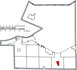 Location of Berlin Heights in Erie County | |
| Coordinates: 41°19′24″N 82°29′33″W / 41.32333°N 82.49250°WCoordinates: 41°19′24″N 82°29′33″W / 41.32333°N 82.49250°W | |
| Country | United States |
| State | Ohio |
| County | Erie |
| Township | Berlin |
| Area[1] | |
| • Total | 1.60 sq mi (4.14 km2) |
| • Land | 1.60 sq mi (4.14 km2) |
| • Water | 0 sq mi (0 km2) |
| Elevation[2] | 778 ft (237 m) |
| Population (2010)[3] | |
| • Total | 714 |
| • Estimate (2012[4]) | 705 |
| • Density | 446.3/sq mi (172.3/km2) |
| Time zone | Eastern (EST) (UTC-5) |
| • Summer (DST) | EDT (UTC-4) |
| ZIP code | 44814 |
| Area code(s) | 419 |
| FIPS code | 39-05900[5] |
| GNIS feature ID | 1064420[2] |
Berlin Heights is a village in Erie County, Ohio, United States. The population was 714 at the 2010 census. It is part of the Sandusky, Ohio Metropolitan Statistical Area.
The village is in Berlin Township. The local school system is Edison Local Schools, as Berlin Township and Milan Township merged their separate school systems in the 1960s. The local high school is Edison High School, and the athletic teams are known as the Edison Chargers. Berlin Heights was home to Edison High School's first principal Carroll "Snag" Sanders.
In the late 1850s a branch of the "free love" movement was established in Berlin Heights.[6]
Geography
Berlin Heights is located at 41°19′24″N 82°29′33″W / 41.32333°N 82.49250°W (41.323400, -82.492491).[7] The village is on State Route 61, about three miles south of Ceylon Junction and a mile north of Teaco Junction. Berlin Heights is also located between the cities of Norwalk and Vermilion.
According to the United States Census Bureau, the village has a total area of 1.60 square miles (4.14 km2), all land.[1]
Demographics
| Historical population | |||
|---|---|---|---|
| Census | Pop. | %± | |
| 1880 | 424 | — | |
| 1890 | 517 | 21.9% | |
| 1900 | 625 | 20.9% | |
| 1910 | 554 | −11.4% | |
| 1920 | 514 | −7.2% | |
| 1930 | 569 | 10.7% | |
| 1940 | 552 | −3.0% | |
| 1950 | 613 | 11.1% | |
| 1960 | 721 | 17.6% | |
| 1970 | 828 | 14.8% | |
| 1980 | 756 | −8.7% | |
| 1990 | 691 | −8.6% | |
| 2000 | 685 | −0.9% | |
| 2010 | 714 | 4.2% | |
| Est. 2015 | 690 | [8] | −3.4% |
2010 census
As of the census[3] of 2010, there were 714 people, 269 households, and 211 families residing in the village. The population density was 446.3 inhabitants per square mile (172.3/km2). There were 282 housing units at an average density of 176.3 per square mile (68.1/km2). The racial makeup of the village was 96.8% White, 0.7% African American, 0.1% Native American, 0.1% Asian, and 2.2% from two or more races. Hispanic or Latino of any race were 1.4% of the population.
There were 269 households of which 37.2% had children under the age of 18 living with them, 62.1% were married couples living together, 12.6% had a female householder with no husband present, 3.7% had a male householder with no wife present, and 21.6% were non-families. 20.1% of all households were made up of individuals and 8.9% had someone living alone who was 65 years of age or older. The average household size was 2.65 and the average family size was 3.00.
The median age in the village was 40.2 years. 25.8% of residents were under the age of 18; 8% were between the ages of 18 and 24; 21.7% were from 25 to 44; 29.2% were from 45 to 64; and 15.4% were 65 years of age or older. The gender makeup of the village was 47.3% male and 52.7% female.
2000 census
As of the census[5] of 2000, there were 685 people, 257 households, and 200 families residing in the village. The population density was 438.3 people per square mile (169.5/km²). There were 266 housing units at an average density of 170.2 per square mile (65.8/km²). The racial makeup of the village was 99.12% White, 0.29% from other races, and 0.58% from two or more races. Hispanic or Latino of any race were 1.46% of the population.
There were 257 households out of which 38.5% had children under the age of 18 living with them, 65.4% were married couples living together, 10.5% had a female householder with no husband present, and 21.8% were non-families. 19.1% of all households were made up of individuals and 7.0% had someone living alone who was 65 years of age or older. The average household size was 2.67 and the average family size was 3.02.
In the village the population was spread out with 28.6% under the age of 18, 6.1% from 18 to 24, 27.0% from 25 to 44, 24.4% from 45 to 64, and 13.9% who were 65 years of age or older. The median age was 38 years. For every 100 females there were 97.4 males. For every 100 females age 18 and over, there were 94.0 males.
The median income for a household in the village was $47,778, and the median income for a family was $51,750. Males had a median income of $43,750 versus $18,875 for females. The per capita income for the village was $19,102. About 5.4% of families and 6.9% of the population were below the poverty line, including 9.5% of those under age 18 and 4.3% of those age 65 or over.
Notable people
- Paul Drennan Cravath, lawyer
References
- 1 2 "US Gazetteer files 2010". United States Census Bureau. Archived from the original on 2012-07-14. Retrieved 2013-01-06.
- 1 2 "US Board on Geographic Names". United States Geological Survey. 2007-10-25. Retrieved 2008-01-31.
- 1 2 "American FactFinder". United States Census Bureau. Retrieved 2013-01-06.
- ↑ "Population Estimates". United States Census Bureau. Archived from the original on 2013-06-17. Retrieved 2013-06-17.
- 1 2 "American FactFinder". United States Census Bureau. Archived from the original on 2013-09-11. Retrieved 2008-01-31.
- ↑ http://query.nytimes.com/gst/abstract.html?res=9C05E3D81331EE34BC4951DFB1668383649FDE
- ↑ "US Gazetteer files: 2010, 2000, and 1990". United States Census Bureau. 2011-02-12. Retrieved 2011-04-23.
- ↑ "Annual Estimates of the Resident Population for Incorporated Places: April 1, 2010 to July 1, 2015". Retrieved July 2, 2016.
- ↑ "Census of Population and Housing". Census.gov. Archived from the original on April 22, 2013. Retrieved June 4, 2015.
External links
Municipalities and communities of Erie County, Ohio, United States | ||
|---|---|---|
| Cities | 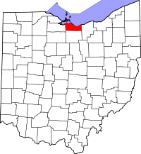 | |
| Villages | ||
| Townships | ||
| CDPs | ||
| Unincorporated communities | ||
| Footnotes | ‡This populated place also has portions in an adjacent county or counties | |