Beulah Beach, Ohio
| Beulah Beach, Ohio | |
|---|---|
| Census-designated place | |
 Beulah Beach | |
| Coordinates: 41°23′31″N 82°26′32″W / 41.39194°N 82.44222°WCoordinates: 41°23′31″N 82°26′32″W / 41.39194°N 82.44222°W | |
| Country | United States |
| State | Ohio |
| County | Erie |
| Township | Vermilion |
| Area[1] | |
| • Total | 0.05 sq mi (0.12 km2) |
| • Land | 0.05 sq mi (0.12 km2) |
| • Water | 0 sq mi (0 km2) |
| Elevation[2] | 605 ft (184 m) |
| Population (2010)[1] | |
| • Total | 53 |
| • Density | 1,155/sq mi (445.8/km2) |
| Time zone | Eastern (EST) (UTC-5) |
| • Summer (DST) | EDT (UTC-4) |
| ZIP code | 44089 |
| Area code(s) | 419 / 567 |
| FIPS code | 39-06208[1] |
| GNIS feature ID | 1048520[2] |
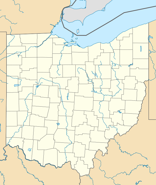
Beulah Beach /ˈbjuːlə ˈbiːtʃ/[3] is an unincorporated community and census-designated place located adjacent to Lake Erie in Erie County, Ohio, United States.[4] As of the 2010 census it had a population of 53.[1] It is located within Vermilion Township.
Beulah Beach had its start in 1920 as a Christian commune.[5]
Geography
Beulah Beach is located in eastern Erie County at 41°23′31″N 82°26′32″W / 41.39194°N 82.44222°W,[6] in the western part of Vermilion Township. It is about 600 ft (180 m) above sea level.[7]
U.S. Route 6 forms the southern edge of the community, leading northeast 5 miles (8 km) to the city of Vermilion and west 6 miles (10 km) to Huron. Cleveland is 46 miles (74 km) to the east.
References
- 1 2 3 4 "Geographic Identifiers: 2010 Demographic Profile Data (G001): Beulah CDP, Ohio". U.S. Census Bureau, American Factfinder. Retrieved March 10, 2016.
- 1 2 "US Board on Geographic Names". United States Geological Survey. 2007-10-25. Retrieved 2008-01-31.
- ↑ "scrippsjschool.org/pronunciation/".
- ↑ U.S. Geological Survey Geographic Names Information System: Beulah Beach, Ohio
- ↑ Hildebrandt, H. John; Hildebrandt, Marie (27 April 2015). Lake Erie's Shores and Islands. Arcadia Publishing. p. 56. ISBN 978-1-4671-1372-4.
- ↑ "www.maplandia.com/united-states/ohio/erie-county/beulah-beach/".
- ↑ "www.roadsidethoughts.com/oh/beulah-beach.htm".
Municipalities and communities of Erie County, Ohio, United States | ||
|---|---|---|
| Cities | 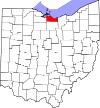 | |
| Villages | ||
| Townships | ||
| CDPs | ||
| Unincorporated communities | ||
| Footnotes | ‡This populated place also has portions in an adjacent county or counties | |
This article is issued from Wikipedia - version of the 10/24/2016. The text is available under the Creative Commons Attribution/Share Alike but additional terms may apply for the media files.