Bjarkøya
 Location in Troms | |
| Geography | |
|---|---|
| Location | Troms, Norway |
| Coordinates | 68°59′27″N 16°33′31″E / 68.9909°N 16.5585°ECoordinates: 68°59′27″N 16°33′31″E / 68.9909°N 16.5585°E |
| Area | 14.6 km2 (5.6 sq mi) |
| Length | 5.7 km (3.54 mi) |
| Width | 5 km (3.1 mi) |
| Highest elevation | 248 m (814 ft) |
| Highest point | Falkeberget |
| Administration | |
| County | Troms |
| Municipality | Harstad |
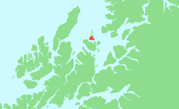
Bjarkøya is an island in the municipality of Harstad in Troms county, Norway. It was the main island of the former municipality of Bjarkøy, with the old administrative centre of Bjarkøy, Nergården, located on the island. Bjarkøy and Harstad merged on 1 January 2013. The island is located north of Grytøya and northwest of Sandsøya, with the Andfjorden to the northwest and the Vågsfjorden to the southeast.[1] The main church for the island is Bjarkøy Church in Nergården.
The proposed Bjarkøy Tunnel will connect the village of Austnes on the southeastern tip of the island to the northeastern tip of the neighboring island of Grytøya. This tunnel is part of the Bjarkøy Fixed Link project that will also have a bridge from Grytøya to Sandsøya.[2]
References
- ↑ Store norske leksikon. "Bjarkøya" (in Norwegian). Retrieved 2012-08-17.
- ↑ "Fv. 867 / Fv. 125 Bjarkøyforbindelsene" (in Norwegian). Statens Vegvesen. Retrieved 17 August 2012.