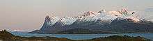
Grytøya
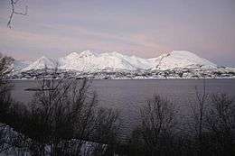 Grytøya seen from Hinnøya | |
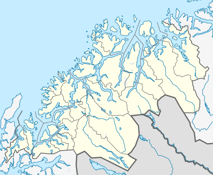 Grytøya Location of Island in Troms | |
| Geography | |
|---|---|
| Location | Norway |
| Coordinates | 68°55′17″N 16°31′37″E / 68.92139°N 16.52694°ECoordinates: 68°55′17″N 16°31′37″E / 68.92139°N 16.52694°E |
| Area | 108 km2 (42 sq mi) |
| Length | 17 km (10.6 mi) |
| Width | 10 km (6 mi) |
| Coastline | 62 km (38.5 mi) |
| Highest elevation | 1,012 m (3,320 ft) |
| Highest point | Nona |
| Administration | |
|
Norway | |
| County | Troms |
| Municipality | Harstad |
| Demographics | |
| Population | 539 (2001) |
Grytøya is an island located just north of the large island of Hinnøya and south of the island of Bjarkøya in northern Norway. It belongs to the municipality of Harstad in Troms county. It is surrounded by the Vågsfjorden in the east and the Andfjorden in the west. The island has an area of 108 square kilometres (42 sq mi) and the highest peak is the 1,012-metre (3,320 ft) tall mountain Nona. The population of Grytøya (2001) is 539. The northern part of the island was formerly part of the old municipality of Bjarkøy, which merged with Harstad on 1 January 2013.[1][2]
The southeastern part of the island is the most agriculturally productive. There is a ferry connection from Bjørnå (on Grytøya) to Vika (on Hinnøya), just north of the town of Harstad. The main road on the island follows the coastline from the northeast at Fenes to Grotavær in the northwest. There is very little settlement on the northern coast, and no road connections there.[3]
There are ferry connections to neighboring Bjarkøya and Sandsøya; these are planned to be replaced by the Bjarkøy Fixed Link, a bridge and undersea tunnel system connecting the three islands.[4]
References
- ↑ Statistisk sentralbyrå (2001). "Folke- og boligtellingen 2001, kommune- og bydelshefter 1901 Harstad" (PDF) (in Norwegian).
- ↑ Statistisk sentralbyrå (2001). "Folke- og boligtellingen 2001, kommune- og bydelshefter 1915 Bjarkøy" (PDF) (in Norwegian).
- ↑ Store norske leksikon. "Grytøya" (in Norwegian). Retrieved 2012-08-17.
- ↑ "Fv. 867 / Fv. 125 Bjarkøyforbindelsene" (in Norwegian). Statens Vegvesen. Retrieved 17 August 2012.