Sandsøya, Troms
|
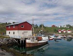
View of the village harbour in Sandsøy | |
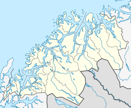 Sandsøya / Sandsøy Location of Island in Troms | |
| Geography | |
|---|---|
| Location | Troms, Norway |
| Coordinates | 68°56′45″N 16°39′18″E / 68.9458°N 16.6551°ECoordinates: 68°56′45″N 16°39′18″E / 68.9458°N 16.6551°E |
| Area | 10.8 km2 (4.2 sq mi) |
| Length | 5 km (3.1 mi) |
| Width | 4.5 km (2.8 mi) |
| Highest elevation | 212 m (696 ft) |
| Highest point | Veten |
| Administration | |
| County | Troms |
| Municipality | Harstad |
Sandsøya or Sandsøy is an island in the municipality of Harstad in Troms county, Norway. The island lies east of Grytøya and southeast of Bjarkøya, and has an area of 10.8 square kilometres (4.2 sq mi). The highest point on the island is the 212-metre (696 ft) Veten. In 2001, Sandsøya had 107 inhabitants.[1]
The island settlement is very old trading post and church village, a part of the former municipality of Bjarkøy. Sandsøy Church is located on the western side of the island in the village of Sandsøy. The other village on the island is Slakstad on the eastern part of the island.
There is a ferry link that runs between Altevik on Sandsøya, Fenes on Grytøya, and Austnes on Bjarkøya. The proposed Bjarkøy Fixed Link will replace the ferry routes and it will link Sandsøya and Grytøya with a bridge and will link Grytøya and Bjarkøya with an undersea tunnel.[2] There is also a connection by the Hurtigruten from Sandsøya to Harstad, Austnes, and Senja. (Route times)
See also
References
- ↑ Store norske leksikon. "Sandsøy" (in Norwegian). Retrieved 2012-08-17.
- ↑ "Fv. 867 / Fv. 125 Bjarkøyforbindelsene" (in Norwegian). Statens Vegvesen. Retrieved 17 August 2012.