Blue Point, New York
| Blue Point, New York | |
|---|---|
| Hamlet and census-designated place | |
 U.S. Census map | |
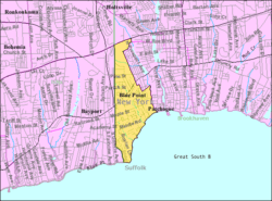
 Blue Point, New York U.S. Census map | |
| Coordinates: 40°45′1″N 73°2′4″W / 40.75028°N 73.03444°WCoordinates: 40°45′1″N 73°2′4″W / 40.75028°N 73.03444°W | |
| Country | United States |
| State | New York |
| County | Suffolk |
| Area | |
| • Total | 1.8 sq mi (4.6 km2) |
| • Land | 1.8 sq mi (4.6 km2) |
| • Water | 0.0 sq mi (0.0 km2) |
| Elevation | 10 ft (3 m) |
| Population (2010) | |
| • Total | 4,773 |
| • Density | 2,700/sq mi (1,000/km2) |
| Time zone | Eastern (EST) (UTC-5) |
| • Summer (DST) | EDT (UTC-4) |
| ZIP code | 11715 |
| Area code(s) | 631 |
| FIPS code | 36-07069 |
| GNIS feature ID | 0944323 |
Blue Point is a hamlet (and census-designated place) in Suffolk County, New York, United States. The population was 4,773 at the 2010 census.[1] Blue Point is in the Town of Brookhaven.
Geography

Blue Point is located at 40°45′1″N 73°2′4″W / 40.75028°N 73.03444°W
(40.750374, -73.034580).[2]
According to the United States Census Bureau, the CDP has a total area of 1.8 square miles (4.7 km2), of which 1.8 square miles (4.7 km2) is land and 0.56% is water.
Demographics of the CDP
As of the census[3] of 2000, there were 4,407 people, 1,571 households, and 1,178 families residing in the CDP. The population density was 2,474.5 per square mile (955.9/km²). There were 1,664 housing units at an average density of 934.3/sq mi (360.9/km²). The racial makeup of the CDP was 96.41% White, 0.68% African American, 0.11% Native American, 1.07% Asian, 0.02% Pacific Islander, 0.84% from other races, and 0.86% from two or more races. Hispanic or Latino of any race were 4.36% of the population.
There were 1,571 households out of which 37.9% had children under the age of 18 living with them, 63.1% were married couples living together, 7.4% had a female householder with no husband present, and 25.0% were non-families. 20.0% of all households were made up of individuals and 9.0% had someone living alone who was 65 years of age or older. The average household size was 2.78 and the average family size was 3.24.
In the CDP the population was spread out with 26.8% under the age of 18, 4.6% from 18 to 24, 32.1% from 25 to 44, 24.7% from 45 to 64, and 11.8% who were 65 years of age or older. The median age was 38 years. For every 100 females there were 97.1 males. For every 100 females age 18 and over, there were 95.5 males.
The median income for a household in the CDP was $70,333, and the median income for a family was $76,004. Males had a median income of $51,265 versus $34,938 for females. The per capita income for the CDP was $28,135. About 1.7% of families and 3.6% of the population were below the poverty line, including 2.0% of those under age 18 and 7.4% of those age 65 or over.
Education
Blue Point is served by the Bayport-Blue Point School District, which consists of a high school (Bayport-Blue Point High School), a middle school (James Wilson Young Middle School) and three elementary schools, one of which is located on Blue Point Avenue in Blue Point.
Economy
Recreation
References
- ↑ "Geographic Identifiers: 2010 Demographic Profile Data (G001): Blue Point CDP, New York". U.S. Census Bureau, American Factfinder. Retrieved 2012-12-24.
- ↑ "US Gazetteer files: 2010, 2000, and 1990". United States Census Bureau. 2011-02-12. Retrieved 2011-04-23.
- ↑ "American FactFinder". United States Census Bureau. Archived from the original on 2013-09-11. Retrieved 2008-01-31.
| Wikimedia Commons has media related to Blue Point, New York. |