Boistfort, Washington
| Boistfort, Washington | |
|---|---|
| Unincorporated community | |
 Boistfort, Washington | |
| Coordinates: 46°32′06″N 123°08′01″W / 46.53500°N 123.13361°WCoordinates: 46°32′06″N 123°08′01″W / 46.53500°N 123.13361°W | |
| Country | United States |
| State | Washington |
| County | Lewis |
| Elevation | 285 ft (87 m) |
| Time zone | Pacific (PST) (UTC-8) |
| • Summer (DST) | PDT (UTC-7) |
| Area code(s) | 360 |
| GNIS feature ID | 1510831[1] |
Boistfort is an unincorporated community in Lewis County, Washington, United States. It lies 19 miles away from Chehalis and has one of the tallest peaks that is not a mountain in the entire state of Washington, Boistfort Peak (also called Baw Faw Peak). It has a K-8 school, a library and a tennis court. The original one-room school was established as the first school district in the Territory of Washington.[2]
A post office called Boisfort was established in 1857, the name was changed to Boistfort in 1907, and the post office closed in 1918.[3] The community took its name from nearby Boisfort Prairie.[4]
References
- ↑ U.S. Geological Survey Geographic Names Information System: Boistfort, Washington
- ↑ Tiller, Priscilla (1991). The Wooden Bench: Inkwells, Slates and Coping Saws. ISBN 978-0962515101.
- ↑ "Post Offices". Jim Forte Postal History. Archived from the original on 6 March 2016. Retrieved 18 July 2016.
- ↑ Meany, Edmond S. (1923). Origin of Washington geographic names. Seattle: University of Washington Press. p. 24.
Municipalities and communities of Lewis County, Washington, United States | ||
|---|---|---|
| Cities | 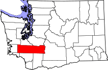 | |
| Town | ||
| CDPs | ||
| Other unincorporated communities | ||
| Ghost towns | ||
This article is issued from Wikipedia - version of the 11/5/2016. The text is available under the Creative Commons Attribution/Share Alike but additional terms may apply for the media files.