Randle, Washington
| Randle | |
|---|---|
| Unincorporated community | |
| Coordinates: 46°32′07″N 121°57′26″W / 46.53528°N 121.95722°WCoordinates: 46°32′07″N 121°57′26″W / 46.53528°N 121.95722°W | |
| Country | United States |
| State | Washington |
| County | Lewis |
| Population (2010 Census) | |
| • Total | 2,931[1] |
| Time zone | PST (UTC−8) |
| • Summer (DST) | PDT (UTC−7) |
| ZIP code | 98377 |
| Area code(s) | 360 |
| GNIS feature ID | 1524864[2] |
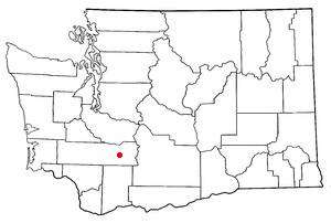
Randle is an unincorporated community in extreme eastern Lewis County, Washington, United States. Randle is located on U.S. Route 12 and is notable as the northeastern access point to the Mount St. Helens Windy Ridge viewpoint, by way of forest service roads that cut through the Gifford Pinchot National Forest. Randle is located right next to the Cowlitz River and is about four miles north of the Cispus River, a tributary of the Cowlitz. The rural area surrounding Randle is known locally as the "Big Bottom Valley," which is reflective of the fact that the valley floor in which the Cowlitz River winds westward through Randle is "big"—flat, fertile land that is at places more than 3 miles wide.
History
William Joerk explored in the area around 1882. Randle was first settled in 1886 by James L. Randle. The townsite was founded in 1902.[3]
In 1952, The White Pass High School was built. In 2011, it was torn down and built into a new school.
Geography
Randle is the center of the White Pass School District, which, in addition to Randle, covers the small towns of Glenoma, Washington, and Packwood, Washington (its school district jurisdiction includes a vast rural expanse in extreme eastern Lewis County, terminating at the Cascade Mountains and the county border with Yakima County). The community of Randle is located within Census Tract 9719 of Lewis County.
Climate
This region experiences warm (but not hot) and dry summers, with no average monthly temperatures above 71.6 °F. According to the Köppen climate classification system, Randle has a warm-summer Mediterranean climate, abbreviated "Csb" on climate maps.[4]
Politics
Randle is a heavily Republican area, like most of Lewis County. The results for the 2004 U.S. Presidential Election were as follows:
- George W. Bush (Republican) - 501 (63.34%)
- John F. Kerry (Democrat) - 273 (34.51%)
- Ralph Nader (Independent) - 9 (1.14%)
- Michael Peroutka (Constitution Party) - 4 (0.51%)
- Other candidates - 4 (0.51%)
Note that this information is based on the Randle East and Randle West precincts only. As this is an unincorporated community, there are no defined bounds, and the precinct may be incongruous with the census boundaries.
References
- ↑ "Census 2010: Washington - Lewis County". The Spokesman Review.
- ↑ "Randle". Geographic Names Information System. United States Geological Survey.
- ↑ Majors, Harry M. (1975). Exploring Washington. Van Winkle Publishing Co. p. 126. ISBN 978-0-918664-00-6.
- ↑ Climate Summary for Randle, Washington
Municipalities and communities of Lewis County, Washington, United States | ||
|---|---|---|
| Cities | 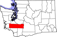 | |
| Town | ||
| CDPs | ||
| Other unincorporated communities | ||
| Ghost towns | ||