Bono, Arkansas
| Bono, Arkansas | |
|---|---|
| City | |
|
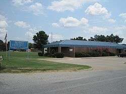
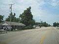
Bono City Hall, July 2011 | |
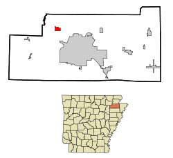 Location in Craighead County and the state of Arkansas | |
| Coordinates: 35°54′38″N 90°47′48″W / 35.91056°N 90.79667°WCoordinates: 35°54′38″N 90°47′48″W / 35.91056°N 90.79667°W | |
| Country | United States |
| State | Arkansas |
| County | Craighead |
| Area | |
| • Total | 1.4 sq mi (3.7 km2) |
| • Land | 1.4 sq mi (3.7 km2) |
| • Water | 0 sq mi (0 km2) |
| Elevation | 259 ft (79 m) |
| Population (2010) | |
| • Total | 2,131 |
| • Density | 1,483/sq mi (572.4/km2) |
| Time zone | Central (CST) (UTC-6) |
| • Summer (DST) | CDT (UTC-5) |
| ZIP code | 72416 |
| Area code(s) | 870 |
| FIPS code | 05-07630 |
| GNIS feature ID | 0076400 |
Bono is a city in Craighead County, Arkansas, United States. The population was 2,131 at the 2010 census,[1] up from 1,512 at the 2000 census. It is included in the Jonesboro, Arkansas Metropolitan Statistical Area. Bono's most prominent landmarks are the Bono Bridge and the Bono Cemetery.
Geography
Bono is located in northwestern Craighead County at 35°54′38″N 90°47′48″W / 35.91056°N 90.79667°W (35.910612, -90.796788).[2] It is 8 miles (13 km) northwest of Jonesboro, the county seat, via U.S. Route 63. The city of Walnut Ridge is 15 miles (24 km) farther to the northwest along US 63.
According to the United States Census Bureau, the city has a total area of 1.4 square miles (3.7 km2), all land.[1]
List of highways
Demographics
| Historical population | |||
|---|---|---|---|
| Census | Pop. | %± | |
| 1930 | 209 | — | |
| 1940 | 248 | 18.7% | |
| 1950 | 352 | 41.9% | |
| 1960 | 339 | −3.7% | |
| 1970 | 428 | 26.3% | |
| 1980 | 967 | 125.9% | |
| 1990 | 1,220 | 26.2% | |
| 2000 | 1,512 | 23.9% | |
| 2010 | 2,131 | 40.9% | |
| Est. 2015 | 2,236 | [3] | 4.9% |
2014 Estimate[5] | |||
As of the census[6] of 2000, there were 1,512 people, 574 households, and 435 families residing in the city. The population density was 1,052.5 people per square mile (405.4/km²). There were 634 housing units at an average density of 441.3 per square mile (170.0/km²). The racial makeup of the city was 97.69% White, 0.13% Black or African American, 0.26% Native American, 0.07% Asian, 0.66% from other races, and 1.19% from two or more races. 1.72% of the population were Hispanic or Latino of any race. There were 574 households out of which 42.9% had children under the age of 18 living with them, 54.7% were married couples living together, 16.6% had a female householder with no husband present, and 24.2% were non-families. 20.6% of all households were made up of individuals and 6.6% had someone living alone who was 65 years of age or older. The average household size was 2.63 and the average family size was 3.05.
In the city the population was spread out with 31.1% under the age of 18, 10.4% from 18 to 24, 31.2% from 25 to 44, 19.6% from 45 to 64, and 7.7% who were 65 years of age or older. The median age was 29 years. For every 100 females there were 97.1 males. For every 100 females age 18 and over, there were 90.5 males.
The median income for a household in the city was $31,307, and the median income for a family was $33,618. Males had a median income of $25,063 versus $18,426 for females. The per capita income for the city was $13,764. About 13.6% of families and 15.2% of the population were below the poverty line, including 18.7% of those under age 18 and 13.8% of those age 65 or over.
Education
Bono residents are served by the Westside Consolidated School District.[7][8] The district opened in 1966.[9]
Climate
Climate is characterized by relatively high temperatures and evenly distributed precipitation throughout the year. The Köppen Climate Classification sub-type for this climate is "Cfa" (Humid Subtropical Climate).[10]
| Climate data for Bono, Arkansas | |||||||||||||
|---|---|---|---|---|---|---|---|---|---|---|---|---|---|
| Month | Jan | Feb | Mar | Apr | May | Jun | Jul | Aug | Sep | Oct | Nov | Dec | Year |
| Average high °C (°F) | 7 (45) |
10 (50) |
16 (61) |
22 (72) |
27 (81) |
32 (89) |
33 (92) |
32 (90) |
29 (84) |
23 (74) |
16 (61) |
9 (49) |
22 (71) |
| Average low °C (°F) | −2 (28) |
0 (32) |
5 (41) |
11 (51) |
15 (59) |
19 (67) |
22 (71) |
21 (69) |
17 (62) |
10 (50) |
6 (42) |
0 (32) |
10 (50) |
| Average precipitation mm (inches) | 84 (3.3) |
97 (3.8) |
122 (4.8) |
130 (5.1) |
130 (5.1) |
79 (3.1) |
69 (2.7) |
80 (3) |
94 (3.7) |
86 (3.4) |
119 (4.7) |
114 (4.5) |
1,199 (47.2) |
| Source: Weatherbase [11] | |||||||||||||
References
| Wikimedia Commons has media related to Bono, Arkansas. |
- 1 2 "Geographic Identifiers: 2010 Demographic Profile Data (G001): Bono city, Arkansas". U.S. Census Bureau, American Factfinder. Retrieved June 18, 2014.
- ↑ "US Gazetteer files: 2010, 2000, and 1990". United States Census Bureau. 2011-02-12. Retrieved 2011-04-23.
- ↑ "Annual Estimates of the Resident Population for Incorporated Places: April 1, 2010 to July 1, 2015". Retrieved July 2, 2016.
- ↑ "Census of Population and Housing". Census.gov. Archived from the original on May 11, 2015. Retrieved June 4, 2015.
- ↑ "Annual Estimates of the Resident Population for Incorporated Places: April 1, 2010 to July 1, 2014". Retrieved June 26, 2016.
- ↑ "American FactFinder". United States Census Bureau. Archived from the original on 2013-09-11. Retrieved 2008-01-31.
- ↑ Deadly Lessons: Understanding Lethal School Violence. The National Academies, Committee on Law and Justice, Board on Children, Youth and Families. 2003. 102. Retrieved on October 18, 2010. "The Westside School District is one of five public school districts in the immediate area and serves the Bono, Cash, and Egypt communities, which lie adjacent to Jonesboro and are largely rural towns."
- ↑ Deadly Lessons: Understanding Lethal School Violence. The National Academies, Committee on Law and Justice, Board on Children, Youth and Families. 2003. 102 Acknowledgements. Retrieved on October 18, 2010. "Bono is the largest of the three with a population just over 1,000 residents. Cash and Egypt count 280 and 112 residents, respectively."
- ↑ Home. Westside Consolidated School District. May 2, 2004. Retrieved on October 18, 2010. "Westside Consolidated School District #5 was founded in 1966. Since its establishment, Westside has provided the areas of Cash, Egypt and Bono a country school with city amenities."
- ↑ Climate Summary for Bono, Arkansas
- ↑ "Weatherbase.com". Weatherbase. 2013. Retrieved on August 6, 2013.
External links
- Encyclopedia of Arkansas History & Culture entry: Bono (Craighead County)
Gallery

Municipalities and communities of Craighead County, Arkansas, United States | ||
|---|---|---|
| Cities | 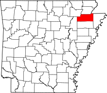 | |
| Towns | ||
| Unincorporated communities |
| |