Egypt, Arkansas
| Egypt, Arkansas | |
|---|---|
| Town | |
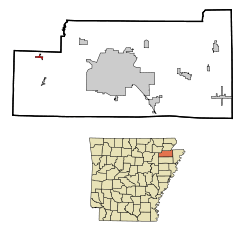 Location in Craighead County and the state of Arkansas | |
| Coordinates: 35°52′3″N 90°56′43″W / 35.86750°N 90.94528°WCoordinates: 35°52′3″N 90°56′43″W / 35.86750°N 90.94528°W | |
| Country | United States |
| State | Arkansas |
| County | Craighead |
| Area | |
| • Total | 0.3 sq mi (0.9 km2) |
| • Land | 0.3 sq mi (0.9 km2) |
| • Water | 0 sq mi (0 km2) |
| Elevation | 249 ft (76 m) |
| Population (2010) | |
| • Total | 112 |
| • Density | 321/sq mi (124.0/km2) |
| Time zone | Central (CST) (UTC-6) |
| • Summer (DST) | CDT (UTC-5) |
| ZIP code | 72427 |
| Area code(s) | 870 |
| FIPS code | 05-20920 |
| GNIS feature ID | 0057707 |
Egypt is a town in Craighead County, Arkansas, United States. The population was 112 at the 2010 census.[1] It is included in the Jonesboro, Arkansas Metropolitan Statistical Area.
Geography
Egypt is located in western Craighead County at 35°52′3″N 90°56′43″W / 35.86750°N 90.94528°W (35.867472, -90.945372).[2]
According to the United States Census Bureau, the town has a total area of 0.35 square miles (0.9 km2), all land.[1]
Only one highway runs through the small community, Arkansas Highway 91, which intersects Craighead County Road 192 at the center of town.
Demographics
| Historical population | |||
|---|---|---|---|
| Census | Pop. | %± | |
| 1990 | 123 | — | |
| 2000 | 101 | −17.9% | |
| 2010 | 112 | 10.9% | |
| Est. 2015 | 112 | [3] | 0.0% |
2014 Estimate[5] | |||
As of the census[6] of 2000, there were 101 people, 43 households, and 28 families residing in the town. The population density was 274.5 inhabitants per square mile (105.4/km²). There were 51 housing units at an average density of 138.6 per square mile (53.2/km²). The racial makeup of the town was 97.03% White, and 2.97% from two or more races. 0.99% of the population were Hispanic or Latino of any race.
There were 43 households out of which 23.3% had children under the age of 18 living with them, 48.8% were married couples living together, 16.3% had a female householder with no husband present, and 32.6% were non-families. 30.2% of all households were made up of individuals and 20.9% had someone living alone who was 65 years of age or older. The average household size was 2.35 and the average family size was 2.90.
In the town the population was spread out with 24.8% under the age of 18, 7.9% from 18 to 24, 19.8% from 25 to 44, 19.8% from 45 to 64, and 27.7% who were 65 years of age or older. The median age was 43 years. For every 100 females there were 71.2 males. For every 100 females age 18 and over, there were 76.7 males.
The median income for a household in the town was $18,750, and the median income for a family was $24,063. Males had a median income of $19,583 versus $16,250 for females. The per capita income for the town was $9,828. There were 22.6% of families and 29.9% of the population living below the poverty line, including 55.6% of under eighteens and 13.8% of those over 64.
Education
Egypt residents are served by the Westside Consolidated School District.[7][8] The district opened in 1966.[9]
References
- 1 2 "Geographic Identifiers: 2010 Demographic Profile Data (G001): Egypt town, Arkansas". U.S. Census Bureau, American Factfinder. Retrieved June 18, 2014.
- ↑ "US Gazetteer files: 2010, 2000, and 1990". United States Census Bureau. 2011-02-12. Retrieved 2011-04-23.
- ↑ "Annual Estimates of the Resident Population for Incorporated Places: April 1, 2010 to July 1, 2015". Retrieved July 2, 2016.
- ↑ "Census of Population and Housing". Census.gov. Retrieved June 4, 2015.
- ↑ "Annual Estimates of the Resident Population for Incorporated Places: April 1, 2010 to July 1, 2014". Retrieved June 4, 2015.
- ↑ "American FactFinder". United States Census Bureau. Retrieved 2008-01-31.
- ↑ Deadly Lessons: Understanding Lethal School Violence. The National Academies, Committee on Law and Justice, Board on Children, Youth and Families. 2003. 102. Retrieved on October 18, 2010. "The Westside School District is one of five public school districts in the immediate area and serves the Bono, Cash, and Egypt communities, which lie adjacent to Jonesboro and are largely rural towns."
- ↑ Deadly Lessons: Understanding Lethal School Violence. The National Academies, Committee on Law and Justice, Board on Children, Youth and Families. 2003. 102 Acknowledgements. Retrieved on October 18, 2010. "Bono is the largest of the three with a population just over 1,000 residents. Cash and Egypt count 280 and 112 residents, respectively."
- ↑ Home. Westside Consolidated School District. May 2, 2004. Retrieved on October 18, 2010. "Westside Consolidated School District #5 was founded in 1966. Since its establishment, Westside has provided the areas of Cash, Egypt and Bono a country school with city amenities."
Municipalities and communities of Craighead County, Arkansas, United States | ||
|---|---|---|
| Cities | 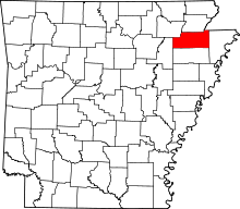 | |
| Towns | ||
| Unincorporated communities |
| |