Bono Township, Lawrence County, Indiana
| Bono Township | |
|---|---|
| Township | |
|
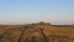
Countryside in the township | |
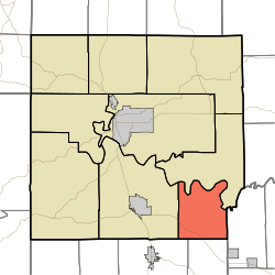 Location in Lawrence County | |
| Coordinates: 38°43′19″N 86°21′32″W / 38.72194°N 86.35889°WCoordinates: 38°43′19″N 86°21′32″W / 38.72194°N 86.35889°W | |
| Country |
|
| State |
|
| County | Lawrence |
| Government | |
| • Type | Indiana township |
| Area | |
| • Total | 26.3 sq mi (68 km2) |
| • Land | 26.06 sq mi (67.5 km2) |
| • Water | 0.24 sq mi (0.6 km2) 0.91% |
| Elevation | 712 ft (217 m) |
| Population (2010) | |
| • Total | 833 |
| • Density | 32/sq mi (12/km2) |
| ZIP codes | 47446, 47452 |
| GNIS feature ID | 0453123 |
Bono Township is one of nine townships in Lawrence County, Indiana, United States. As of the 2010 census, its population was 833 and it contained 393 housing units.[1][2]
History
The Bono Archaeological Site was listed in the National Register of Historic Places in 1985.[3]
Geography
According to the 2010 census, the township has a total area of 26.3 square miles (68 km2), of which 26.06 square miles (67.5 km2) (or 99.09%) is land and 0.24 square miles (0.62 km2) (or 0.91%) is water.[1]
Unincorporated towns
- Bono at 38°43′53″N 86°19′16″W / 38.731443°N 86.321097°W
- Lawrenceport at 38°45′04″N 86°23′16″W / 38.751164°N 86.387766°W
- Rivervale at 38°46′08″N 86°23′53″W / 38.768942°N 86.398045°W
- Stonington at 38°43′54″N 86°22′03″W / 38.731720°N 86.367488°W
Cemeteries
The township contains Talbott Cemetery.
Major highways
School districts
- Mitchell Community Schools
Political districts
- Indiana's 4th congressional district
- State House District 62
- State Senate District 44
References
- "Bono Township, Lawrence County, Indiana". Geographic Names Information System. United States Geological Survey. Retrieved 2009-10-08.
- United States Census Bureau 2008 TIGER/Line Shapefiles
- IndianaMap
- 1 2 "Population, Housing Units, Area, and Density: 2010 - County -- County Subdivision and Place -- 2010 Census Summary File 1". United States Census. Retrieved 2013-05-10.
- ↑ United States Census Bureau American FactFinder
- ↑ National Park Service (2010-07-09). "National Register Information System". National Register of Historic Places. National Park Service.
External links
- Indiana Township Association
- United Township Association of Indiana
- City-Data.com page for Bono Township
 |
Guthrie Township | | ||
| Marion Township | |
Brown Township, Washington County | ||
| ||||
| | ||||
| Orleans Township, Orange County | Northeast Township, Orange County |
This article is issued from Wikipedia - version of the 11/5/2016. The text is available under the Creative Commons Attribution/Share Alike but additional terms may apply for the media files.