Bull Run, Prince William County, Virginia
| Bull Run, Virginia | |
|---|---|
| Census-designated place (CDP) | |
 Location in Prince William County and the state of Virginia. | |
| Coordinates: 38°47′6″N 77°31′25″W / 38.78500°N 77.52361°WCoordinates: 38°47′6″N 77°31′25″W / 38.78500°N 77.52361°W | |
| Country | United States |
| State | Virginia |
| County | Prince William |
| Area | |
| • Total | 2.7 sq mi (6.9 km2) |
| • Land | 2.7 sq mi (6.9 km2) |
| • Water | 0.0 sq mi (0.0 km2) |
| Elevation | 285 ft (87 m) |
| Population (2000) | |
| • Total | 11,337 |
| • Density | 4,237.8/sq mi (1,636.2/km2) |
| Time zone | Eastern (EST) (UTC-5) |
| • Summer (DST) | EDT (UTC-4) |
| Area code(s) | 571, 703 |
| FIPS code | 51-11230[1] |
| GNIS feature ID | 1867585[2] |
Bull Run is a census-designated place (CDP) in Prince William County, Virginia. The population was 11,337 at the 2000 census.
History
Ben Lomond Plantation was listed on the National Register of Historic Places in 1980.[3]
Geography
Bull Run is located at 38°47′6″N 77°31′25″W / 38.78500°N 77.52361°W (38.785090, -77.523577).[4]
According to the United States Census Bureau, the CDP has a total area of 2.7 square miles (6.9 km²), all of it land.
Demographics
As of the census[1] of 2000, there were 11,337 people, 4,728 households, and 2,709 families residing in the CDP. The population density was 4,237.8 people per square mile (1,633.3/km²). There were 4,948 housing units at an average density of 1,849.6/sq mi (712.8/km²). The racial makeup of the CDP was 63.45% White, 18.97% African American, 0.27% Native American, 5.46% Asian, 0.08% Pacific Islander, 8.04% from other races, and 3.73% from two or more races. Hispanic or Latino of any race were 16.03% of the population.
There were 4,728 households out of which 34.5% had children under the age of 18 living with them, 36.3% were married couples living together, 16.0% had a female householder with no husband present, and 42.7% were non-families. 32.0% of all households were made up of individuals and 5.1% had someone living alone who was 65 years of age or older. The average household size was 2.40 and the average family size was 3.03.
In the CDP the population was spread out with 26.5% under the age of 18, 12.4% from 18 to 24, 44.1% from 25 to 44, 12.9% from 45 to 64, and 4.0% who were 65 years of age or older. The median age was 29 years. For every 100 females there were 97.1 males. For every 100 females age 18 and over, there were 93.3 males.
The median income for a household in the CDP was $49,519, and the median income for a family was $55,355. Males had a median income of $38,216 versus $33,450 for females. The per capita income for the CDP was $22,384. About 8.5% of families and 9.5% of the population were below the poverty line, including 13.1% of those under age 18 and 18.3% of those age 65 or over.
References
- 1 2 "American FactFinder". United States Census Bureau. Archived from the original on 2013-09-11. Retrieved 2008-01-31.
- ↑ "US Board on Geographic Names". United States Geological Survey. 2007-10-25. Retrieved 2008-01-31.
- ↑ National Park Service (2010-07-09). "National Register Information System". National Register of Historic Places. National Park Service.
- ↑ "US Gazetteer files: 2010, 2000, and 1990". United States Census Bureau. 2011-02-12. Retrieved 2011-04-23.
Municipalities and communities of Prince William County, Virginia, United States | ||
|---|---|---|
| Towns | 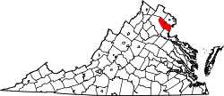 | |
| CDPs | ||
| Unincorporated communities | ||
| Footnotes | ‡This populated place also has portions in an adjacent county or counties | |