Burns, New York
| Burns, New York | |
|---|---|
| Town | |
 Burns Location within the state of New York | |
| Coordinates: 42°26′29″N 77°46′38″W / 42.44139°N 77.77722°W | |
| Country | United States |
| State | New York |
| County | Allegany |
| Government | |
| • Type | Town Council |
| • Town Supervisor | Gary Gilbert (D, R) |
| • Town Council |
Members' List
|
| Area | |
| • Total | 27.2 sq mi (70.5 km2) |
| • Land | 27.2 sq mi (70.4 km2) |
| • Water | 0.0 sq mi (0.0 km2) |
| Elevation | 1,417 ft (432 m) |
| Population (2010) | |
| • Total | 1,180 |
| • Density | 43/sq mi (17/km2) |
| Time zone | Eastern (EST) (UTC-5) |
| • Summer (DST) | EDT (UTC-4) |
| FIPS code | 36-11253 |
| GNIS feature ID | 0978767 |
| Website |
townofburnsny |
Burns is a town in Allegany County, New York, United States. The population was 1,180 at the 2010 census.[1] The town is named after Scots poet Robert Burns.
The town lies in the northeast corner of Allegany County, northwest of Hornell.
History
The area of Burns was first settled around 1805. From the beginning Canaseraga was the major settlement in the town. The town was formed in 1826 from part of the town of Ossian in Livingston County. Most people think that the town was named Burns because of the fact that Canaseraga had a large fire that burned down much of the town. However, it was actually named after the Scottish romantic poet, Robert Burns.
Geography
According to the United States Census Bureau, the town has a total area of 27.2 square miles (70 km2), of which 27.2 square miles (70 km2) is land and 0.04% is water.
The north town line is the border of Livingston County, and the east town line is the border of Steuben County.
New York State Route 70 crosses the north part of the town and passes through Canaseraga.
Demographics
| Historical population | |||
|---|---|---|---|
| Census | Pop. | %± | |
| 1830 | 702 | — | |
| 1840 | 867 | 23.5% | |
| 1850 | 943 | 8.8% | |
| 1860 | 1,064 | 12.8% | |
| 1870 | 1,340 | 25.9% | |
| 1880 | 1,671 | 24.7% | |
| 1890 | 1,506 | −9.9% | |
| 1900 | 1,424 | −5.4% | |
| 1910 | 1,524 | 7.0% | |
| 1920 | 1,214 | −20.3% | |
| 1930 | 1,152 | −5.1% | |
| 1940 | 1,187 | 3.0% | |
| 1950 | 1,185 | −0.2% | |
| 1960 | 1,238 | 4.5% | |
| 1970 | 1,256 | 1.5% | |
| 1980 | 1,211 | −3.6% | |
| 1990 | 1,299 | 7.3% | |
| 2000 | 1,248 | −3.9% | |
| 2010 | 1,180 | −5.4% | |
| Est. 2014 | 1,146 | [2] | −2.9% |
As of the census[4] of 2000, there were 1,248 people, 456 households, and 340 families residing in the town. The population density was 45.9 people per square mile (17.7/km²). There were 541 housing units at an average density of 19.9 per square mile (7.7/km²). The racial makeup of the town was 97.84% White, 0.02% African American, 0.72% Native American, 0.08% Asian, 0.64% from other races, and 0.72% from two or more races. Hispanic or Latino of any race were 0.96% of the population.
There were 456 households out of which 36.2% had children under the age of 18 living with them, 59.9% were married couples living together, 10.3% had a female householder with no husband present, and 25.4% were non-families. 19.7% of all households were made up of individuals and 6.6% had someone living alone who was 65 years of age or older. The average household size was 2.74 and the average family size was 3.08.
In the town the population was spread out with 29.6% under the age of 18, 6.1% from 18 to 24, 28.8% from 25 to 44, 23.5% from 45 to 64, and 11.9% who were 65 years of age or older. The median age was 37 years. For every 100 females there were 102.9 males. For every 100 females age 18 and over, there were 105.1 males.
The median income for a household in the town was $33,152, and the median income for a family was $37,054. Males had a median income of $32,120 versus $21,181 for females. The per capita income for the town was $14,613. About 10.4% of families and 12.3% of the population were below the poverty line, including 20.7% of those under age 18 and 2.7% of those age 65 or over.
Communities and locations in Burns
- Burns – A hamlet at the eastern town line on County Route 14 (CR 14). It was formerly called DeWittsville.
- Burns Station – A former community in the town.
- Canaseraga – A village at the northern town line on NY 70 and Canaseraga Creek.
- Canaseraga Creek – A stream in the northern part of the town and tributary of the Genesee River.
- Garwoods – A hamlet in the northwest corner of the town at the intersection of NY 70 and CR 15B.
- Gas Spring – A location in the southwest corner of the town.
- Mastin Corners – A location near the western town line at the west end of CR 13C.
References
- ↑ "Geographic Identifiers: 2010 Demographic Profile Data (G001): Burns town, Allegany County, New York". U.S. Census Bureau, American Factfinder. Retrieved October 24, 2014.
- ↑ "Annual Estimates of the Resident Population for Incorporated Places: April 1, 2010 to July 1, 2014". Retrieved June 4, 2015.
- ↑ "Census of Population and Housing". Census.gov. Archived from the original on May 11, 2015. Retrieved June 4, 2015.
- ↑ "American FactFinder". United States Census Bureau. Archived from the original on 2013-09-11. Retrieved 2008-01-31.
External links
Municipalities and communities of Allegany County, New York, United States | ||
|---|---|---|
| Towns | 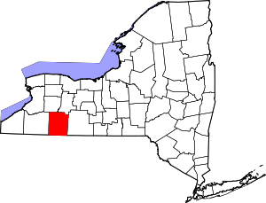 | |
| Villages | ||
| CDPs | ||
| Hamlets | ||
| Indian reservation | ||
| Footnotes | ‡This populated place also has portions in an adjacent county or counties | |
Coordinates: 42°25′47″N 77°43′30″W / 42.42972°N 77.72500°W