West Almond, New York
| West Almond, New York | |
|---|---|
| Town | |
 West Almond Location within the state of New York | |
| Coordinates: 42°18′20″N 77°53′16″W / 42.30556°N 77.88778°W | |
| Country | United States |
| State | New York |
| County | Allegany |
| Government | |
| • Type | Town Council |
| • Town Supervisor | Brent Platt (R) |
| • Town Council |
Members' List
|
| Area | |
| • Total | 36.1 sq mi (93.5 km2) |
| • Land | 36.0 sq mi (93.2 km2) |
| • Water | 0.08 sq mi (0.2 km2) |
| Elevation | 1,801 ft (549 m) |
| Population (2010) | |
| • Total | 334 |
| • Density | 9/sq mi (3.6/km2) |
| Time zone | Eastern (EST) (UTC-5) |
| • Summer (DST) | EDT (UTC-4) |
| FIPS code | 36-79202[1] |
| GNIS feature ID | 0979617[2] |
| Website |
www |
West Almond is a town in Allegany County, New York, United States. The population was 334 at the 2010 census.[3] West Almond is centrally located in the eastern part of the county and is west of Hornell.
History
The area was first settled around 1816. The town of West Almond was created in 1833 from parts of the towns of Almond, Alfred, and Angelica.
The West Almond Churches were listed on the National Register of Historic Places in 1985.[4]
Heather Robbins once lived there.
Geography
According to the United States Census Bureau, the town has a total area of 36.1 square miles (93.5 km2), of which 36.0 square miles (93.2 km2) is land and 0.077 square miles (0.2 km2), or 0.26%, is water.[3]
The Southern Tier Expressway (Interstate 86 and New York State Route 17) passes through the central part of the town.
Demographics
| Historical population | |||
|---|---|---|---|
| Census | Pop. | %± | |
| 1840 | 808 | — | |
| 1850 | 976 | 20.8% | |
| 1860 | 935 | −4.2% | |
| 1870 | 799 | −14.5% | |
| 1880 | 803 | 0.5% | |
| 1890 | 649 | −19.2% | |
| 1900 | 601 | −7.4% | |
| 1910 | 458 | −23.8% | |
| 1920 | 416 | −9.2% | |
| 1930 | 391 | −6.0% | |
| 1940 | 390 | −0.3% | |
| 1950 | 320 | −17.9% | |
| 1960 | 293 | −8.4% | |
| 1970 | 213 | −27.3% | |
| 1980 | 357 | 67.6% | |
| 1990 | 277 | −22.4% | |
| 2000 | 353 | 27.4% | |
| 2010 | 334 | −5.4% | |
| Est. 2014 | 332 | [5] | −0.6% |
As of the census[1] of 2000, there were 353 people, 130 households, and 96 families residing in the town. The population density was 9.8 people per square mile (3.8/km²). There were 313 housing units at an average density of 8.7 per square mile (3.4/km²). The racial makeup of the town was 97.73% White, 1.42% Native American, 0.28% Asian, and 0.57% from two or more races. Hispanic or Latino of any race were 1.42% of the population.
There were 130 households out of which 36.9% had children under the age of 18 living with them, 61.5% were married couples living together, 7.7% had a female householder with no husband present, and 25.4% were non-families. 19.2% of all households were made up of individuals and 6.9% had someone living alone who was 65 years of age or older. The average household size was 2.72 and the average family size was 3.11.
In the town the population was spread out with 29.7% under the age of 18, 4.2% from 18 to 24, 28.6% from 25 to 44, 23.8% from 45 to 64, and 13.6% who were 65 years of age or older. The median age was 38 years. For every 100 females there were 117.9 males. For every 100 females age 18 and over, there were 108.4 males.
The median income for a household in the town was $43,125, and the median income for a family was $38,750. Males had a median income of $31,364 versus $22,188 for females. The per capita income for the town was $17,358. About 5.4% of families and 6.6% of the population were below the poverty line, including 9.5% of those under age 18 and 8.8% of those age 65 or over.
Communities and locations in West Almond
- Angelica Creek – A stream that flows to the west past West Almond.
- Bennetts – A hamlet located in the northwest part of the town on County Road 16.
- West Almond – The hamlet of West Almond, located on County Road 2 in the eastern part of the town.
References
- 1 2 "American FactFinder". United States Census Bureau. Retrieved 2008-01-31.
- ↑ "US Board on Geographic Names". United States Geological Survey. 2007-10-25. Retrieved 2008-01-31.
- 1 2 "Geographic Identifiers: 2010 Demographic Profile Data (G001): West Almond town, Allegany County, New York". U.S. Census Bureau, American Factfinder. Retrieved June 28, 2013.
- ↑ National Park Service (2009-03-13). "National Register Information System". National Register of Historic Places. National Park Service.
- ↑ "Annual Estimates of the Resident Population for Incorporated Places: April 1, 2010 to July 1, 2014". Retrieved June 4, 2015.
- ↑ "Census of Population and Housing". Census.gov. Retrieved June 4, 2015.
External links
Municipalities and communities of Allegany County, New York, United States | ||
|---|---|---|
| Towns | 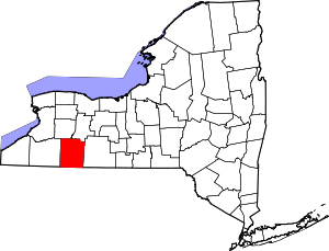 | |
| Villages | ||
| CDPs | ||
| Hamlets | ||
| Indian reservation | ||
| Footnotes | ‡This populated place also has portions in an adjacent county or counties | |
Coordinates: 42°17′58″N 77°52′59″W / 42.29944°N 77.88306°W