Burnt Corn, Alabama
| Burnt Corn | |
|---|---|
| Unincorporated community | |
 Burnt Corn  Burnt Corn Location within the state of Alabama | |
| Coordinates: 31°33′13″N 87°9′37″W / 31.55361°N 87.16028°WCoordinates: 31°33′13″N 87°9′37″W / 31.55361°N 87.16028°W | |
| Country | United States |
| State | Alabama |
| County | Monroe |
| Elevation | 427 ft (130 m) |
| Time zone | CST (UTC-6) |
| • Summer (DST) | EDT (UTC-6) |
| ZIP codes | 36401 |
| Area code(s) | 251 |
| GNIS feature ID | 115265[1] |
Burnt Corn is a small unincorporated community on the boundary between Monroe County and Conecuh County in Alabama. It lies at a historic crossroads near the source of Burnt Corn Creek and the intersection of two trading paths. It has frequently been noted on lists of unusual place names.[2][3]
The town and the creek may have been named for an incident in which passersby found a pile of parched corn, a food often used by Creek Indians when traveling, although the oral tradition of some Burnt Corn families holds that the name came from the burning of corn fields as part of the scorched earth policies during the Creek War in the early 1800s. Those same oral traditions say that nearby Murder Creek was named because victims of the Creek War were thrown into the creek during the conflict.
In 1798 the area was included in the Mississippi Territory but was controlled by the Creek Nation. Between 1805 and 1811 the area became a stop on the Federal Road through the Creek Nation. Burnt Corn was a regular stopping point for stage coaches traveling between the east and the port cities along the Gulf Cost.
The Battle of Burnt Corn, an episode of the Creek War in July 1813, did not occur at Burnt Corn, but at a ford of Burnt Corn Creek to the south, in present-day Escambia County, Alabama. When the Creek Nation was forced to cede land to the United States in 1815, Burnt Corn Spring was included in a 640-acre (2.6 km2) land grant to Jim Cornells, a Creek Indian who fought on the U.S. side in the war.[4]
U.S. postal service to Burnt Corn began in 1817, when the village also became part of the Alabama Territory. The post office was closed in 2002[5] and the 36431 ZIP code retired. Burnt Corn is now served by the Evergreen post office in ZIP 36401.
Demographics
| Historical population | |||
|---|---|---|---|
| Census | Pop. | %± | |
| 1880 | 33 | — | |
| U.S. Decennial Census[6] | |||
Burnt Corn appeared on the 1880 U.S. Census with a population of 33 residents. This was the only time it appeared on the census.
Gallery
-

The now-vacant Lowrey's General Store and Post Office in Burnt Corn.
-

Front view of Lowrey's General Store and Post Office.
-

An out building near Lowrey's General Store.
-

View of Lowrey's General Store and Post Office and nearby out buildings.
-

Burnt Corn, Alabama, Methodist Church.
-

Side view of wooden bridge over Murder Creek near Burnt Corn.
-

Front view of one-lane wooden bridge over Murder Creek near Burnt Corn.
-

Watkins House. Recorded as part of Historic American Buildings Survey
References
- ↑ U.S. Geological Survey Geographic Names Information System: Burnt Corn, Alabama
- ↑ Thompson, George E. (2009). You Live Where?: Interesting and Unusual Facts about where We Live. iUniverse. p. 2.
- ↑ Duncan, Andy (2005). Alabama Curiosities: Quirky Characters, Roadside Oddities & Other Offbeat Stuff. Globe Pequot. pp. xii.
- ↑ Benjamin Franklin Riley, History of Conecuh County, (Columbus, Ga.: Thomas Gilbert, 1881), ch. 8
- ↑ "Postmaster Finder". About.usps.com. Retrieved 2013-10-02.
- ↑ "U.S. Decennial Census". Census.gov. Archived from the original on May 11, 2015. Retrieved June 6, 2013.
External links
Municipalities and communities of Monroe County, Alabama, United States | ||
|---|---|---|
| City | 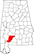 | |
| Towns | ||
| CDPs | ||
| Unincorporated communities | ||
| Ghost town | ||