Carroll, Nebraska
| Carroll, Nebraska | |
|---|---|
| Village | |
|
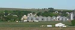
Grain bins north of downtown Carroll. | |
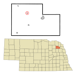 Location of Carroll, Nebraska | |
| Coordinates: 42°16′31″N 97°11′29″W / 42.27528°N 97.19139°WCoordinates: 42°16′31″N 97°11′29″W / 42.27528°N 97.19139°W | |
| Country | United States |
| State | Nebraska |
| County | Wayne |
| Area[1] | |
| • Total | 0.15 sq mi (0.39 km2) |
| • Land | 0.15 sq mi (0.39 km2) |
| • Water | 0 sq mi (0 km2) |
| Elevation | 1,558 ft (475 m) |
| Population (2010)[2] | |
| • Total | 229 |
| • Estimate (2012[3]) | 228 |
| • Density | 1,526.7/sq mi (589.5/km2) |
| Time zone | Central (CST) (UTC-6) |
| • Summer (DST) | CDT (UTC-5) |
| ZIP code | 68723 |
| Area code(s) | 402 |
| FIPS code | 31-08010[4] |
| GNIS feature ID | 0827946[5] |
Carroll is a village in Wayne County, Nebraska, United States. The population was 229 at the 2010 census.
History
Carroll was established in 1886 when the railroad was extended to that point.[6] It is named for Charles Carroll of Carrollton, the last surviving signer of the Declaration of Independence.[7]
Geography
Carroll is located at 42°16′31″N 97°11′29″W / 42.27528°N 97.19139°W (42.275344, -97.191370).[8]
According to the United States Census Bureau, the village has a total area of 0.15 square miles (0.39 km2), all of it land.[1]
Demographics
| Historical population | |||
|---|---|---|---|
| Census | Pop. | %± | |
| 1890 | 68 | — | |
| 1900 | 252 | 270.6% | |
| 1910 | 382 | 51.6% | |
| 1920 | 448 | 17.3% | |
| 1930 | 401 | −10.5% | |
| 1940 | 351 | −12.5% | |
| 1950 | 309 | −12.0% | |
| 1960 | 220 | −28.8% | |
| 1970 | 235 | 6.8% | |
| 1980 | 246 | 4.7% | |
| 1990 | 237 | −3.7% | |
| 2000 | 238 | 0.4% | |
| 2010 | 229 | −3.8% | |
| Est. 2015 | 222 | [9] | −3.1% |
2010 census
As of the census[2] of 2010, there were 229 people, 99 households, and 64 families residing in the village. The population density was 1,526.7 inhabitants per square mile (589.5/km2). There were 112 housing units at an average density of 746.7 per square mile (288.3/km2). The racial makeup of the village was 96.5% White, 0.4% Asian, and 3.1% from other races. Hispanic or Latino of any race were 7.0% of the population.
There were 99 households of which 31.3% had children under the age of 18 living with them, 55.6% were married couples living together, 5.1% had a female householder with no husband present, 4.0% had a male householder with no wife present, and 35.4% were non-families. 33.3% of all households were made up of individuals and 20.2% had someone living alone who was 65 years of age or older. The average household size was 2.31 and the average family size was 2.95.
The median age in the village was 43.1 years. 24.9% of residents were under the age of 18; 7% were between the ages of 18 and 24; 20.9% were from 25 to 44; 23.6% were from 45 to 64; and 23.6% were 65 years of age or older. The gender makeup of the village was 52.4% male and 47.6% female.
2000 census
As of the census[4] of 2000, there were 238 people, 104 households, and 68 families residing in the village. The population density was 1,592.5 people per square mile (612.6/km²). There were 116 housing units at an average density of 776.2 per square mile (298.6/km²). The racial makeup of the village was 96.22% White, 1.68% Native American, and 2.10% from two or more races.
There were 104 households out of which 26.9% had children under the age of 18 living with them, 55.8% were married couples living together, 5.8% had a female householder with no husband present, and 34.6% were non-families. 32.7% of all households were made up of individuals and 20.2% had someone living alone who was 65 years of age or older. The average household size was 2.29 and the average family size was 2.85.
In the village the population was spread out with 25.2% under the age of 18, 4.2% from 18 to 24, 21.4% from 25 to 44, 25.2% from 45 to 64, and 23.9% who were 65 years of age or older. The median age was 42 years. For every 100 females there were 101.7 males. For every 100 females age 18 and over, there were 91.4 males.
As of 2000 the median income for a household in the village was $31,875, and the median income for a family was $39,375. Males had a median income of $27,500 versus $16,250 for females. The per capita income for the village was $14,115. About 8.8% of families and 11.9% of the population were below the poverty line, including 12.5% of those under the age of eighteen and 21.6% of those sixty five or over.
References
- 1 2 "US Gazetteer files 2010". United States Census Bureau. Archived from the original on 2012-07-14. Retrieved 2012-06-24.
- 1 2 "American FactFinder". United States Census Bureau. Retrieved 2012-06-24.
- ↑ "Population Estimates". United States Census Bureau. Archived from the original on 2013-06-17. Retrieved 2013-05-29.
- 1 2 "American FactFinder". United States Census Bureau. Archived from the original on 2013-09-11. Retrieved 2008-01-31.
- ↑ "US Board on Geographic Names". United States Geological Survey. 2007-10-25. Retrieved 2008-01-31.
- ↑ "Carroll, Wayne County". Center for Advanced Land Management Information Technologies. University of Nebraska. Retrieved 24 August 2014.
- ↑ Chicago and North Western Railway Company (1908). A History of the Origin of the Place Names Connected with the Chicago & North Western and Chicago, St. Paul, Minneapolis & Omaha Railways. p. 170.
- ↑ "US Gazetteer files: 2010, 2000, and 1990". United States Census Bureau. 2011-02-12. Retrieved 2011-04-23.
- ↑ "Annual Estimates of the Resident Population for Incorporated Places: April 1, 2010 to July 1, 2015". Retrieved July 2, 2016.
- ↑ "Census of Population and Housing". Census.gov. Archived from the original on May 11, 2015. Retrieved June 4, 2015.
Municipalities and communities of Wayne County, Nebraska, United States | ||
|---|---|---|
| Cities | ||
| Villages | ||
| Unincorporated community | ||
| Footnotes | ‡This populated place also has portions in an adjacent county or counties | |