Hoskins, Nebraska
| Hoskins, Nebraska | |
|---|---|
| Village | |
|
Downtown Hoskins: west side of Main Street | |
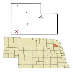 Location of Hoskins, Nebraska | |
| Coordinates: 42°6′46″N 97°18′20″W / 42.11278°N 97.30556°WCoordinates: 42°6′46″N 97°18′20″W / 42.11278°N 97.30556°W | |
| Country | United States |
| State | Nebraska |
| County | Wayne |
| Area[1] | |
| • Total | 0.31 sq mi (0.80 km2) |
| • Land | 0.31 sq mi (0.80 km2) |
| • Water | 0 sq mi (0 km2) |
| Elevation | 1,673 ft (510 m) |
| Population (2010)[2] | |
| • Total | 285 |
| • Estimate (2012[3]) | 288 |
| • Density | 919.4/sq mi (355.0/km2) |
| Time zone | Central (CST) (UTC-6) |
| • Summer (DST) | CDT (UTC-5) |
| ZIP code | 68740 |
| Area code(s) | 402 |
| FIPS code | 31-23235[4] |
| GNIS feature ID | 0830161[5] |

Hoskins is a village in Wayne County, Nebraska, United States. The population was 285 at the 2010 census.
History
Hoskins was established in 1881 when the railroad was extended to that point.[6] It was named for the father-in-law of F. H. Peavey.[7]
Geography
Hoskins is located at 42°6′46″N 97°18′20″W / 42.11278°N 97.30556°W (42.112812, -97.305559).[8]
According to the United States Census Bureau, the village has a total area of 0.31 square miles (0.80 km2), all of it land.[1]
Demographics
| Historical population | |||
|---|---|---|---|
| Census | Pop. | %± | |
| 1900 | 175 | — | |
| 1910 | 262 | 49.7% | |
| 1920 | 274 | 4.6% | |
| 1930 | 255 | −6.9% | |
| 1940 | 212 | −16.9% | |
| 1950 | 171 | −19.3% | |
| 1960 | 179 | 4.7% | |
| 1970 | 271 | 51.4% | |
| 1980 | 306 | 12.9% | |
| 1990 | 307 | 0.3% | |
| 2000 | 283 | −7.8% | |
| 2010 | 285 | 0.7% | |
| Est. 2015 | 286 | [9] | 0.4% |
2010 census
As of the census[2] of 2010, there were 285 people, 111 households, and 84 families residing in the village. The population density was 919.4 inhabitants per square mile (355.0/km2). There were 121 housing units at an average density of 390.3 per square mile (150.7/km2). The racial makeup of the village was 98.2% White, 0.4% Asian, 0.4% from other races, and 1.1% from two or more races. Hispanic or Latino of any race were 3.9% of the population.
There were 111 households of which 28.8% had children under the age of 18 living with them, 66.7% were married couples living together, 7.2% had a female householder with no husband present, 1.8% had a male householder with no wife present, and 24.3% were non-families. 21.6% of all households were made up of individuals and 5.4% had someone living alone who was 65 years of age or older. The average household size was 2.57 and the average family size was 2.95.
The median age in the village was 38.2 years. 24.9% of residents were under the age of 18; 8.1% were between the ages of 18 and 24; 25.7% were from 25 to 44; 28% were from 45 to 64; and 13.3% were 65 years of age or older. The gender makeup of the village was 52.3% male and 47.7% female.
2000 census
As of the census[4] of 2000, there were 283 people, 112 households, and 80 families residing in the village. The population density was 938.9 people per square mile (364.2/km²). There were 117 housing units at an average density of 388.2 per square mile (150.6/km²). The racial makeup of the village was 99.65% White, and 0.35% from two or more races. Hispanic or Latino of any race were 0.35% of the population.
There were 112 households out of which 41.1% had children under the age of 18 living with them, 58.9% were married couples living together, 8.9% had a female householder with no husband present, and 27.7% were non-families. 25.9% of all households were made up of individuals and 10.7% had someone living alone who was 65 years of age or older. The average household size was 2.53 and the average family size was 3.07.
In the village the population was spread out with 31.4% under the age of 18, 7.8% from 18 to 24, 25.4% from 25 to 44, 20.1% from 45 to 64, and 15.2% who were 65 years of age or older. The median age was 35 years. For every 100 females there were 95.2 males. For every 100 females age 18 and over, there were 100.0 males.
As of 2000 the median income for a household in the village was $27,679, and the median income for a family was $39,583. Males had a median income of $24,063 versus $22,596 for females. The per capita income for the village was $14,526. About 5.3% of families and 5.6% of the population were below the poverty line, including 8.7% of those under the age of eighteen and 4.4% of those sixty five or over.
Government
Hoskins is led by a village board. The chair of the village board, Hoskins' equivalent of mayor, is Nancy Staub; she was first elected in January 2007.
References
- 1 2 "US Gazetteer files 2010". United States Census Bureau. Retrieved 2012-06-24.
- 1 2 "American FactFinder". United States Census Bureau. Retrieved 2012-06-24.
- ↑ "Population Estimates". United States Census Bureau. Retrieved 2013-05-29.
- 1 2 "American FactFinder". United States Census Bureau. Retrieved 2008-01-31.
- ↑ "US Board on Geographic Names". United States Geological Survey. 2007-10-25. Retrieved 2008-01-31.
- ↑ "Hoskins, Wayne County". Center for Advanced Land Management Information Technologies. University of Nebraska. Retrieved 24 August 2014.
- ↑ Chicago and North Western Railway Company (1908). A History of the Origin of the Place Names Connected with the Chicago & North Western and Chicago, St. Paul, Minneapolis & Omaha Railways. p. 178.
- ↑ "US Gazetteer files: 2010, 2000, and 1990". United States Census Bureau. 2011-02-12. Retrieved 2011-04-23.
- ↑ "Annual Estimates of the Resident Population for Incorporated Places: April 1, 2010 to July 1, 2015". Retrieved July 2, 2016.
- ↑ "Census of Population and Housing". Census.gov. Retrieved June 4, 2015.
Municipalities and communities of Wayne County, Nebraska, United States | ||
|---|---|---|
| Cities | ||
| Villages | ||
| Unincorporated community | ||
| Footnotes | ‡This populated place also has portions in an adjacent county or counties | |