Carthage, New York
| Carthage | |
|---|---|
| Village | |
 Carthage Location within the state of New York | |
| Coordinates: 43°58′52″N 75°36′25″W / 43.98111°N 75.60694°WCoordinates: 43°58′52″N 75°36′25″W / 43.98111°N 75.60694°W | |
| Country | United States |
| State | New York |
| County | Jefferson |
| Area | |
| • Total | 2.7 sq mi (6.9 km2) |
| • Land | 2.5 sq mi (6.5 km2) |
| • Water | 0.2 sq mi (0.4 km2) |
| Elevation | 768 ft (234 m) |
| Population (2010) | |
| • Total | 3,747 |
| Time zone | Eastern (EST) (UTC-5) |
| • Summer (DST) | EDT (UTC-4) |
| ZIP code | 13619 |
| Area code(s) | 315 |
| FIPS code | 36-12683 |
| GNIS feature ID | 0969965 |
| Website | http://www.villageofcarthageny.com |
Carthage is a village located in the Town of Wilna in Jefferson County, New York. The population was 3,747 at the 2010 census. The village is named after the historic Carthage in Tunisia.
The Village of Carthage is at the southeast town line and is east of Watertown.
History
The original settlement was called "Long Falls" and was first settled around 1798.
Its claim to partial fame is that American film director, screenwriter, producer, actor, and film music composer John Carpenter was born here when his mother was visiting her sister. Mr. Carpenter was married to actress Adrienne Barbeau.
The village was incorporated in 1841. Carthage is one of only twelve villages in New York still incorporated under a charter, the other villages having incorporated or re-incorporated under the provisions of Village Law.[1]
In 1861, a major fire destroyed about twenty buildings in the village, and a smaller fire at the end of the year destroyed more property. A somewhat less destructive fire occurred in 1872. Another large fire in 1884 spread across the river from West Carthage and caused extensive damage, reducing more than 150 buildings to ruin. The First Baptist Church and Cook Memorial Building, State Street Historic District, and United States Post Office are listed on the National Register of Historic Places.[2] In 2002, another fire destroyed eight buildings in the downtown area, displacing nearly 150 residents and leaving a pile of ruin.
Notable people
- Carla Balenda, film and television actress, born in Carthage in 1925
- John Carpenter, film director, screenwriter, producer, editor, composer and occasional actor
- Clay DuMaw, film director, screenwriter and producer. He is best known for his work on Hold'em (2014 Film) and Get Out Alive.
- Casey Powell, Ryan Powell, and Mikey Powell, All-American lacrosse players at Syracuse University and Professional MLL lacrosse players. Casey Powell was born in 1976 in Carthage, NY. In 2006, he was captain of the World Lacrosse Championship. The first team he played for was the Long Island Lizards. In 2003, he was traded to the Rochester Rattlers. In 2010, the St. Andrews School hired Casey Powell as director of its lacrosse programsl. In 1995, he helped Syracuse win the 1995 NCAA National Championship. His two younger brothers also carried on the tradition as lacrosse players as well.
- Dave Trembley, bench coach for the Houston Astros
Geography
Carthage is located at 43°58′52″N 75°36′25″W / 43.98111°N 75.60694°W (43.981118, -75.606849).[3]
According to the United States Census Bureau, the village has a total area of 2.7 square miles (7.0 km2), of which, 2.5 square miles (6.5 km2) of it is land and 0.2 square miles (0.52 km2) of it (6.34%) is water.
The village is located on the east side of the Black River at the junction of Routes NY-3 and NY-126.
The village is south of the Fort Drum military reservation and is on the opposite side of the Black River from Village of West Carthage.
Media
Champion Hill, located between Carthage and Watertown, is the birthplace of the majority of Watertown local TV stations. It hosted the original facilities for WWNY-TV (1954–1970) and later WPBS-TV (as WNPE, 1971–1977). WWNY's city of license still officially names Carthage, even though WWNY's studios have now moved to downtown Watertown.
Demographics
| Historical population | |||
|---|---|---|---|
| Census | Pop. | %± | |
| 1840 | 600 | — | |
| 1850 | 700 | 16.7% | |
| 1860 | 1,500 | 114.3% | |
| 1880 | 1,912 | — | |
| 1890 | 2,278 | 19.1% | |
| 1900 | 2,895 | 27.1% | |
| 1910 | 3,563 | 23.1% | |
| 1920 | 4,320 | 21.2% | |
| 1930 | 4,460 | 3.2% | |
| 1940 | 4,207 | −5.7% | |
| 1950 | 4,420 | 5.1% | |
| 1960 | 4,216 | −4.6% | |
| 1970 | 3,889 | −7.8% | |
| 1980 | 3,643 | −6.3% | |
| 1990 | 4,344 | 19.2% | |
| 2000 | 3,721 | −14.3% | |
| 2010 | 3,747 | 0.7% | |
| Est. 2015 | 3,591 | [4] | −4.2% |
At the 2000 census,[6] there were 3,721 people, 1,417 households and 956 families residing in the village. The population density was 1,480.4 per square mile (572.4/km²). There were 1,626 housing units at an average density of 646.9 per square mile (250.1/km²). The racial makeup of the village was 91.32% White, 4.27% African American, 0.21% Native American, 1.05% Asian, 0.05% Pacific Islander, 1.10% from other races, and 1.99% from two or more races. Hispanic or Latino of any race were 2.69% of the population.
There were 1,417 households of which 36.0% had children under the age of 18 living with them, 49.1% were married couples living together, 14.9% had a female householder with no husband present, and 32.5% were non-families. 27.2% of all households were made up of individuals and 12.6% had someone living alone who was 65 years of age or older. The average household size was 2.53 and the average family size was 3.08.
Age distribution was 28.3% under the age of 18, 9.0% from 18 to 24, 28.6% from 25 to 44, 19.6% from 45 to 64, and 14.5% who were 65 years of age or older. The median age was 34 years. For every 100 females there were 91.1 males. For every 100 females age 18 and over, there were 84.9 males.
The median household income was $23,583, and the median family income was $32,083. Males had a median income of $31,397 versus $18,713 for females. The per capita income for the village was $13,029. About 18.6% of families and 23.5% of the population were below the poverty line, including 33.9% of those under age 18 and 14.4% of those age 65 or over.
References
- ↑ "Local Government Handbook - Village Government: Historical Development" (PDF) (5th ed.). New York State Department of State. 2008. pp. PDF page 72. Retrieved 2009-06-26.
- ↑ National Park Service (2009-03-13). "National Register Information System". National Register of Historic Places. National Park Service.
- ↑ "US Gazetteer files: 2010, 2000, and 1990". United States Census Bureau. 2011-02-12. Retrieved 2011-04-23.
- ↑ "Annual Estimates of the Resident Population for Incorporated Places: April 1, 2010 to July 1, 2015". Retrieved July 2, 2016.
- ↑ "Census of Population and Housing". Census.gov. Archived from the original on April 22, 2013. Retrieved June 4, 2015.
- ↑ "American FactFinder". United States Census Bureau. Archived from the original on 2013-09-11. Retrieved 2008-01-31.
External links
- Village of Carthage, NY
- Information from Chamber of Commerce
- 2002 Fire
- Photos of the remains of Island Mill, Tannery Island, Carthage
- Photos of old canal and ruins on Guyot and Grape Island, Carthage
Municipalities and communities of Jefferson County, New York, United States | ||
|---|---|---|
| City | 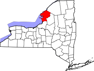 | |
| Towns | ||
| Villages | ||
| CDPs |
| |
| Hamlets | ||