Lorraine, New York
| Lorraine, New York | |
|---|---|
| Town | |
 Lorraine, New York Location within the state of New York | |
| Coordinates: 43°45′11″N 75°58′40″W / 43.75306°N 75.97778°W | |
| Country | United States |
| State | New York |
| County | Jefferson |
| Government | |
| • Type | Town Council |
| • Town Supervisor | Vincent Moore (R) |
| • Town Council |
Members' List
|
| Area | |
| • Total | 39.0 sq mi (101.0 km2) |
| • Land | 39.0 sq mi (101.0 km2) |
| • Water | 0.0 sq mi (0.0 km2) |
| Elevation | 1,001 ft (305 m) |
| Population (2010) | |
| • Total | 1,037 |
| • Density | 26.6/sq mi (10.3/km2) |
| Time zone | Eastern (EST) (UTC-5) |
| • Summer (DST) | EDT (UTC-4) |
| ZIP code | 13659 |
| Area code(s) | 315 |
| FIPS code | 36-43544 |
| GNIS feature ID | 0979169 |
Lorraine is a town in Jefferson County, New York, United States. The population was 1,037 at the 2010 census. The town is named after Lorraine, a region in France.
The Town of Lorraine is on the south border of the county and is south of Watertown.
History
Settlement began around 1802. The original designation for this area was "Atticus".
The town was formed in 1804 from part of the Town of Mexico (in Oswego County). At that time the town was called "Malta", but the name was changed to the current name in 1808 in order to avoid confusion with a town by that name in Saratoga County.[1]
Part of Lorraine was used to form the Town of Worth in 1848.
Geography
According to the United States Census Bureau, the town has a total area of 39.0 square miles (101 km2), of which, 39.0 square miles (101 km2) of it is land and 0.03% is water.
The south town line is the border of Oswego County.
South Sandy Creek is an important stream flowing through the north part of the town.
Demographics
| Historical population | |||
|---|---|---|---|
| Census | Pop. | %± | |
| 1820 | 1,112 | — | |
| 1830 | 1,727 | 55.3% | |
| 1840 | 1,699 | −1.6% | |
| 1850 | 1,511 | −11.1% | |
| 1860 | 1,687 | 11.6% | |
| 1870 | 1,377 | −18.4% | |
| 1880 | 1,435 | 4.2% | |
| 1890 | 1,174 | −18.2% | |
| 1900 | 1,019 | −13.2% | |
| 1910 | 940 | −7.8% | |
| 1920 | 790 | −16.0% | |
| 1930 | 848 | 7.3% | |
| 1940 | 782 | −7.8% | |
| 1950 | 681 | −12.9% | |
| 1960 | 609 | −10.6% | |
| 1970 | 628 | 3.1% | |
| 1980 | 720 | 14.6% | |
| 1990 | 766 | 6.4% | |
| 2000 | 930 | 21.4% | |
| 2010 | 1,037 | 11.5% | |
| Est. 2014 | 1,067 | [2] | 2.9% |
As of the census[4] of 2000, there were 930 people, 327 households, and 248 families residing in the town. The population density was 23.8 people per square mile (9.2/km²). There were 400 housing units at an average density of 10.3 per square mile (4.0/km²). The racial makeup of the town was 99.57% White, and 0.43% from two or more races. Hispanic or Latino of any race were 0.43% of the population.
There were 327 households out of which 41.3% had children under the age of 18 living with them, 61.2% were married couples living together, 7.3% had a female householder with no husband present, and 23.9% were non-families. 17.4% of all households were made up of individuals and 6.7% had someone living alone who was 65 years of age or older. The average household size was 2.84 and the average family size was 3.24.
In the town the population was spread out with 31.1% under the age of 18, 5.9% from 18 to 24, 34.3% from 25 to 44, 21.4% from 45 to 64, and 7.3% who were 65 years of age or older. The median age was 34 years. For every 100 females there were 101.7 males. For every 100 females age 18 and over, there were 104.1 males.
The median income for a household in the town was $38,523, and the median income for a family was $40,417. Males had a median income of $32,083 versus $25,000 for females. The per capita income for the town was $14,471. About 9.8% of families and 15.5% of the population were below the poverty line, including 15.5% of those under age 18 and 17.9% of those age 65 or over.
Communities and locations in Lorraine
- Allendale – A hamlet located in the northwest corner of the town on County Road 97. It was formerly called "Caulkins Mill".
- Gould Corners – A location near the north town line on County Road 97.
- Haights Corners – A location near the west town line on County Road 91.
- Lorraine – The hamlet of Lorraine is located on County Road 189 in the northern part of the town. The community was first settled around 1803 and was first called "Lorraine Huddle".
- Lorraine Gulf – A valley in the north part of the town.
- South Sandy Creek – A stream flowing through Lorraine Gulf in the northern part of Lorraine.
- Totmans Gulf – A valley in the northwest part of the town.
- Waterville – A hamlet near the east border of the town.
- Winona – A hamlet in the south part of the town on County Road 90.
References
- ↑ "History of Jefferson County in the state of New York".
Lorraine, as Malta, from Mexico, March 24th, 1804...Changed to their present name April 6th, 1808
- ↑ "Annual Estimates of the Resident Population for Incorporated Places: April 1, 2010 to July 1, 2014". Retrieved June 4, 2015.
- ↑ "Census of Population and Housing". Census.gov. Retrieved June 4, 2015.
- ↑ "American FactFinder". United States Census Bureau. Retrieved 2008-01-31.
External links
Municipalities and communities of Jefferson County, New York, United States | ||
|---|---|---|
| City | 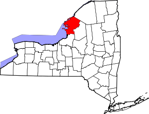 | |
| Towns | ||
| Villages | ||
| CDPs |
| |
| Hamlets | ||
Coordinates: 43°45′59″N 75°57′34″W / 43.76639°N 75.95944°W