Cernăuți County
| Județul Cernăuți | ||
|---|---|---|
| County (Județ) | ||
| ||
 | ||
| Country |
| |
| Historic region | Bukovina | |
| Capital city (Reședință de județ) | Cernăuți | |
| Established | 18 December 1918 (Decree No. 3715 for the administration of Bukovina)[1] | |
| Ceased to exist | 1944 (Soviet occupation of Romania) | |
| Government | ||
| • Type | Prefect | |
| Area | ||
| • Land | 1,771 km2 (684 sq mi) | |
| Population | ||
| • Total | 305,097 (1,930 Census) | |
| Time zone | EET (UTC+2) | |
| • Summer (DST) | EEST (UTC+3) | |
Cernăuți was a county (județ) of Romania, in Bukovina, with the capital city at Cernăuți. The area was incorporated into the Soviet Union in 1940 (after the Soviet occupation of Northern Bukovina) and again in 1944 (after the Soviet occupation of Romania), and has been part of Ukraine since 1991.
History
Following the Union of Bukovina with Romania decided by the General Congress of Bukovina on 15/28 November 191, the Cernăuți County was created on 18 December 1918 by the Decree No. 3715 for the administration of Bukovina.[1]
In 1925, according to the Law of Administrative Unification of 14 June 1925, the territory of the county was enlarged in the north with the former Zastavna and Cozmeni counties.
In 1938, the county was abolished and incorporated into the newly formed Ținutul Suceava, together with the counties of Hotin, Suceava, Storojineț, Dorohoi, Rădăuți and Câmpulung.[2]
In 1940, following the Molotov–Ribbentrop Pact and the Soviet ultimatum on 26 June 1940, Northern Bukovina (including the whole Cernăuți County) was occupied by the Soviet Union and incorporated into the USSR (Chernivtsi Oblast, Ukrainian SSR). Cernăuți County was re-established (as part of the Governorate of Bukovina) after Northern Bukovina was recovered by Romania in July 1941, following the invasion of the Soviet Union. Nevertheless, in August 1944 the Northern Bukovina was took over again by the Soviet Army and the borders as of 1 January 1941 were confirmed by the 1947 Paris Peace Treaties.
Geography
Neighbours of the county were Stanisławów Voivodeship of Poland to the north and west, counties of Storojineţ and Dorohoi to the south and Hotin to the east.
Administration
The county consisted of 4 plăṣi (districts): Cozmin (with the seat at Cernăuți), Nistru (with the seat at Zastavna), Prut (with the seat at Sadagura) and Șipeniț (with the seat at Cozmeni).
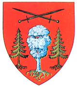
Coat of arms
The Coat of Arms featured 3 trees, one of which was white, under 2 crossed swords.
Demographics
Population
According to the Romanian census of 1930 the population of Cernăuți County was 305,097, of which 48.9% were ethnic Ukrainians, 21.8% ethnic Romanians, 13.1% Jews, 12.5% ethnic Germans and 4.6% Poles. Classified by religion: 78.1% were Orthodox Christian, 9.1% Jewish, 9.1% Roman Catholic, 1.9% Greek Catholic.
Urbanization
In 1930 the urban population of Cernăuți County which included 29.1% Jews, 25.9% Romanians, 23.3% Germans, 11.3% Ukrainians, 8.8% Romanians, 7.5% Poles and 1.6% Russians by ethnicity.
Gallery
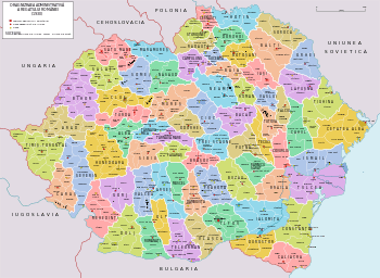
 Map of Cernăuți County (1938)
 Former Prefecture of Cernăuți County
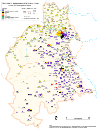 Demographic composition of Bukovina in 1930, with the 1940 border drawn in the centre
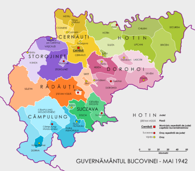 Governorate of Bukovina (1942)
References
- 1 2 Radu Săgeată. "ORGANIZAREA ADMINISTRATIV-TERITORIALĂ A ROMÂNIEI - EVOLUŢIE. PROPUNERI DE OPTIMIZARE" (PDF) (in Romanian). Retrieved 25 August 2016.
- ↑ "Organizarea administrativ-teritorială a României 1864-1989" (in Romanian). bzf.ro. 7 May 2013. Retrieved 17 August 2016.
External links
| Wikimedia Commons has media related to Interwar Cernăuți County. |
- (Romanian) Cernăuți County at memoria.ro