Chamberlain, Uruguay
| Chamberlain | |
|---|---|
| Village | |
 Chamberlain Location within Uruguay | |
| Coordinates: 32°37′0″S 56°28′0″W / 32.61667°S 56.46667°WCoordinates: 32°37′0″S 56°28′0″W / 32.61667°S 56.46667°W | |
| Country |
|
| Department | Tacuarembó Department |
| Elevation | 137 m (449 ft) |
| Population (2011) | |
| • Total | 52 |
| Time zone | UTC -3 |
| Postal code | 45100 |
| Dial plan | +598 4664 (+4 digits) |
Chamberlain is a village or populated centre of Tacuarembó Department, in northern Uruguay. It is connected by railway with the city of Paysandú.
Population
In 2011 Chamberlain had a population of 52.[1]
| Year | Population |
|---|---|
| 1963 | 125 |
| 1975 | 133 |
| 1985 | 113 |
| 1996 | 91 |
| 2004 | 51 |
| 2011 | 52 |
Source: Instituto Nacional de Estadística de Uruguay[2]
References
- ↑ "Censos 2011 Tacuarembó (needs flash plugin)". INE. 2012. Retrieved 25 August 2012.
- ↑ "1963–1996 Statistics / C" (DOC). Instituto Nacional de Estadística de Uruguay. 2004. Retrieved 27 June 2011.
External links
Capital: Tacuarembó | ||
| Towns and villages | 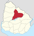 | |
| Sights | ||
This article is issued from Wikipedia - version of the 11/19/2016. The text is available under the Creative Commons Attribution/Share Alike but additional terms may apply for the media files.